Stag Mountain Topo Map Nevada
To zoom in, hover over the map of Stag Mountain
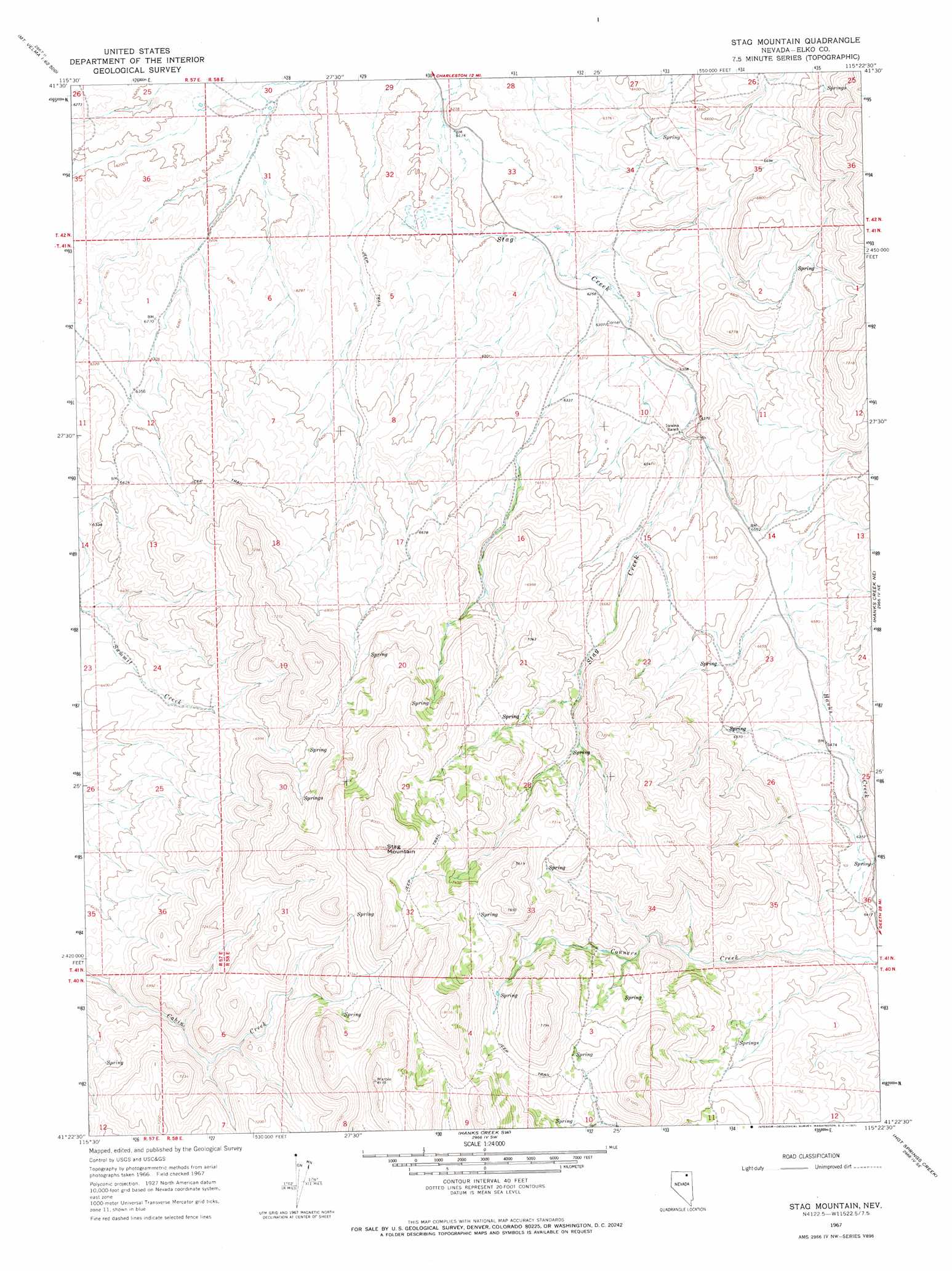
USGS Topo Quad 41115d4 - 1:24,000 scale
| Topo Map Name: | Stag Mountain |
| USGS Topo Quad ID: | 41115d4 |
| Print Size: | ca. 21 1/4" wide x 27" high |
| Southeast Coordinates: | 41.375° N latitude / 115.375° W longitude |
| Map Center Coordinates: | 41.4375° N latitude / 115.4375° W longitude |
| U.S. State: | NV |
| Filename: | o41115d4.jpg |
| Download Map JPG Image: | Stag Mountain topo map 1:24,000 scale |
| Map Type: | Topographic |
| Topo Series: | 7.5´ |
| Map Scale: | 1:24,000 |
| Source of Map Images: | United States Geological Survey (USGS) |
| Alternate Map Versions: |
Stag Mountain NV 1967, updated 1971 Download PDF Buy paper map Stag Mountain NV 2012 Download PDF Buy paper map Stag Mountain NV 2014 Download PDF Buy paper map |
1:24,000 Topo Quads surrounding Stag Mountain
Cornwall Mountain |
Annie Creek |
Marys River Basin Nw |
Marys River Basin Ne |
Sun Creek Nw |
Wagon Springs |
Mount Ichabod |
Charleston Reservoir |
Marys River Basin Se |
Hot Creek |
Double Mountain |
Devils Armchair |
Stag Mountain |
Hanks Creek Ne |
Buena Vista Ranch |
Tule Valley |
Double Mountain Se |
Hanks Creek Sw |
Hot Springs Creek |
Black Butte Sw |
Coal Mine Basin |
The Narrows |
Peko Peak |
Twin Buttes |
Tabor Flats |
> Back to 41115a1 at 1:100,000 scale
> Back to 41114a1 at 1:250,000 scale
> Back to U.S. Topo Maps home
Stag Mountain topo map: Gazetteer
Stag Mountain: Springs
Thatcher Spring elevation 1952m 6404′Union Spring elevation 2152m 7060′
Stag Mountain: Summits
Stag Mountain elevation 2484m 8149′Stag Mountain digital topo map on disk
Buy this Stag Mountain topo map showing relief, roads, GPS coordinates and other geographical features, as a high-resolution digital map file on DVD: