Sun Creek Nw Topo Map Nevada
To zoom in, hover over the map of Sun Creek Nw
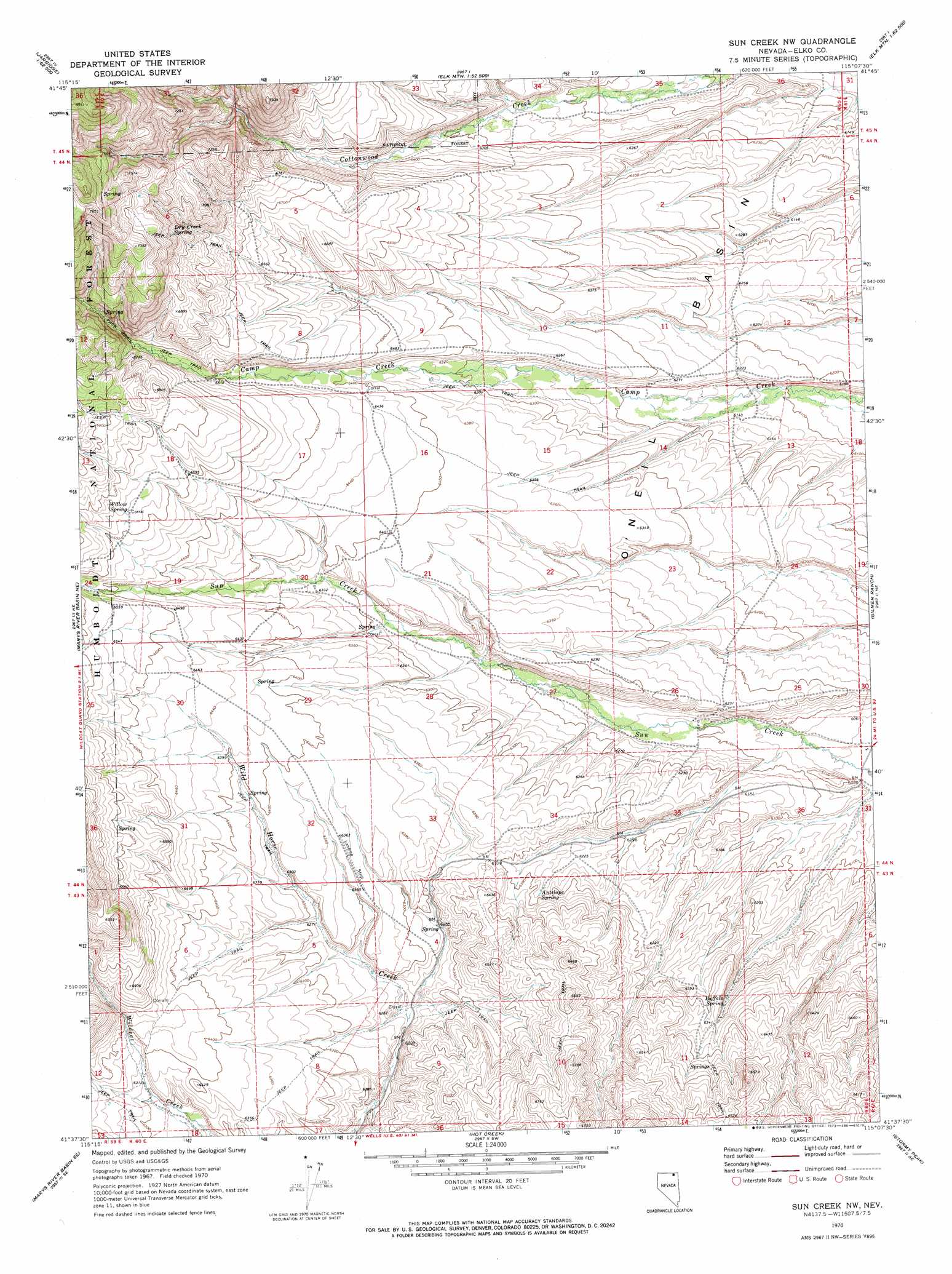
USGS Topo Quad 41115f2 - 1:24,000 scale
| Topo Map Name: | Sun Creek Nw |
| USGS Topo Quad ID: | 41115f2 |
| Print Size: | ca. 21 1/4" wide x 27" high |
| Southeast Coordinates: | 41.625° N latitude / 115.125° W longitude |
| Map Center Coordinates: | 41.6875° N latitude / 115.1875° W longitude |
| U.S. State: | NV |
| Filename: | o41115f2.jpg |
| Download Map JPG Image: | Sun Creek Nw topo map 1:24,000 scale |
| Map Type: | Topographic |
| Topo Series: | 7.5´ |
| Map Scale: | 1:24,000 |
| Source of Map Images: | United States Geological Survey (USGS) |
| Alternate Map Versions: |
Sun Creek NW NV 1970, updated 1973 Download PDF Buy paper map Sun Creek NW NV 2012 Download PDF Buy paper map Sun Creek NW NV 2015 Download PDF Buy paper map |
| FStopo: | US Forest Service topo Sun Creek NW is available: Download FStopo PDF Download FStopo TIF |
1:24,000 Topo Quads surrounding Sun Creek Nw
Jarbidge North |
Robinson Creek |
Caudle Creek |
Elk Mountain |
Bear Mountain |
Jarbidge South |
Gods Pocket Peak |
Goat Creek |
Buckhorn Ridge |
Twin Meadows Ranch |
Marys River Basin Nw |
Marys River Basin Ne |
Sun Creek Nw |
Gilmer Ranch |
Hubbard Basin |
Charleston Reservoir |
Marys River Basin Se |
Hot Creek |
Stormy Peak |
Boies Reservoir |
Stag Mountain |
Hanks Creek Ne |
Buena Vista Ranch |
Black Butte Ne |
Loomis Mountain |
> Back to 41115e1 at 1:100,000 scale
> Back to 41114a1 at 1:250,000 scale
> Back to U.S. Topo Maps home
Sun Creek Nw topo map: Gazetteer
Sun Creek Nw: Basins
O'Neil Basin elevation 1911m 6269′Sun Creek Nw: Springs
Antelope Spring elevation 1912m 6272′Buffalo Spring elevation 1916m 6286′
Dry Creek Spring elevation 2148m 7047′
Willow Spring elevation 1945m 6381′
Willow Spring elevation 1958m 6423′
Willow Spring elevation 2024m 6640′
Sun Creek Nw digital topo map on disk
Buy this Sun Creek Nw topo map showing relief, roads, GPS coordinates and other geographical features, as a high-resolution digital map file on DVD: