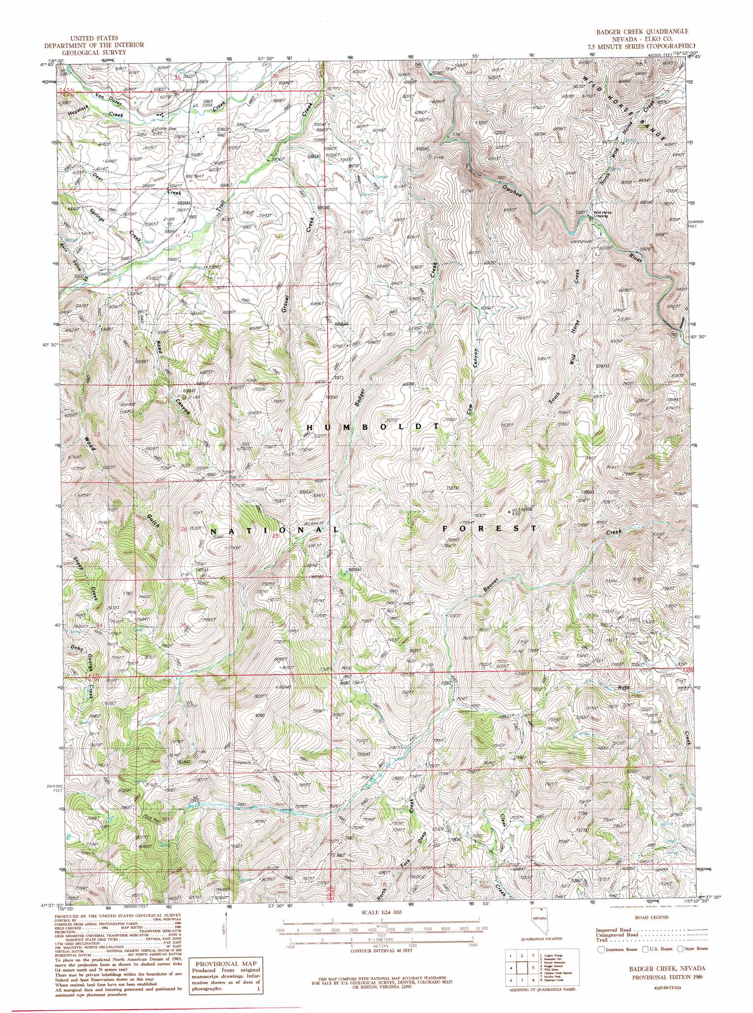
Badger Creek Topo Map Nevada
To zoom in, hover over the map of Badger Creek
USGS Topo Quad 41115f8 - 1:24,000 scale
| Topo Map Name: | Badger Creek |
| USGS Topo Quad ID: | 41115f8 |
| Print Size: | ca. 21 1/4" wide x 27" high |
| Southeast Coordinates: | 41.625° N latitude / 115.875° W longitude |
| Map Center Coordinates: | 41.6875° N latitude / 115.9375° W longitude |
| U.S. State: | NV |
| Filename: | o41115f8.jpg |
| Download Map JPG Image: | Badger Creek topo map 1:24,000 scale |
| Map Type: | Topographic |
| Topo Series: | 7.5´ |
| Map Scale: | 1:24,000 |
| Source of Map Images: | United States Geological Survey (USGS) |
| Alternate Map Versions: |
Badger Creek NV 1986, updated 1987 Download PDF Buy paper map Badger Creek NV 2012 Download PDF Buy paper map Badger Creek NV 2014 Download PDF Buy paper map |
| FStopo: | US Forest Service topo Badger Creek is available: Download FStopo PDF Download FStopo TIF |
1:24,000 Topo Quads surrounding Badger Creek
The Point |
Owyhee |
Winter Ridge |
Hicks Mountain |
Big Table |
Dry Creek Reservoir |
Ungina Wongo |
Mountain City |
Merritt Mountain |
Tennessee Mountain |
Bull Run Reservoir |
Maggie Summit |
Badger Creek |
Wild Horse |
Cornwall Mountain |
Deep Creek |
Chicken Creek Summit |
Mcafee Peak |
Delaware Creek |
Wagon Springs |
Cottonwood Peak |
Jacks Peak |
California Mountain |
North Fork |
Double Mountain |
> Back to 41115e1 at 1:100,000 scale
> Back to 41114a1 at 1:250,000 scale
> Back to U.S. Topo Maps home
Badger Creek topo map: Gazetteer
Badger Creek: Airports
Byington Ranch Airport elevation 1802m 5912′Badger Creek: Mines
Wood Gulch Mine elevation 2267m 7437′Badger Creek: Streams
Badger Creek elevation 1818m 5964′Deer Creek elevation 1787m 5862′
Gravel Creek elevation 1772m 5813′
Haystack Creek elevation 1804m 5918′
Machado Creek elevation 1829m 6000′
North Wild Horse Creek elevation 1791m 5875′
South Wild Horse Creek elevation 1800m 5905′
Springs Creek elevation 1799m 5902′
Wood Gulch Creek elevation 1805m 5921′
Badger Creek: Valleys
Barn Gulch elevation 1816m 5958′Cow Canyon elevation 1900m 6233′
Road Canyon elevation 1793m 5882′
Wood Gulch elevation 1817m 5961′
Badger Creek digital topo map on disk
Buy this Badger Creek topo map showing relief, roads, GPS coordinates and other geographical features, as a high-resolution digital map file on DVD: