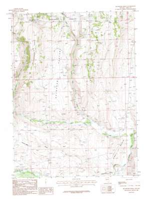
Buckhorn Ridge Topo Map Nevada
To zoom in, hover over the map of Buckhorn Ridge
USGS Topo Quad 41115g1 - 1:24,000 scale
| Topo Map Name: | Buckhorn Ridge |
| USGS Topo Quad ID: | 41115g1 |
| Print Size: | ca. 21 1/4" wide x 27" high |
| Southeast Coordinates: | 41.75° N latitude / 115° W longitude |
| Map Center Coordinates: | 41.8125° N latitude / 115.0625° W longitude |
| U.S. State: | NV |
| Filename: | o41115g1.jpg |
| Download Map JPG Image: | Buckhorn Ridge topo map 1:24,000 scale |
| Map Type: | Topographic |
| Topo Series: | 7.5´ |
| Map Scale: | 1:24,000 |
| Source of Map Images: | United States Geological Survey (USGS) |
| Alternate Map Versions: |
Buckhorn Ridge NV 1986, updated 1987 Download PDF Buy paper map Buckhorn Ridge NV 2012 Download PDF Buy paper map Buckhorn Ridge NV 2015 Download PDF Buy paper map |
| FStopo: | US Forest Service topo Buckhorn Ridge is available: Download FStopo PDF Download FStopo TIF |
1:24,000 Topo Quads surrounding Buckhorn Ridge
> Back to 41115e1 at 1:100,000 scale
> Back to 41114a1 at 1:250,000 scale
> Back to U.S. Topo Maps home
Buckhorn Ridge topo map: Gazetteer
Buckhorn Ridge: Flats
Elk Meadows elevation 2086m 6843′Buckhorn Ridge: Mines
Robinette Mine elevation 1960m 6430′Buckhorn Ridge: Populated Places
O'Neil (historical) elevation 1757m 5764′Buckhorn Ridge: Post Offices
O'Neil Post Office elevation 1757m 5764′Buckhorn Ridge: Ridges
Buckhorn Ridge elevation 2227m 7306′Buckhorn Ridge: Slopes
Buckhorn Pasture elevation 1977m 6486′Buckhorn Ridge: Springs
Buckhorn Spring elevation 2009m 6591′Elk Spring elevation 2105m 6906′
Buckhorn Ridge: Streams
Canyon Creek elevation 1736m 5695′O'Neil Creek elevation 1927m 6322′
Pole Creek elevation 1769m 5803′
Buckhorn Ridge: Valleys
Choke-A-Man Draw elevation 1768m 5800′Buckhorn Ridge digital topo map on disk
Buy this Buckhorn Ridge topo map showing relief, roads, GPS coordinates and other geographical features, as a high-resolution digital map file on DVD:


