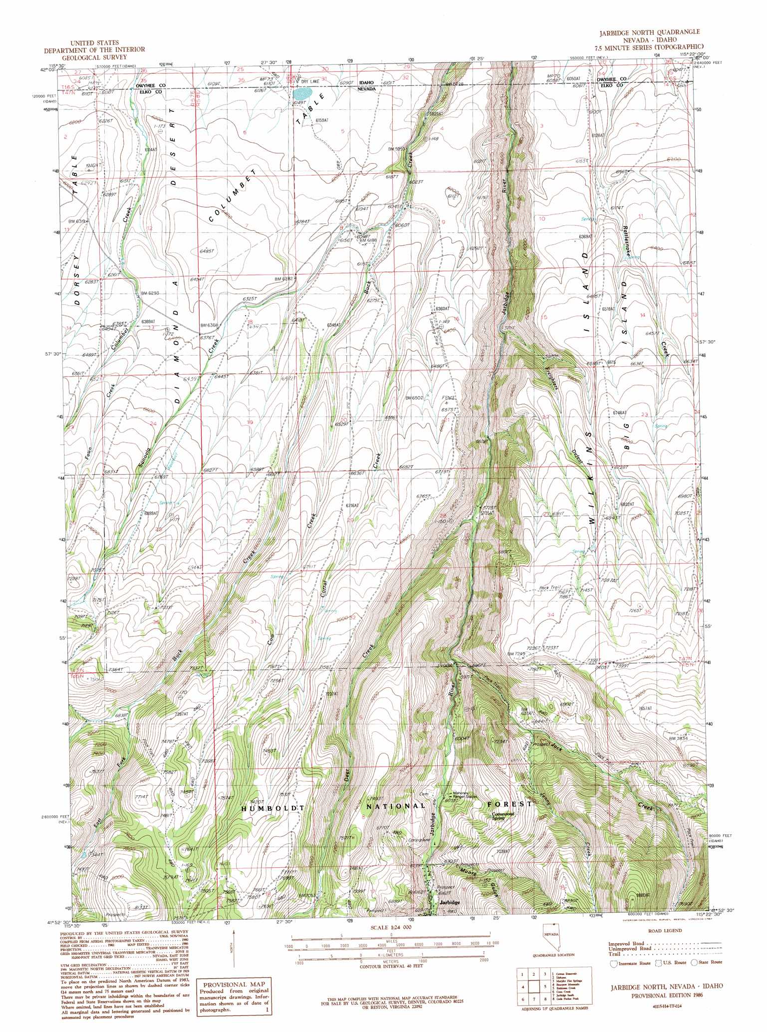
Jarbidge North Topo Map Nevada
To zoom in, hover over the map of Jarbidge North
USGS Topo Quad 41115h4 - 1:24,000 scale
| Topo Map Name: | Jarbidge North |
| USGS Topo Quad ID: | 41115h4 |
| Print Size: | ca. 21 1/4" wide x 27" high |
| Southeast Coordinates: | 41.875° N latitude / 115.375° W longitude |
| Map Center Coordinates: | 41.9375° N latitude / 115.4375° W longitude |
| U.S. States: | NV, ID |
| Filename: | o41115h4.jpg |
| Download Map JPG Image: | Jarbidge North topo map 1:24,000 scale |
| Map Type: | Topographic |
| Topo Series: | 7.5´ |
| Map Scale: | 1:24,000 |
| Source of Map Images: | United States Geological Survey (USGS) |
| Alternate Map Versions: |
Jarbidge North NV 1986, updated 1987 Download PDF Buy paper map Jarbidge North NV 1986, updated 1987 Download PDF Buy paper map Jarbidge North NV 2012 Download PDF Buy paper map Jarbidge North NV 2014 Download PDF Buy paper map |
| FStopo: | US Forest Service topo Jarbidge North is available: Download FStopo PDF Download FStopo TIF |
1:24,000 Topo Quads surrounding Jarbidge North
Triguero Lake |
The Arch |
Poison Butte |
Mosquito Lake Butte |
Salls Crossing |
Triplet Butte |
Cowan Reservoir |
Dishpan |
Murphy Hot Springs |
Three Creek |
Big Table |
Bearpaw Mountain |
Jarbidge North |
Robinson Creek |
Caudle Creek |
Tennessee Mountain |
Coon Creek |
Jarbidge South |
Gods Pocket Peak |
Goat Creek |
Cornwall Mountain |
Annie Creek |
Marys River Basin Nw |
Marys River Basin Ne |
Sun Creek Nw |
> Back to 41115e1 at 1:100,000 scale
> Back to 41114a1 at 1:250,000 scale
> Back to U.S. Topo Maps home
Jarbidge North topo map: Gazetteer
Jarbidge North: Areas
Big Island elevation 1951m 6400′Columbet Table elevation 1871m 6138′
Wilkins Island elevation 1958m 6423′
Jarbidge North: Mines
Golden Queen Mine elevation 2079m 6820′Midnight Mine elevation 1959m 6427′
Virginus Mine elevation 2256m 7401′
Virginus Number One Mine elevation 2276m 7467′
Virginus Number Two Mine elevation 2255m 7398′
Jarbidge North: Populated Places
Jack Creek Camp elevation 2002m 6568′Jarbidge North: Springs
Cottonwood Spring elevation 2007m 6584′Jarbidge North: Streams
Corral Creek elevation 1840m 6036′Cow Creek elevation 1916m 6286′
Deer Creek elevation 1778m 5833′
East Fork Buck Creek elevation 2071m 6794′
Fawn Creek elevation 1940m 6364′
Freighters Defeat elevation 1695m 5561′
Jack Creek elevation 1850m 6069′
Jenny Creek elevation 1951m 6400′
Jones Spring Wash elevation 1783m 5849′
Sanovia Creek elevation 1869m 6131′
Jarbidge North: Valleys
Corral Creek Canyon elevation 1847m 6059′Cow Creek Canyon elevation 1899m 6230′
East Fork Rattlesnake Canyon elevation 1856m 6089′
Moore Gulch elevation 1875m 6151′
West Fork Rattlesnake Canyon elevation 1856m 6089′
Jarbidge North digital topo map on disk
Buy this Jarbidge North topo map showing relief, roads, GPS coordinates and other geographical features, as a high-resolution digital map file on DVD: