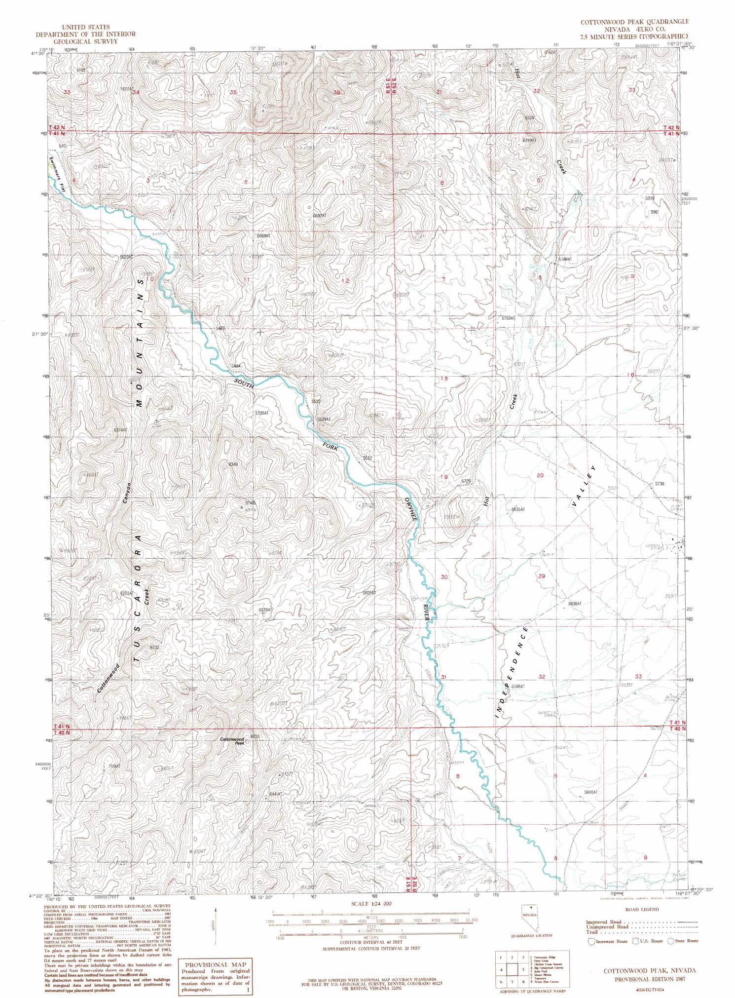
Cottonwood Peak Topo Map Nevada
To zoom in, hover over the map of Cottonwood Peak
USGS Topo Quad 41116d2 - 1:24,000 scale
| Topo Map Name: | Cottonwood Peak |
| USGS Topo Quad ID: | 41116d2 |
| Print Size: | ca. 21 1/4" wide x 27" high |
| Southeast Coordinates: | 41.375° N latitude / 116.125° W longitude |
| Map Center Coordinates: | 41.4375° N latitude / 116.1875° W longitude |
| U.S. State: | NV |
| Filename: | o41116d2.jpg |
| Download Map JPG Image: | Cottonwood Peak topo map 1:24,000 scale |
| Map Type: | Topographic |
| Topo Series: | 7.5´ |
| Map Scale: | 1:24,000 |
| Source of Map Images: | United States Geological Survey (USGS) |
| Alternate Map Versions: |
Cottonwood Peak NV 1987, updated 1987 Download PDF Buy paper map Cottonwood Peak NV 2012 Download PDF Buy paper map Cottonwood Peak NV 2014 Download PDF Buy paper map |
1:24,000 Topo Quads surrounding Cottonwood Peak
Fourmile Butte |
Wilson Reservoir |
Bull Run Reservoir |
Maggie Summit |
Badger Creek |
I-L Ranch |
Cornucopia Ridge |
Deep Creek |
Chicken Creek Summit |
Mcafee Peak |
Red Cow Creek |
Big Cottonwood Canyon |
Cottonwood Peak |
Jacks Peak |
California Mountain |
Toe Jam Mountain |
Mount Blitzen |
Tuscarora |
Water Pipe Canyon |
Mahala Creek West |
China Camp |
Sugarloaf Butte |
Lake Mountain |
Stampede Ranch |
Reed Station |
> Back to 41116a1 at 1:100,000 scale
> Back to 41116a1 at 1:250,000 scale
> Back to U.S. Topo Maps home
Cottonwood Peak topo map: Gazetteer
Cottonwood Peak: Springs
Hot Sulphur Springs elevation 1773m 5816′Cottonwood Peak: Streams
Bull Creek elevation 1726m 5662′Cottonwood Creek elevation 1668m 5472′
Hot Creek elevation 1693m 5554′
Niagara Creek elevation 1711m 5613′
Skull Creek elevation 1666m 5465′
Cottonwood Peak: Summits
Cottonwood Peak elevation 2010m 6594′Cottonwood Peak: Valleys
Cottonwood Creek Canyon elevation 1671m 5482′Cottonwood Peak digital topo map on disk
Buy this Cottonwood Peak topo map showing relief, roads, GPS coordinates and other geographical features, as a high-resolution digital map file on DVD: