Cornucopia Ridge Topo Map Nevada
To zoom in, hover over the map of Cornucopia Ridge
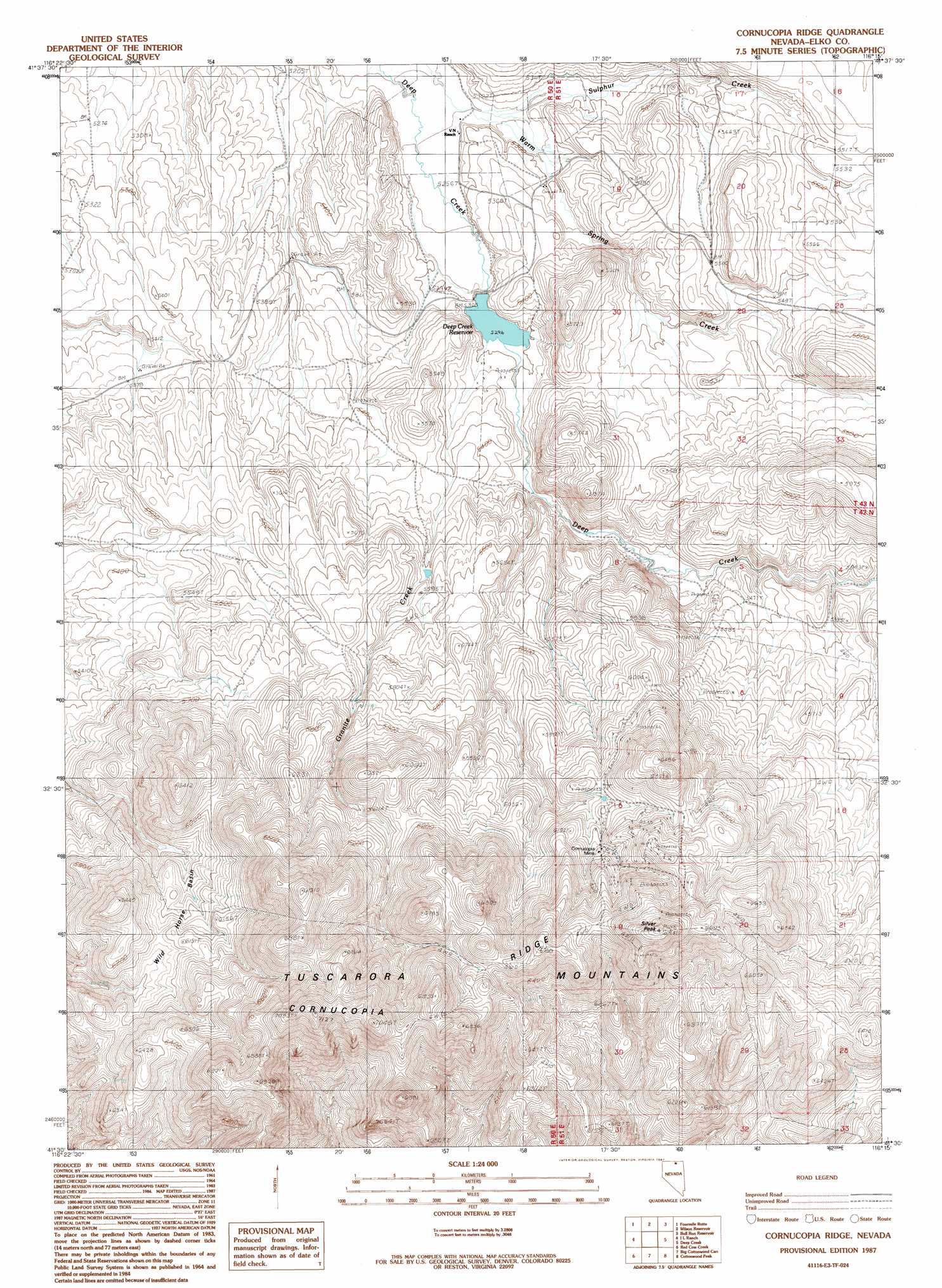
USGS Topo Quad 41116e3 - 1:24,000 scale
| Topo Map Name: | Cornucopia Ridge |
| USGS Topo Quad ID: | 41116e3 |
| Print Size: | ca. 21 1/4" wide x 27" high |
| Southeast Coordinates: | 41.5° N latitude / 116.25° W longitude |
| Map Center Coordinates: | 41.5625° N latitude / 116.3125° W longitude |
| U.S. State: | NV |
| Filename: | o41116e3.jpg |
| Download Map JPG Image: | Cornucopia Ridge topo map 1:24,000 scale |
| Map Type: | Topographic |
| Topo Series: | 7.5´ |
| Map Scale: | 1:24,000 |
| Source of Map Images: | United States Geological Survey (USGS) |
| Alternate Map Versions: |
Cornucopia Ridge NV 1987, updated 1987 Download PDF Buy paper map Cornucopia Ridge NV 2012 Download PDF Buy paper map Cornucopia Ridge NV 2014 Download PDF Buy paper map |
1:24,000 Topo Quads surrounding Cornucopia Ridge
Peterson Table West |
Peterson Table East |
Sheep Creek Reservoir |
Dry Creek Reservoir |
Ungina Wongo |
Desert Ranch |
Fourmile Butte |
Wilson Reservoir |
Bull Run Reservoir |
Maggie Summit |
Middle Draw Reservoir |
I-L Ranch |
Cornucopia Ridge |
Deep Creek |
Chicken Creek Summit |
Soldier Cap |
Red Cow Creek |
Big Cottonwood Canyon |
Cottonwood Peak |
Jacks Peak |
Little Rock Creek |
Toe Jam Mountain |
Mount Blitzen |
Tuscarora |
Water Pipe Canyon |
> Back to 41116e1 at 1:100,000 scale
> Back to 41116a1 at 1:250,000 scale
> Back to U.S. Topo Maps home
Cornucopia Ridge topo map: Gazetteer
Cornucopia Ridge: Basins
Wild Horse Basin elevation 1810m 5938′Cornucopia Ridge: Dams
Deep Creek Dam elevation 1621m 5318′Cornucopia Ridge: Mines
Cornucopia Mine elevation 1884m 6181′Hussey Mine elevation 1884m 6181′
Leopard Mine elevation 1896m 6220′
Panther Mine elevation 1896m 6220′
Republic Mine elevation 1884m 6181′
South Leopard Mine elevation 1884m 6181′
Cornucopia Ridge: Populated Places
Cornucopia (historical) elevation 1892m 6207′Cornucopia Ridge: Post Offices
Cornucopia Post Office (historical) elevation 1892m 6207′Cornucopia Ridge: Reservoirs
Deep Creek Reservoir elevation 1621m 5318′Cornucopia Ridge: Ridges
Cornucopia Ridge elevation 2054m 6738′Cornucopia Ridge: Springs
Allen Spring elevation 2034m 6673′Sulphur Spring elevation 1651m 5416′
Cornucopia Ridge: Streams
Granite Creek elevation 1621m 5318′Sulphur Creek elevation 1600m 5249′
Cornucopia Ridge: Summits
Silver Peak elevation 2112m 6929′Cornucopia Ridge digital topo map on disk
Buy this Cornucopia Ridge topo map showing relief, roads, GPS coordinates and other geographical features, as a high-resolution digital map file on DVD: