I-L Ranch Topo Map Nevada
To zoom in, hover over the map of I-L Ranch
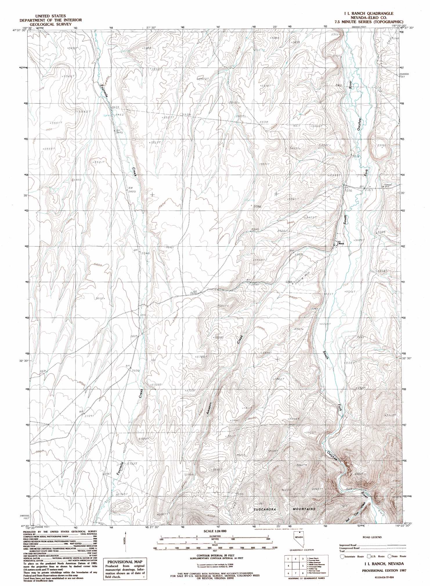
USGS Topo Quad 41116e4 - 1:24,000 scale
| Topo Map Name: | I-L Ranch |
| USGS Topo Quad ID: | 41116e4 |
| Print Size: | ca. 21 1/4" wide x 27" high |
| Southeast Coordinates: | 41.5° N latitude / 116.375° W longitude |
| Map Center Coordinates: | 41.5625° N latitude / 116.4375° W longitude |
| U.S. State: | NV |
| Filename: | o41116e4.jpg |
| Download Map JPG Image: | I-L Ranch topo map 1:24,000 scale |
| Map Type: | Topographic |
| Topo Series: | 7.5´ |
| Map Scale: | 1:24,000 |
| Source of Map Images: | United States Geological Survey (USGS) |
| Alternate Map Versions: |
I L Ranch NV 1987, updated 1987 Download PDF Buy paper map I L Ranch NV 2012 Download PDF Buy paper map I L Ranch NV 2014 Download PDF Buy paper map |
1:24,000 Topo Quads surrounding I-L Ranch
Twelvemile Flat |
Peterson Table West |
Peterson Table East |
Sheep Creek Reservoir |
Dry Creek Reservoir |
Silver Lake |
Desert Ranch |
Fourmile Butte |
Wilson Reservoir |
Bull Run Reservoir |
Winters Ranch Reservoir |
Middle Draw Reservoir |
I-L Ranch |
Cornucopia Ridge |
Deep Creek |
Burner Hills |
Soldier Cap |
Red Cow Creek |
Big Cottonwood Canyon |
Cottonwood Peak |
Scraper Springs |
Little Rock Creek |
Toe Jam Mountain |
Mount Blitzen |
Tuscarora |
> Back to 41116e1 at 1:100,000 scale
> Back to 41116a1 at 1:250,000 scale
> Back to U.S. Topo Maps home
I-L Ranch topo map: Gazetteer
I-L Ranch: Airports
I-L Ranch Airport elevation 1629m 5344′I-L Ranch: Streams
Amazon Creek elevation 1599m 5246′Chino Creek elevation 1751m 5744′
Red Cow Creek elevation 1620m 5314′
I-L Ranch digital topo map on disk
Buy this I-L Ranch topo map showing relief, roads, GPS coordinates and other geographical features, as a high-resolution digital map file on DVD: