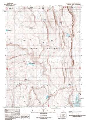
Groundhog Reservoir Topo Map Nevada
To zoom in, hover over the map of Groundhog Reservoir
USGS Topo Quad 41116h3 - 1:24,000 scale
| Topo Map Name: | Groundhog Reservoir |
| USGS Topo Quad ID: | 41116h3 |
| Print Size: | ca. 21 1/4" wide x 27" high |
| Southeast Coordinates: | 41.875° N latitude / 116.25° W longitude |
| Map Center Coordinates: | 41.9375° N latitude / 116.3125° W longitude |
| U.S. States: | NV, ID |
| Filename: | o41116h3.jpg |
| Download Map JPG Image: | Groundhog Reservoir topo map 1:24,000 scale |
| Map Type: | Topographic |
| Topo Series: | 7.5´ |
| Map Scale: | 1:24,000 |
| Source of Map Images: | United States Geological Survey (USGS) |
| Alternate Map Versions: |
Groundhog Reservoir NV 1987, updated 1987 Download PDF Buy paper map Groundhog Reservoir NV 2012 Download PDF Buy paper map Groundhog Reservoir NV 2014 Download PDF Buy paper map |
1:24,000 Topo Quads surrounding Groundhog Reservoir
> Back to 41116e1 at 1:100,000 scale
> Back to 41116a1 at 1:250,000 scale
> Back to U.S. Topo Maps home
Groundhog Reservoir topo map: Gazetteer
Groundhog Reservoir: Dams
Groundhog Reservoir Dam elevation 1655m 5429′Groundhog Reservoir: Lakes
Ross Lake elevation 1785m 5856′Ross Lake elevation 1785m 5856′
Groundhog Reservoir: Reservoirs
Brady Reservoir elevation 1760m 5774′Circle Creek Reservoir elevation 1666m 5465′
Circle Cross Reservoir elevation 1679m 5508′
Dick Reservoir elevation 1756m 5761′
Groundhog Reservoir elevation 1655m 5429′
Manning Reservoir elevation 1696m 5564′
McNeilly Reservoir elevation 1742m 5715′
No Name Reservoir elevation 1647m 5403′
Rattlesnake Reservoir elevation 1664m 5459′
Reservation Fence Reservoir elevation 1696m 5564′
Roger Smith Reservoir elevation 1733m 5685′
Spencer Reservoir elevation 1675m 5495′
Thacker Reservoir elevation 1702m 5583′
Thomas Reservoir elevation 1731m 5679′
Groundhog Reservoir: Wells
Circle Creek Well elevation 1666m 5465′Groundhog Reservoir digital topo map on disk
Buy this Groundhog Reservoir topo map showing relief, roads, GPS coordinates and other geographical features, as a high-resolution digital map file on DVD:


