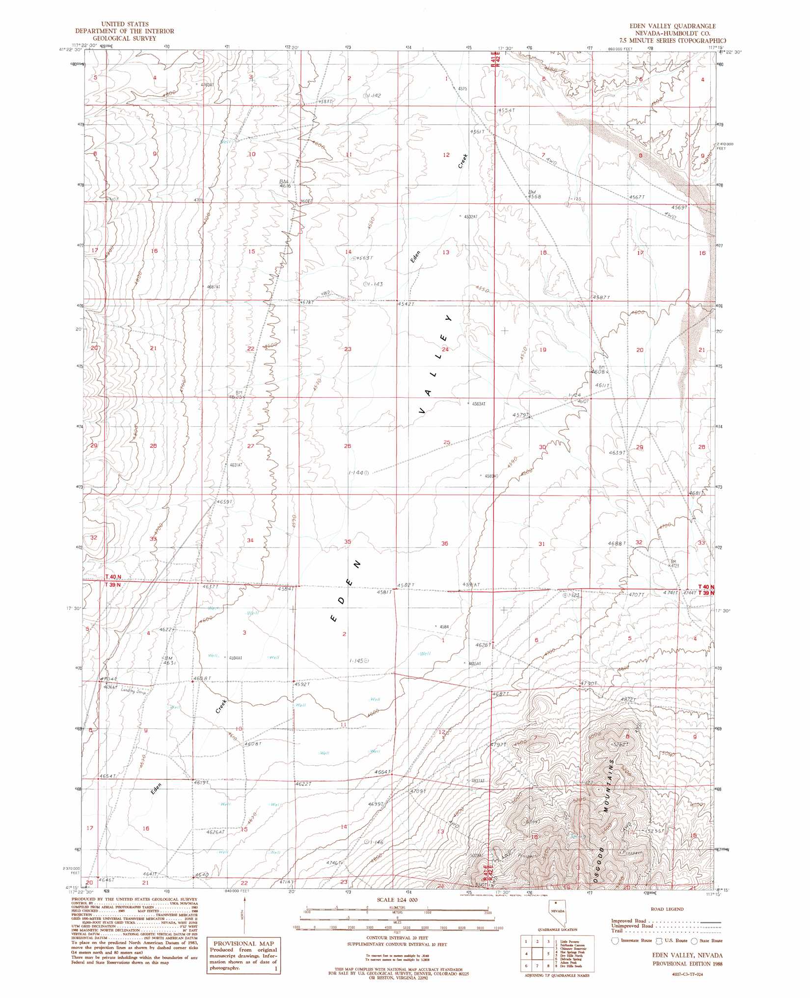
Eden Valley Topo Map Nevada
To zoom in, hover over the map of Eden Valley
USGS Topo Quad 41117c3 - 1:24,000 scale
| Topo Map Name: | Eden Valley |
| USGS Topo Quad ID: | 41117c3 |
| Print Size: | ca. 21 1/4" wide x 27" high |
| Southeast Coordinates: | 41.25° N latitude / 117.25° W longitude |
| Map Center Coordinates: | 41.3125° N latitude / 117.3125° W longitude |
| U.S. State: | NV |
| Filename: | o41117c3.jpg |
| Download Map JPG Image: | Eden Valley topo map 1:24,000 scale |
| Map Type: | Topographic |
| Topo Series: | 7.5´ |
| Map Scale: | 1:24,000 |
| Source of Map Images: | United States Geological Survey (USGS) |
| Alternate Map Versions: |
Eden Valley NV 1988, updated 1989 Download PDF Buy paper map Eden Valley NV 2011 Download PDF Buy paper map Eden Valley NV 2015 Download PDF Buy paper map |
1:24,000 Topo Quads surrounding Eden Valley
Mullinix Creek |
Spring City |
Hardscrabble |
Whiskey Springs |
Greeley Flat Se |
Paradise Valley |
Little Poverty |
Fairbanks Canyon |
Chimney Reservoir |
Layton Spring |
Willow Point |
Hot Springs Peak |
Eden Valley |
Dry Hills North |
Kenny Creek |
Gumboot Lake |
Delvada Spring |
Adam Peak |
Dry Hills South |
The Knolls |
Golconda Butte |
Anderson Gardens |
Red House Flat West |
Red House Flat East |
Elevenmile Well |
> Back to 41117a1 at 1:100,000 scale
> Back to 41116a1 at 1:250,000 scale
> Back to U.S. Topo Maps home
Eden Valley digital topo map on disk
Buy this Eden Valley topo map showing relief, roads, GPS coordinates and other geographical features, as a high-resolution digital map file on DVD: