Hot Springs Peak Topo Map Nevada
To zoom in, hover over the map of Hot Springs Peak
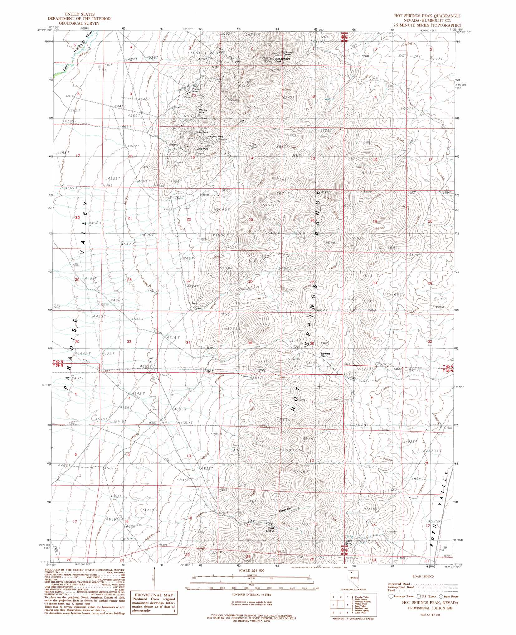
USGS Topo Quad 41117c4 - 1:24,000 scale
| Topo Map Name: | Hot Springs Peak |
| USGS Topo Quad ID: | 41117c4 |
| Print Size: | ca. 21 1/4" wide x 27" high |
| Southeast Coordinates: | 41.25° N latitude / 117.375° W longitude |
| Map Center Coordinates: | 41.3125° N latitude / 117.4375° W longitude |
| U.S. State: | NV |
| Filename: | o41117c4.jpg |
| Download Map JPG Image: | Hot Springs Peak topo map 1:24,000 scale |
| Map Type: | Topographic |
| Topo Series: | 7.5´ |
| Map Scale: | 1:24,000 |
| Source of Map Images: | United States Geological Survey (USGS) |
| Alternate Map Versions: |
Hot Springs Peak NV 1988, updated 1989 Download PDF Buy paper map Hot Springs Peak NV 2011 Download PDF Buy paper map Hot Springs Peak NV 2015 Download PDF Buy paper map |
1:24,000 Topo Quads surrounding Hot Springs Peak
Santa Rosa Peak |
Mullinix Creek |
Spring City |
Hardscrabble |
Whiskey Springs |
Five Fingers |
Paradise Valley |
Little Poverty |
Fairbanks Canyon |
Chimney Reservoir |
Paradise Well |
Willow Point |
Hot Springs Peak |
Eden Valley |
Dry Hills North |
China Garden |
Gumboot Lake |
Delvada Spring |
Adam Peak |
Dry Hills South |
Weso |
Golconda Butte |
Anderson Gardens |
Red House Flat West |
Red House Flat East |
> Back to 41117a1 at 1:100,000 scale
> Back to 41116a1 at 1:250,000 scale
> Back to U.S. Topo Maps home
Hot Springs Peak topo map: Gazetteer
Hot Springs Peak: Gaps
Stewart Gap elevation 1623m 5324′Hot Springs Peak: Mines
Cahill Mine elevation 1570m 5150′Hapgood Mine elevation 1620m 5314′
Prentiss Mine elevation 1497m 4911′
Snowdrift Mine elevation 1841m 6040′
Sonoma Mine elevation 1486m 4875′
Turillas Mine elevation 1571m 5154′
Wholey Mine elevation 1521m 4990′
Hot Springs Peak: Ranges
Hot Springs Range elevation 1799m 5902′Hot Springs Peak: Springs
Reed Spring elevation 1648m 5406′Scott Spring elevation 1570m 5150′
Hot Springs Peak: Summits
Hot Springs Peak elevation 1937m 6354′Hot Springs Peak: Valleys
Ling Canyon elevation 1536m 5039′Hot Springs Peak digital topo map on disk
Buy this Hot Springs Peak topo map showing relief, roads, GPS coordinates and other geographical features, as a high-resolution digital map file on DVD: