Mullinix Creek Topo Map Nevada
To zoom in, hover over the map of Mullinix Creek
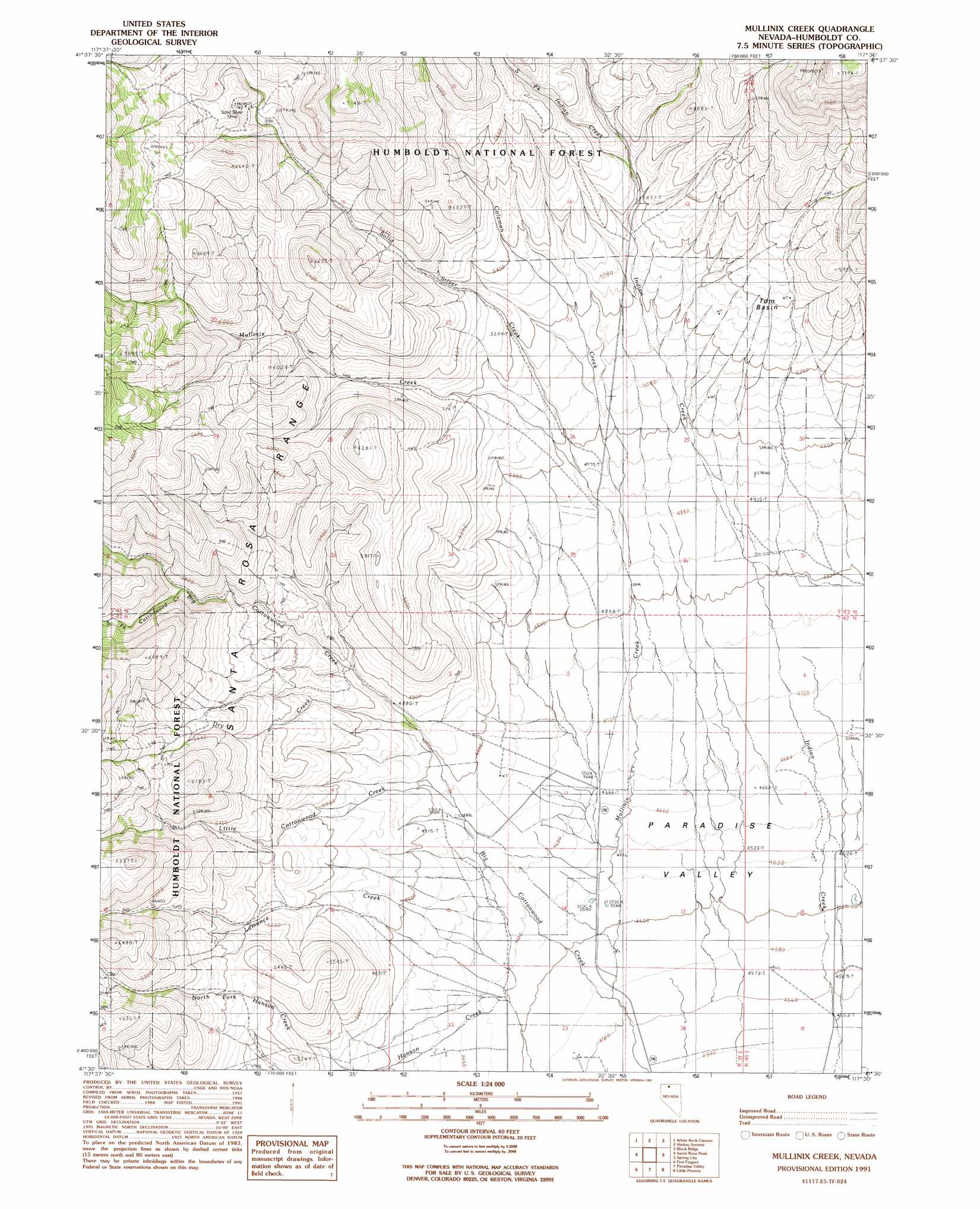
USGS Topo Quad 41117e5 - 1:24,000 scale
| Topo Map Name: | Mullinix Creek |
| USGS Topo Quad ID: | 41117e5 |
| Print Size: | ca. 21 1/4" wide x 27" high |
| Southeast Coordinates: | 41.5° N latitude / 117.5° W longitude |
| Map Center Coordinates: | 41.5625° N latitude / 117.5625° W longitude |
| U.S. State: | NV |
| Filename: | o41117e5.jpg |
| Download Map JPG Image: | Mullinix Creek topo map 1:24,000 scale |
| Map Type: | Topographic |
| Topo Series: | 7.5´ |
| Map Scale: | 1:24,000 |
| Source of Map Images: | United States Geological Survey (USGS) |
| Alternate Map Versions: |
Mullinix Creek NV 1991, updated 1991 Download PDF Buy paper map Mullinix Creek NV 2011 Download PDF Buy paper map Mullinix Creek NV 2015 Download PDF Buy paper map |
| FStopo: | US Forest Service topo Mullinix Creek is available: Download FStopo PDF Download FStopo TIF |
1:24,000 Topo Quads surrounding Mullinix Creek
Hoppin Peaks |
South Of Mcdermitt |
Buckskin Mountain |
Holloway Meadows |
Capitol Peak |
Willow Creek Ranch |
White Rock Canyon |
Hinkey Summit |
Black Ridge |
Coyote Mountain |
Orovada |
Santa Rosa Peak |
Mullinix Creek |
Spring City |
Hardscrabble |
Andorno Ranch |
Five Fingers |
Paradise Valley |
Little Poverty |
Fairbanks Canyon |
Mud Spring Canyon |
Paradise Well |
Willow Point |
Hot Springs Peak |
Eden Valley |
> Back to 41117e1 at 1:100,000 scale
> Back to 41116a1 at 1:250,000 scale
> Back to U.S. Topo Maps home
Mullinix Creek topo map: Gazetteer
Mullinix Creek: Basins
Tom Basin elevation 1617m 5305′Mullinix Creek: Mines
Solid Silver Mine elevation 1880m 6167′Mullinix Creek: Streams
Buttermilk Creek elevation 1450m 4757′Coleman Creek elevation 1474m 4835′
Cottonwood Creek elevation 1448m 4750′
Dry Creek elevation 1474m 4835′
Hanson Creek elevation 1408m 4619′
Indian Creek elevation 1379m 4524′
Lamance Creek elevation 1416m 4645′
Little Cottonwood Creek elevation 1448m 4750′
Mullinix Creek elevation 1395m 4576′
Solid Silver Creek elevation 1512m 4960′
South Fork Cottonwood Creek elevation 1660m 5446′
South Fork Indian Creek elevation 1657m 5436′
Mullinix Creek digital topo map on disk
Buy this Mullinix Creek topo map showing relief, roads, GPS coordinates and other geographical features, as a high-resolution digital map file on DVD: