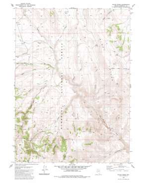
Black Ridge Topo Map Nevada
To zoom in, hover over the map of Black Ridge
USGS Topo Quad 41117f4 - 1:24,000 scale
| Topo Map Name: | Black Ridge |
| USGS Topo Quad ID: | 41117f4 |
| Print Size: | ca. 21 1/4" wide x 27" high |
| Southeast Coordinates: | 41.625° N latitude / 117.375° W longitude |
| Map Center Coordinates: | 41.6875° N latitude / 117.4375° W longitude |
| U.S. State: | NV |
| Filename: | o41117f4.jpg |
| Download Map JPG Image: | Black Ridge topo map 1:24,000 scale |
| Map Type: | Topographic |
| Topo Series: | 7.5´ |
| Map Scale: | 1:24,000 |
| Source of Map Images: | United States Geological Survey (USGS) |
| Alternate Map Versions: |
Black Ridge NV 1980, updated 1980 Download PDF Buy paper map Black Ridge NV 2011 Download PDF Buy paper map Black Ridge NV 2015 Download PDF Buy paper map |
| FStopo: | US Forest Service topo Black Ridge is available: Download FStopo PDF Download FStopo TIF |
1:24,000 Topo Quads surrounding Black Ridge
> Back to 41117e1 at 1:100,000 scale
> Back to 41116a1 at 1:250,000 scale
> Back to U.S. Topo Maps home
Black Ridge topo map: Gazetteer
Black Ridge: Basins
Long Valley elevation 1922m 6305′Black Ridge: Flats
Coon Flat elevation 1614m 5295′Black Ridge: Ranges
Martin Creek Mountains elevation 2198m 7211′Black Ridge: Ridges
Black Ridge elevation 2166m 7106′Mahogany Ridge elevation 2076m 6811′
Black Ridge: Springs
Big Springs elevation 2069m 6788′Coal Pit Spring elevation 2261m 7417′
East Spring elevation 2044m 6706′
Recanzone Spring elevation 2113m 6932′
Black Ridge: Streams
Alkali Creek elevation 1831m 6007′Antelope Creek elevation 1746m 5728′
Bradshaw Creek elevation 1806m 5925′
Cabin Creek elevation 1819m 5967′
Deep Creek elevation 1816m 5958′
Dutch John Creek elevation 1779m 5836′
East Fork Round Corral Creek elevation 1787m 5862′
Harvey Creek elevation 1804m 5918′
Long Valley Creek elevation 1800m 5905′
Middle Fork Round Corral Creek elevation 1840m 6036′
North Fork Cabin Creek elevation 1858m 6095′
Road Creek elevation 1790m 5872′
Round Corral Creek elevation 1723m 5652′
Spring Creek elevation 1695m 5561′
Black Ridge: Summits
Cloister elevation 2239m 7345′Thimble elevation 2290m 7513′
Black Ridge: Valleys
Box Canyon elevation 1984m 6509′Cave Canyon elevation 1579m 5180′
Harvey Canyon elevation 1787m 5862′
Black Ridge digital topo map on disk
Buy this Black Ridge topo map showing relief, roads, GPS coordinates and other geographical features, as a high-resolution digital map file on DVD:


