White Rock Canyon Topo Map Nevada
To zoom in, hover over the map of White Rock Canyon
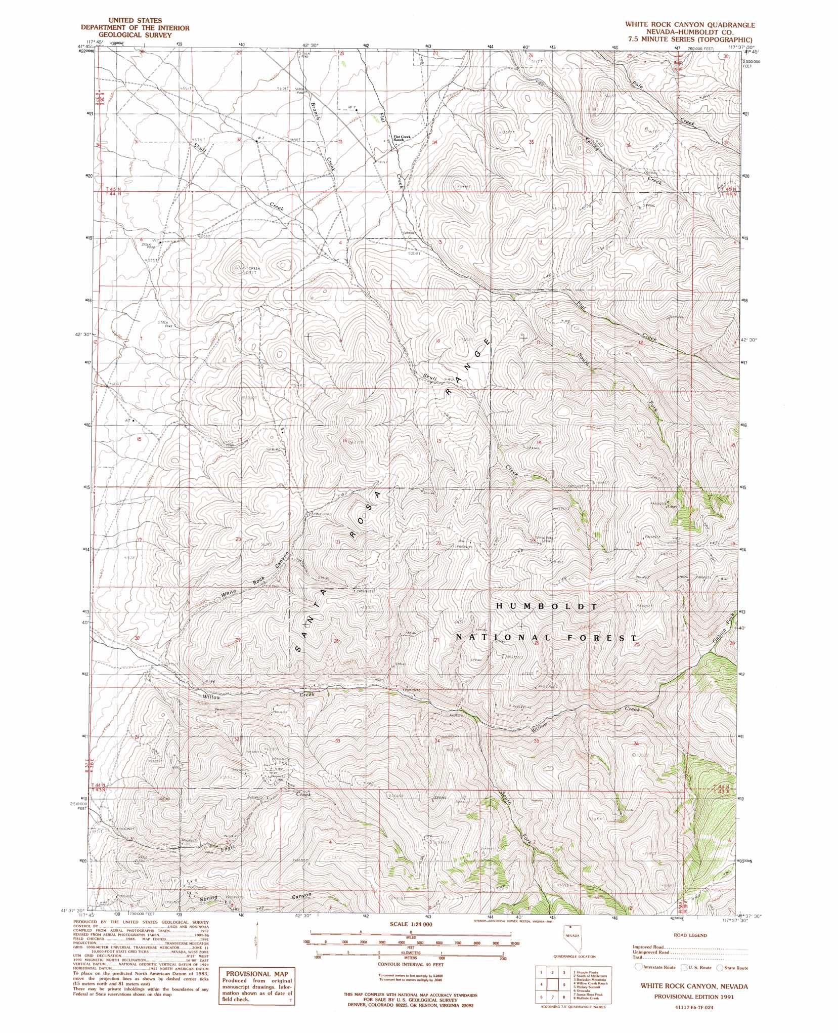
USGS Topo Quad 41117f6 - 1:24,000 scale
| Topo Map Name: | White Rock Canyon |
| USGS Topo Quad ID: | 41117f6 |
| Print Size: | ca. 21 1/4" wide x 27" high |
| Southeast Coordinates: | 41.625° N latitude / 117.625° W longitude |
| Map Center Coordinates: | 41.6875° N latitude / 117.6875° W longitude |
| U.S. State: | NV |
| Filename: | o41117f6.jpg |
| Download Map JPG Image: | White Rock Canyon topo map 1:24,000 scale |
| Map Type: | Topographic |
| Topo Series: | 7.5´ |
| Map Scale: | 1:24,000 |
| Source of Map Images: | United States Geological Survey (USGS) |
| Alternate Map Versions: |
White Rock Canyon NV 1991, updated 1991 Download PDF Buy paper map White Rock Canyon NV 2011 Download PDF Buy paper map White Rock Canyon NV 2015 Download PDF Buy paper map |
| FStopo: | US Forest Service topo White Rock Canyon is available: Download FStopo PDF Download FStopo TIF |
1:24,000 Topo Quads surrounding White Rock Canyon
Jordan Meadow Nw |
Cordero Mine |
Mcdermitt |
Mcconnell Peak |
Odell Mountain |
Jordan Meadow |
Hoppin Peaks |
South Of Mcdermitt |
Buckskin Mountain |
Holloway Meadows |
Sentinel Rock |
Willow Creek Ranch |
White Rock Canyon |
Hinkey Summit |
Black Ridge |
Riverside Ranch |
Orovada |
Santa Rosa Peak |
Mullinix Creek |
Spring City |
Gallagher Flat |
Andorno Ranch |
Five Fingers |
Paradise Valley |
Little Poverty |
> Back to 41117e1 at 1:100,000 scale
> Back to 41116a1 at 1:250,000 scale
> Back to U.S. Topo Maps home
White Rock Canyon topo map: Gazetteer
White Rock Canyon: Streams
Branch Creek elevation 1401m 4596′Gabica Fork Willow Creek elevation 1931m 6335′
South Fork Willow Creek elevation 1635m 5364′
White Rock Canyon: Valleys
White Rock Canyon elevation 1451m 4760′White Rock Canyon digital topo map on disk
Buy this White Rock Canyon topo map showing relief, roads, GPS coordinates and other geographical features, as a high-resolution digital map file on DVD: