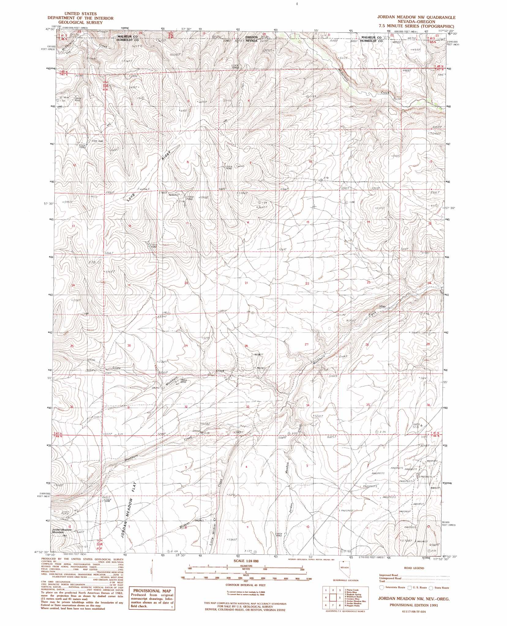
Jordan Meadow Nw Topo Map Nevada
To zoom in, hover over the map of Jordan Meadow Nw
USGS Topo Quad 41117h8 - 1:24,000 scale
| Topo Map Name: | Jordan Meadow Nw |
| USGS Topo Quad ID: | 41117h8 |
| Print Size: | ca. 21 1/4" wide x 27" high |
| Southeast Coordinates: | 41.875° N latitude / 117.875° W longitude |
| Map Center Coordinates: | 41.9375° N latitude / 117.9375° W longitude |
| U.S. States: | NV, OR |
| Filename: | o41117h8.jpg |
| Download Map JPG Image: | Jordan Meadow Nw topo map 1:24,000 scale |
| Map Type: | Topographic |
| Topo Series: | 7.5´ |
| Map Scale: | 1:24,000 |
| Source of Map Images: | United States Geological Survey (USGS) |
| Alternate Map Versions: |
Jordan Meadow NW NV 1991, updated 1991 Download PDF Buy paper map Jordan Meadow NW NV 2011 Download PDF Buy paper map Jordan Meadow NW NV 2015 Download PDF Buy paper map |
1:24,000 Topo Quads surrounding Jordan Meadow Nw
Little Whitehorse Creek |
Doolittle Creek |
Oregon Canyon Ranch |
Bowden Waterhole |
Jackson Summit |
Chicken Spring |
Payne Creek |
Bretz Mine |
Boghole Spring |
Tenmile Ranch |
Disaster Peak |
Washburn Basin |
Jordan Meadow Nw |
Cordero Mine |
Mcdermitt |
Calavera Canyon |
Jordan Meadow Mountain |
Jordan Meadow |
Hoppin Peaks |
South Of Mcdermitt |
Sheep Ranch Springs |
Thacker Pass |
Sentinel Rock |
Willow Creek Ranch |
White Rock Canyon |
> Back to 41117e1 at 1:100,000 scale
> Back to 41116a1 at 1:250,000 scale
> Back to U.S. Topo Maps home
Jordan Meadow Nw topo map: Gazetteer
Jordan Meadow Nw: Streams
Jordan Meadow Creek elevation 1488m 4881′Little Washburn Creek elevation 1483m 4865′
Little Wildcat Creek elevation 1558m 5111′
Wildcat Creek elevation 1497m 4911′
Jordan Meadow Nw digital topo map on disk
Buy this Jordan Meadow Nw topo map showing relief, roads, GPS coordinates and other geographical features, as a high-resolution digital map file on DVD: