Salt Water Spring Topo Map Nevada
To zoom in, hover over the map of Salt Water Spring
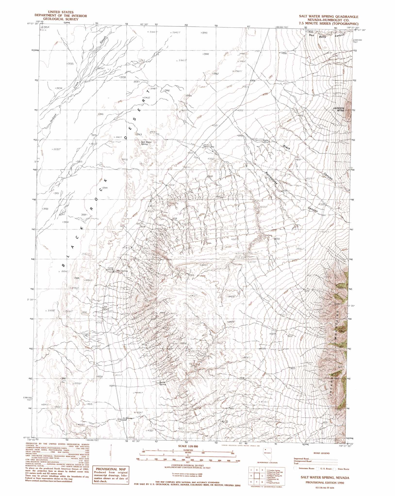
USGS Topo Quad 41118a6 - 1:24,000 scale
| Topo Map Name: | Salt Water Spring |
| USGS Topo Quad ID: | 41118a6 |
| Print Size: | ca. 21 1/4" wide x 27" high |
| Southeast Coordinates: | 41° N latitude / 118.625° W longitude |
| Map Center Coordinates: | 41.0625° N latitude / 118.6875° W longitude |
| U.S. State: | NV |
| Filename: | o41118a6.jpg |
| Download Map JPG Image: | Salt Water Spring topo map 1:24,000 scale |
| Map Type: | Topographic |
| Topo Series: | 7.5´ |
| Map Scale: | 1:24,000 |
| Source of Map Images: | United States Geological Survey (USGS) |
| Alternate Map Versions: |
Salt Water Spring NV 1990, updated 1990 Download PDF Buy paper map Salt Water Spring NV 1999, updated 2003 Download PDF Buy paper map Salt Water Spring NV 2011 Download PDF Buy paper map Salt Water Spring NV 2015 Download PDF Buy paper map |
1:24,000 Topo Quads surrounding Salt Water Spring
Paiute Meadows |
Pinto Mountain |
Leonard Cr Slough South |
Hobo Canyon |
Parrot Peak |
Pidgeon Spring |
Crowbar Spring |
King Lear Peak Nw |
King Lear Peak |
Schoolhouse Butte |
Pidgeon Spring Sw |
Pidgeon Spring Se |
Salt Water Spring |
Red Butte |
Donna Schee Spring |
Black Rock Point East |
Rabbithole Ne |
Floka |
Sugarloaf Knob |
Jungo |
Cholona |
Rabbithole |
Sulphur |
Sawtooth Knob |
Long Canyon |
> Back to 41118a1 at 1:100,000 scale
> Back to 41118a1 at 1:250,000 scale
> Back to U.S. Topo Maps home
Salt Water Spring topo map: Gazetteer
Salt Water Spring: Springs
Butts Spring elevation 1273m 4176′Hot Spring elevation 1244m 4081′
Salt Water Spring elevation 1206m 3956′
Salt Water Spring: Valleys
Black Canyon elevation 1232m 4041′Rattlesnake Canyon elevation 1232m 4041′
Red Butte Canyon elevation 1254m 4114′
Salt Water Spring: Wells
Bill Delong Well elevation 1241m 4071′Salt Water Spring digital topo map on disk
Buy this Salt Water Spring topo map showing relief, roads, GPS coordinates and other geographical features, as a high-resolution digital map file on DVD: