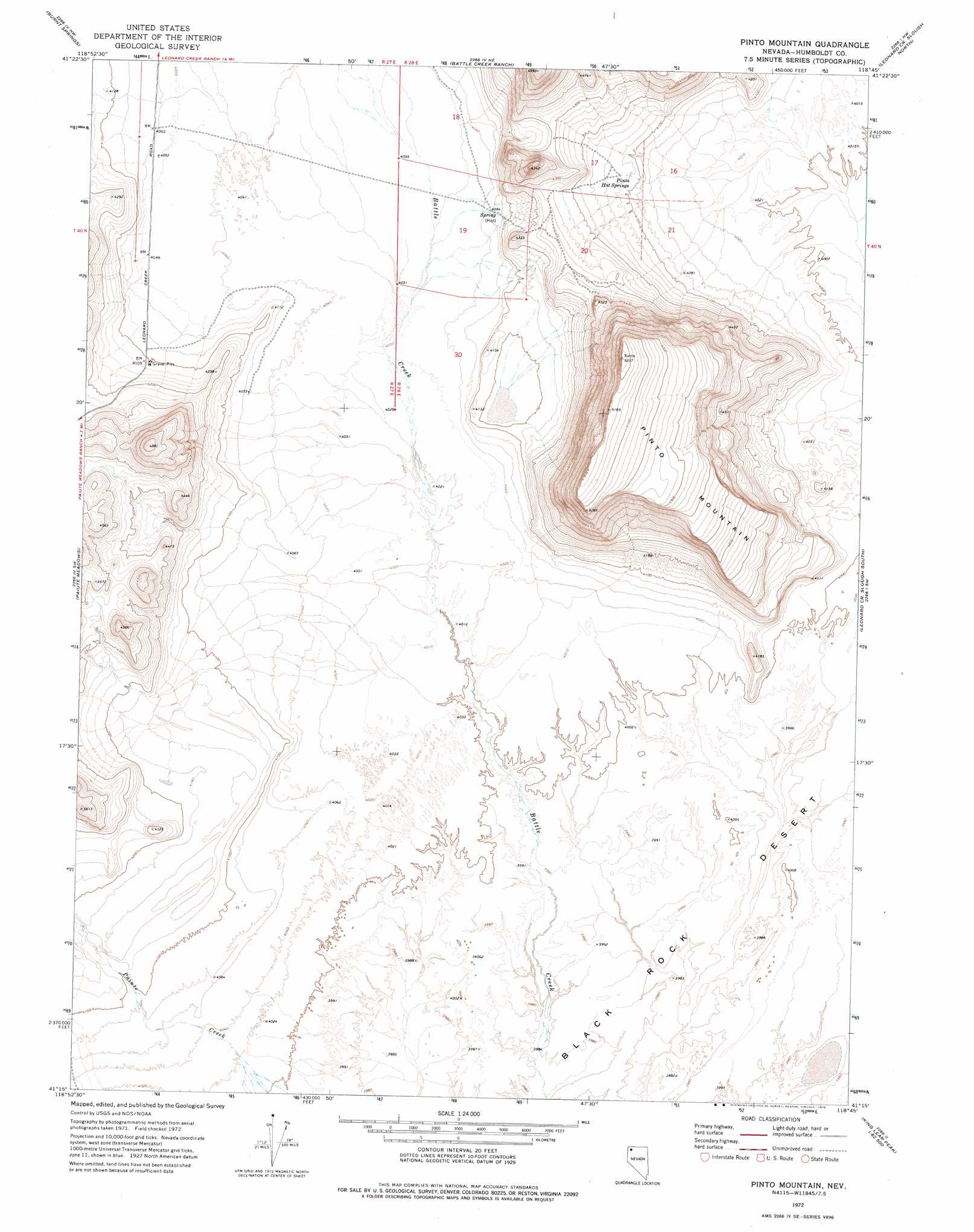
Pinto Mountain Topo Map Nevada
To zoom in, hover over the map of Pinto Mountain
USGS Topo Quad 41118c7 - 1:24,000 scale
| Topo Map Name: | Pinto Mountain |
| USGS Topo Quad ID: | 41118c7 |
| Print Size: | ca. 21 1/4" wide x 27" high |
| Southeast Coordinates: | 41.25° N latitude / 118.75° W longitude |
| Map Center Coordinates: | 41.3125° N latitude / 118.8125° W longitude |
| U.S. State: | NV |
| Filename: | o41118c7.jpg |
| Download Map JPG Image: | Pinto Mountain topo map 1:24,000 scale |
| Map Type: | Topographic |
| Topo Series: | 7.5´ |
| Map Scale: | 1:24,000 |
| Source of Map Images: | United States Geological Survey (USGS) |
| Alternate Map Versions: |
Pinto Mountain NV 1972, updated 1976 Download PDF Buy paper map Pinto Mountain NV 2011 Download PDF Buy paper map Pinto Mountain NV 2015 Download PDF Buy paper map |
1:24,000 Topo Quads surrounding Pinto Mountain
Summit Lake |
Idaho Canyon Spring |
New York Peak |
Bishop Peak |
Dyke Canyon |
Red Mountain |
Burnt Springs |
Battle Creek Ranch |
Leonard Cr Slough North |
Deer Creek Slough |
Big Mountain |
Paiute Meadows |
Pinto Mountain |
Leonard Cr Slough South |
Hobo Canyon |
Clapper Creek |
Pidgeon Spring |
Crowbar Spring |
King Lear Peak Nw |
King Lear Peak |
Double Hot Springs |
Pidgeon Spring Sw |
Pidgeon Spring Se |
Salt Water Spring |
Red Butte |
> Back to 41118a1 at 1:100,000 scale
> Back to 41118a1 at 1:250,000 scale
> Back to U.S. Topo Maps home
Pinto Mountain topo map: Gazetteer
Pinto Mountain: Springs
Pinto Hot Springs elevation 1259m 4130′Sheep Head Spring elevation 1242m 4074′
West Pinto Hot Spring elevation 1243m 4078′
Pinto Mountain: Summits
Pinto Mountain elevation 1551m 5088′Pinto Mountain digital topo map on disk
Buy this Pinto Mountain topo map showing relief, roads, GPS coordinates and other geographical features, as a high-resolution digital map file on DVD: