Bottle Creek Slough Nw Topo Map Nevada
To zoom in, hover over the map of Bottle Creek Slough Nw
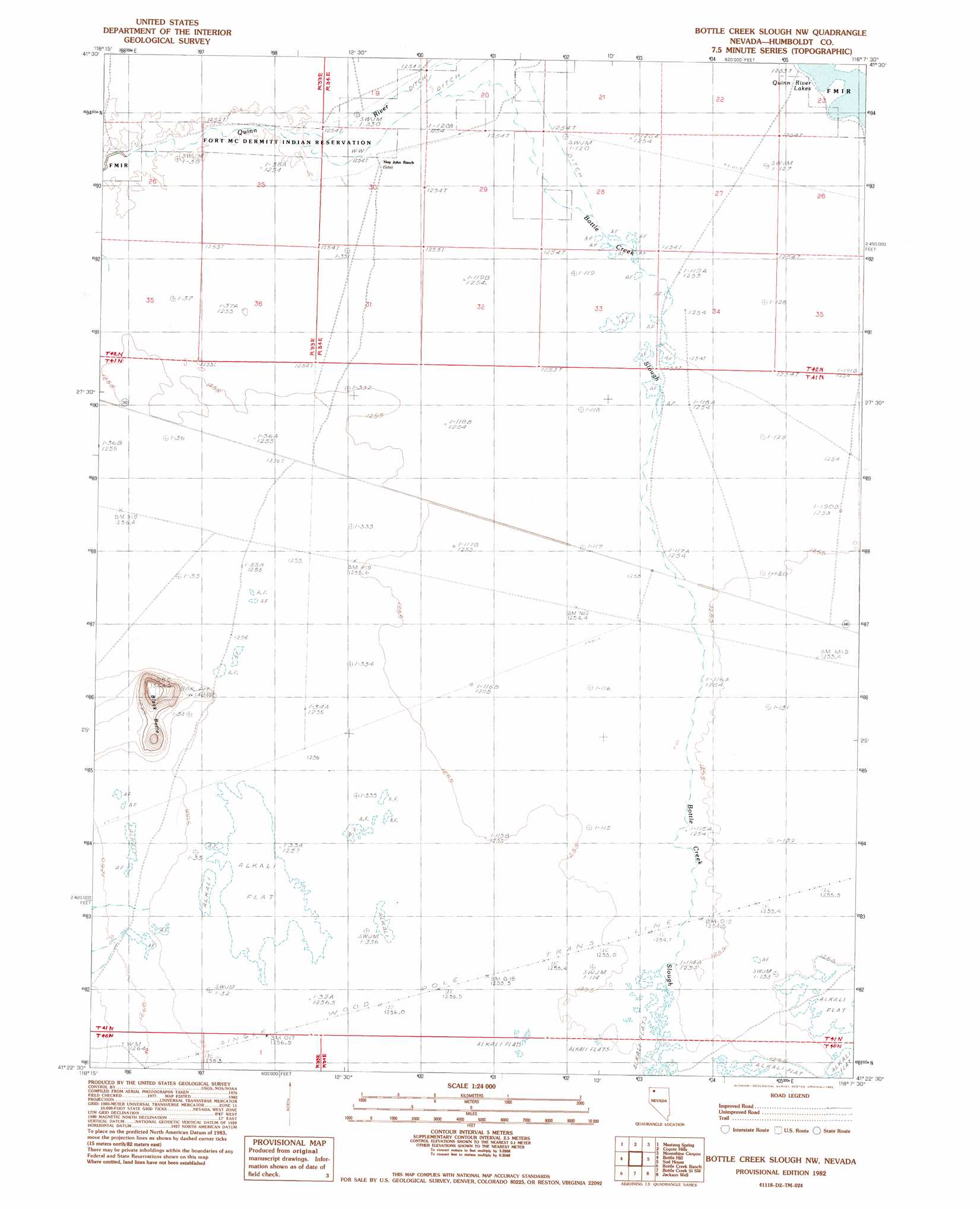
USGS Topo Quad 41118d2 - 1:24,000 scale
| Topo Map Name: | Bottle Creek Slough Nw |
| USGS Topo Quad ID: | 41118d2 |
| Print Size: | ca. 21 1/4" wide x 27" high |
| Southeast Coordinates: | 41.375° N latitude / 118.125° W longitude |
| Map Center Coordinates: | 41.4375° N latitude / 118.1875° W longitude |
| U.S. State: | NV |
| Filename: | o41118d2.jpg |
| Download Map JPG Image: | Bottle Creek Slough Nw topo map 1:24,000 scale |
| Map Type: | Topographic |
| Topo Series: | 7.5´ |
| Map Scale: | 1:24,000 |
| Source of Map Images: | United States Geological Survey (USGS) |
| Alternate Map Versions: |
Bottle Creek Slough NW NV 1982, updated 1982 Download PDF Buy paper map Bottle Creek Slough NW NV 2011 Download PDF Buy paper map Bottle Creek Slough NW NV 2015 Download PDF Buy paper map |
1:24,000 Topo Quads surrounding Bottle Creek Slough Nw
Bilk Creek Reservoir |
Ninemile Summit |
Sheep Ranch Springs |
Thacker Pass |
Sentinel Rock |
Quinn River Crossing |
Mustang Spring |
Coyote Hills |
Moonshine Canyon |
Riverside Ranch |
Deer Creek Peak |
Bottle Hill |
Bottle Creek Slough Nw |
Sod House |
Gallagher Flat |
Parrot Peak |
Bottle Creek Ranch |
Bottle Creek Slough Sw |
Jackson Well |
Awakening Peak |
Schoolhouse Butte |
Dry Hills |
Presnel Well |
Sombrero Peak |
Silver State Draw |
> Back to 41118a1 at 1:100,000 scale
> Back to 41118a1 at 1:250,000 scale
> Back to U.S. Topo Maps home
Bottle Creek Slough Nw topo map: Gazetteer
Bottle Creek Slough Nw: Streams
Bottle Creek Slough elevation 1256m 4120′Bottle Creek Slough Nw: Summits
Black Butte elevation 1336m 4383′Bottle Creek Slough Nw: Valleys
Desert Valley elevation 1255m 4117′Bottle Creek Slough Nw digital topo map on disk
Buy this Bottle Creek Slough Nw topo map showing relief, roads, GPS coordinates and other geographical features, as a high-resolution digital map file on DVD: