Battle Creek Ranch Topo Map Nevada
To zoom in, hover over the map of Battle Creek Ranch
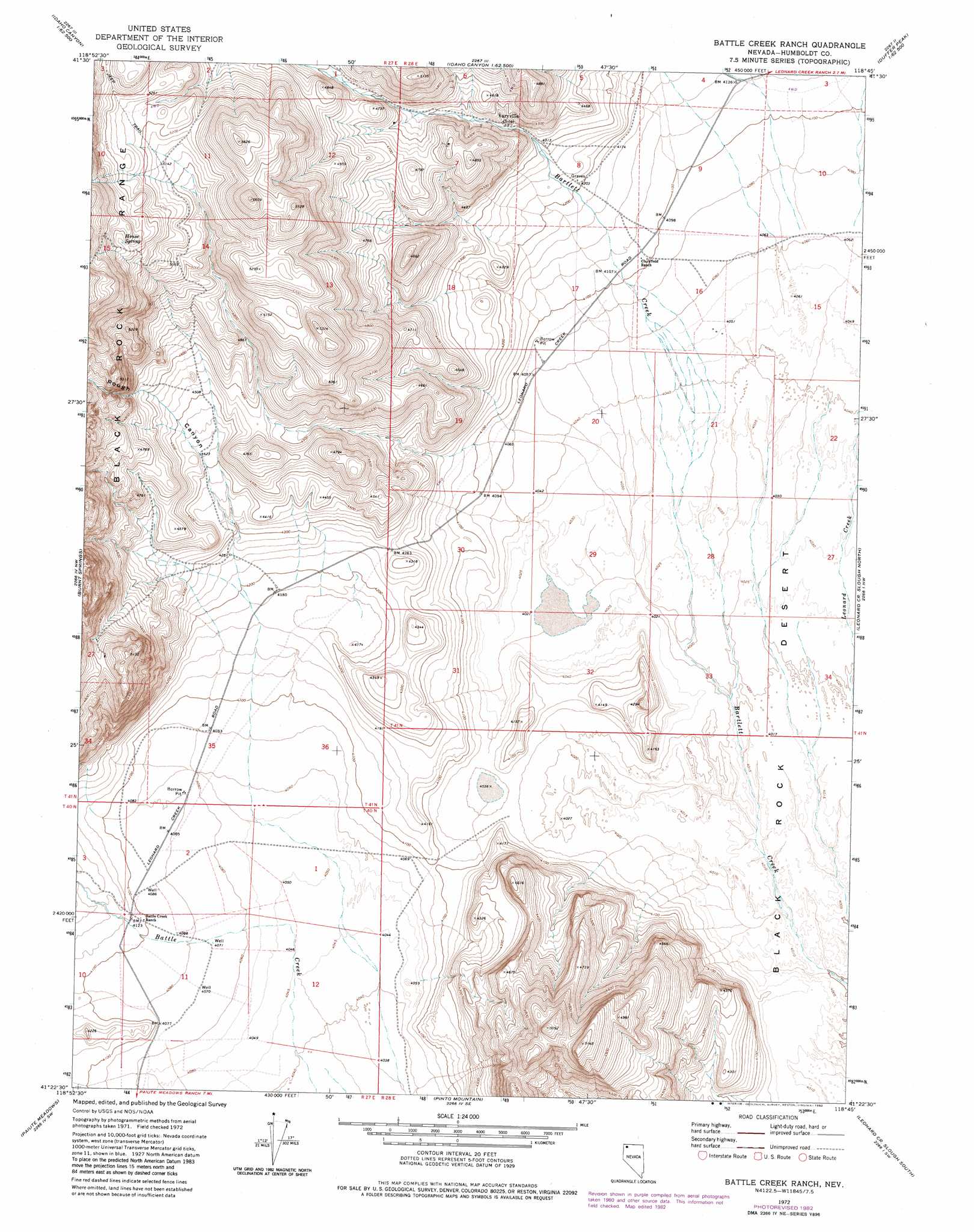
USGS Topo Quad 41118d7 - 1:24,000 scale
| Topo Map Name: | Battle Creek Ranch |
| USGS Topo Quad ID: | 41118d7 |
| Print Size: | ca. 21 1/4" wide x 27" high |
| Southeast Coordinates: | 41.375° N latitude / 118.75° W longitude |
| Map Center Coordinates: | 41.4375° N latitude / 118.8125° W longitude |
| U.S. State: | NV |
| Filename: | o41118d7.jpg |
| Download Map JPG Image: | Battle Creek Ranch topo map 1:24,000 scale |
| Map Type: | Topographic |
| Topo Series: | 7.5´ |
| Map Scale: | 1:24,000 |
| Source of Map Images: | United States Geological Survey (USGS) |
| Alternate Map Versions: |
Battle Creek Ranch NV 1972, updated 1976 Download PDF Buy paper map Battle Creek Ranch NV 1972, updated 1982 Download PDF Buy paper map Battle Creek Ranch NV 2011 Download PDF Buy paper map Battle Creek Ranch NV 2015 Download PDF Buy paper map |
1:24,000 Topo Quads surrounding Battle Creek Ranch
Rock Spring Table |
Knott Creek Ranch |
Knott Creek |
Duffer Peak |
Howard Hot Springs |
Summit Lake |
Idaho Canyon Spring |
New York Peak |
Bishop Peak |
Dyke Canyon |
Red Mountain |
Burnt Springs |
Battle Creek Ranch |
Leonard Cr Slough North |
Deer Creek Slough |
Big Mountain |
Paiute Meadows |
Pinto Mountain |
Leonard Cr Slough South |
Hobo Canyon |
Clapper Creek |
Pidgeon Spring |
Crowbar Spring |
King Lear Peak Nw |
King Lear Peak |
> Back to 41118a1 at 1:100,000 scale
> Back to 41118a1 at 1:250,000 scale
> Back to U.S. Topo Maps home
Battle Creek Ranch topo map: Gazetteer
Battle Creek Ranch: Mines
Battle Chief Mine elevation 1498m 4914′Battle Creek Ranch: Populated Places
Varyville (historical) elevation 1327m 4353′Battle Creek Ranch: Post Offices
Leonard Creek Post Office (historical) elevation 1327m 4353′Battle Creek Ranch: Springs
House Spring elevation 1635m 5364′Battle Creek Ranch: Valleys
Pearl Canyon elevation 1239m 4064′Rough Canyon elevation 1298m 4258′
Battle Creek Ranch digital topo map on disk
Buy this Battle Creek Ranch topo map showing relief, roads, GPS coordinates and other geographical features, as a high-resolution digital map file on DVD: