Burnt Springs Topo Map Nevada
To zoom in, hover over the map of Burnt Springs
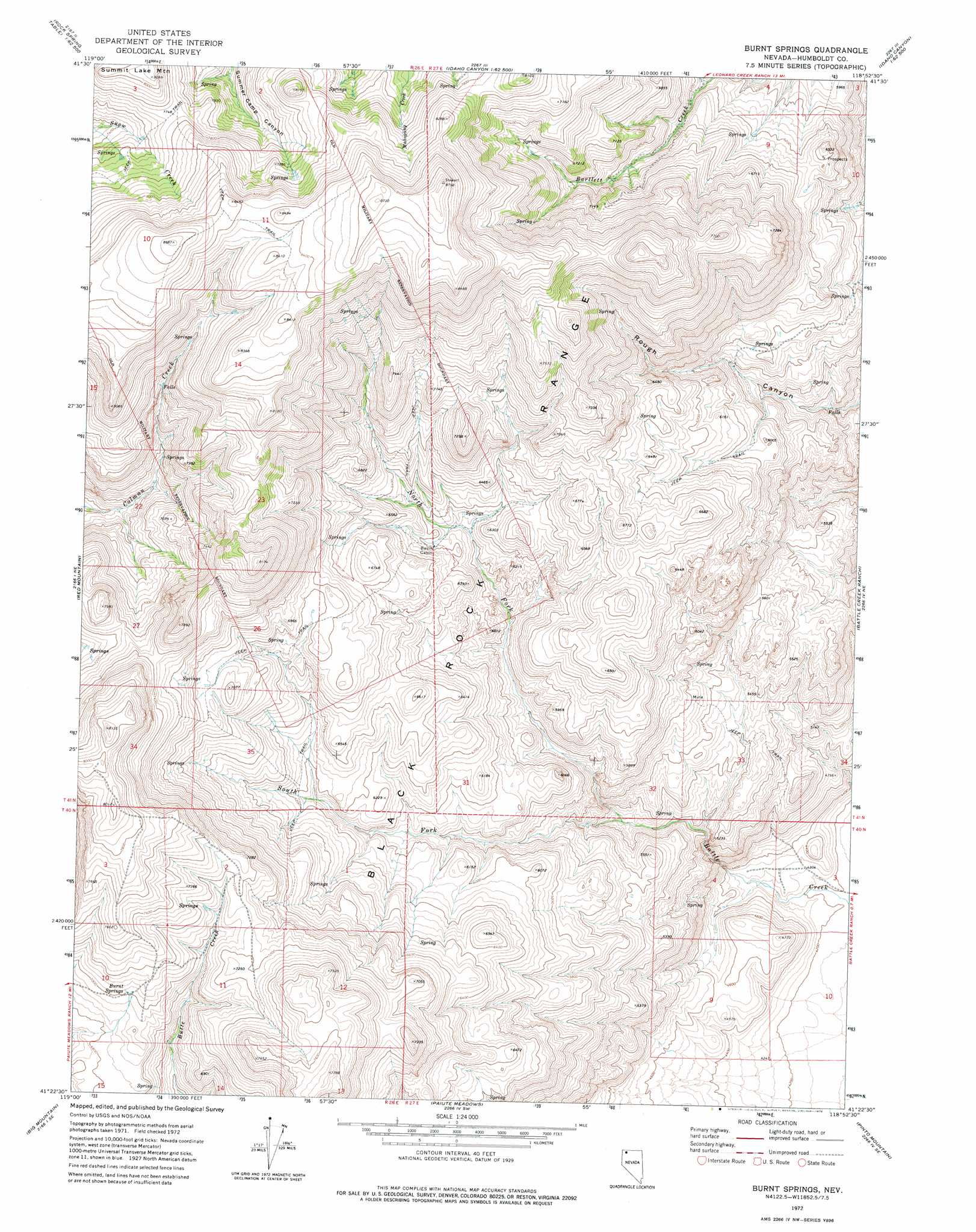
USGS Topo Quad 41118d8 - 1:24,000 scale
| Topo Map Name: | Burnt Springs |
| USGS Topo Quad ID: | 41118d8 |
| Print Size: | ca. 21 1/4" wide x 27" high |
| Southeast Coordinates: | 41.375° N latitude / 118.875° W longitude |
| Map Center Coordinates: | 41.4375° N latitude / 118.9375° W longitude |
| U.S. State: | NV |
| Filename: | o41118d8.jpg |
| Download Map JPG Image: | Burnt Springs topo map 1:24,000 scale |
| Map Type: | Topographic |
| Topo Series: | 7.5´ |
| Map Scale: | 1:24,000 |
| Source of Map Images: | United States Geological Survey (USGS) |
| Alternate Map Versions: |
Burnt Springs NV 1972, updated 1976 Download PDF Buy paper map Burnt Springs NV 2011 Download PDF Buy paper map Burnt Springs NV 2015 Download PDF Buy paper map |
1:24,000 Topo Quads surrounding Burnt Springs
Alkali Peak |
Rock Spring Table |
Knott Creek Ranch |
Knott Creek |
Duffer Peak |
Bear Buttes |
Summit Lake |
Idaho Canyon Spring |
New York Peak |
Bishop Peak |
Soldier Meadow |
Red Mountain |
Burnt Springs |
Battle Creek Ranch |
Leonard Cr Slough North |
Mud Meadow |
Big Mountain |
Paiute Meadows |
Pinto Mountain |
Leonard Cr Slough South |
Wagner Springs |
Clapper Creek |
Pidgeon Spring |
Crowbar Spring |
King Lear Peak Nw |
> Back to 41118a1 at 1:100,000 scale
> Back to 41118a1 at 1:250,000 scale
> Back to U.S. Topo Maps home
Burnt Springs topo map: Gazetteer
Burnt Springs: Mines
Reno Copper Mine elevation 1697m 5567′Burnt Springs: Springs
Burnt Springs elevation 2138m 7014′Hardens Spring elevation 1780m 5839′
Burnt Springs: Streams
North Fork Battle Creek elevation 1546m 5072′South Fork Battle Creek elevation 1548m 5078′
West Branch Battle Creek elevation 1858m 6095′
Burnt Springs digital topo map on disk
Buy this Burnt Springs topo map showing relief, roads, GPS coordinates and other geographical features, as a high-resolution digital map file on DVD: