Moonshine Canyon Topo Map Nevada
To zoom in, hover over the map of Moonshine Canyon
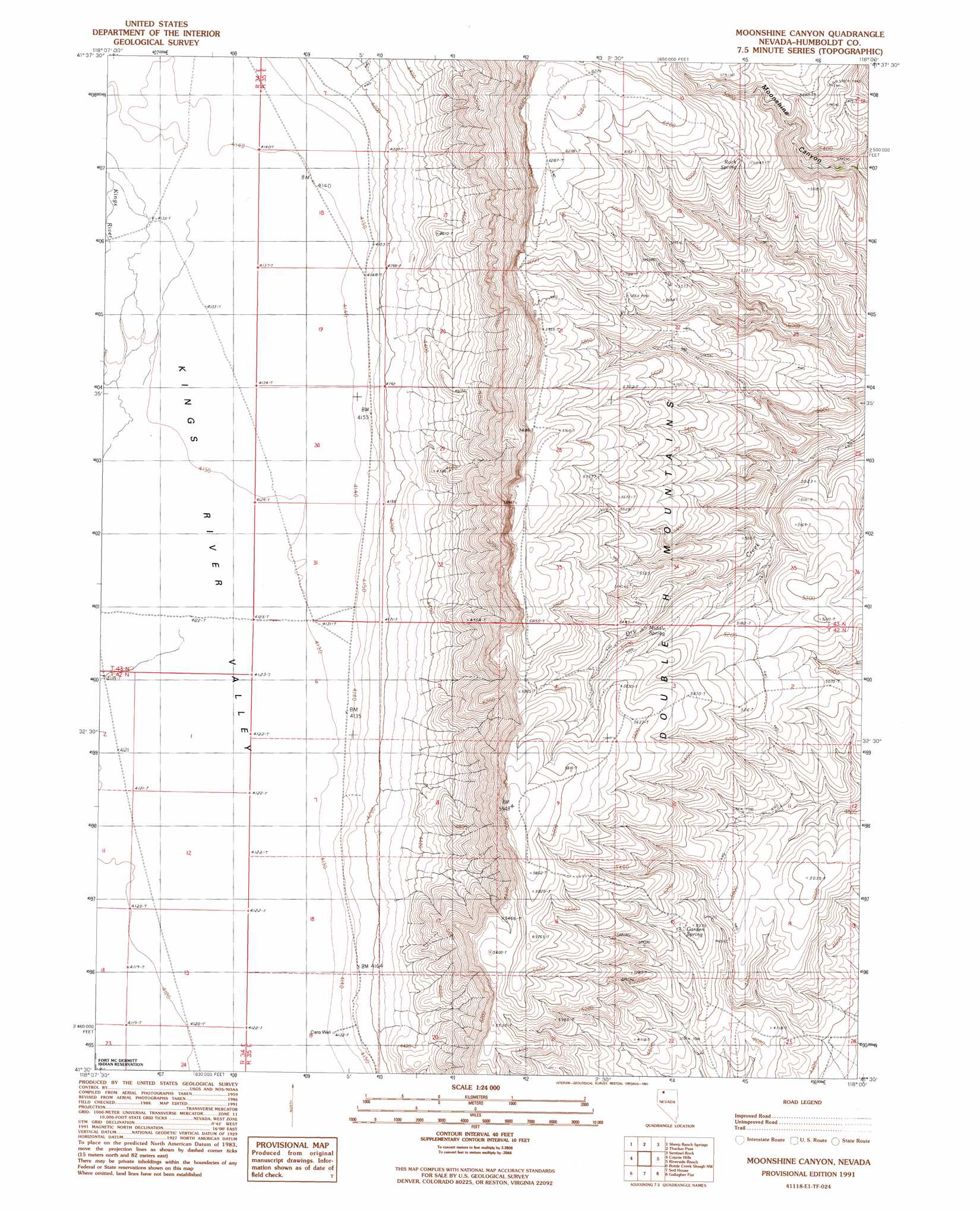
USGS Topo Quad 41118e1 - 1:24,000 scale
| Topo Map Name: | Moonshine Canyon |
| USGS Topo Quad ID: | 41118e1 |
| Print Size: | ca. 21 1/4" wide x 27" high |
| Southeast Coordinates: | 41.5° N latitude / 118° W longitude |
| Map Center Coordinates: | 41.5625° N latitude / 118.0625° W longitude |
| U.S. State: | NV |
| Filename: | o41118e1.jpg |
| Download Map JPG Image: | Moonshine Canyon topo map 1:24,000 scale |
| Map Type: | Topographic |
| Topo Series: | 7.5´ |
| Map Scale: | 1:24,000 |
| Source of Map Images: | United States Geological Survey (USGS) |
| Alternate Map Versions: |
Moonshine Canyon NV 1991, updated 1991 Download PDF Buy paper map Moonshine Canyon NV 2011 Download PDF Buy paper map Moonshine Canyon NV 2015 Download PDF Buy paper map |
1:24,000 Topo Quads surrounding Moonshine Canyon
Kings River Ranch |
Calavera Canyon |
Jordan Meadow Mountain |
Jordan Meadow |
Hoppin Peaks |
Ninemile Summit |
Sheep Ranch Springs |
Thacker Pass |
Sentinel Rock |
Willow Creek Ranch |
Mustang Spring |
Coyote Hills |
Moonshine Canyon |
Riverside Ranch |
Orovada |
Bottle Hill |
Bottle Creek Slough Nw |
Sod House |
Gallagher Flat |
Andorno Ranch |
Bottle Creek Ranch |
Bottle Creek Slough Sw |
Jackson Well |
Awakening Peak |
Mud Spring Canyon |
> Back to 41118e1 at 1:100,000 scale
> Back to 41118a1 at 1:250,000 scale
> Back to U.S. Topo Maps home
Moonshine Canyon topo map: Gazetteer
Moonshine Canyon: Ranges
Double H Mountains elevation 1834m 6017′Moonshine Canyon: Springs
Garden Spring elevation 1524m 5000′Middle Spring elevation 1609m 5278′
Rock Spring elevation 1794m 5885′
Moonshine Canyon: Wells
Cleto Well elevation 1261m 4137′Moonshine Canyon digital topo map on disk
Buy this Moonshine Canyon topo map showing relief, roads, GPS coordinates and other geographical features, as a high-resolution digital map file on DVD: