Dyke Canyon Topo Map Nevada
To zoom in, hover over the map of Dyke Canyon
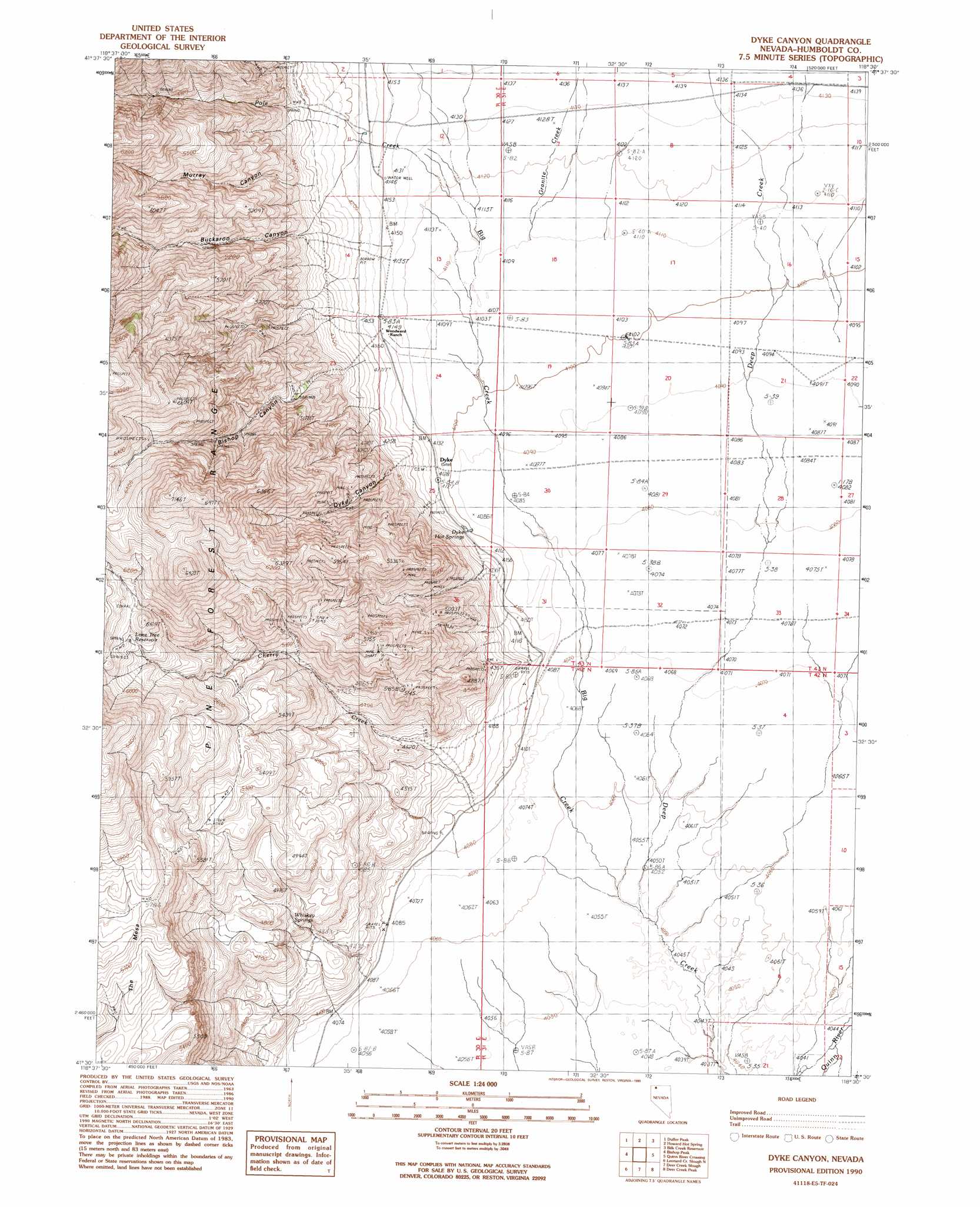
USGS Topo Quad 41118e5 - 1:24,000 scale
| Topo Map Name: | Dyke Canyon |
| USGS Topo Quad ID: | 41118e5 |
| Print Size: | ca. 21 1/4" wide x 27" high |
| Southeast Coordinates: | 41.5° N latitude / 118.5° W longitude |
| Map Center Coordinates: | 41.5625° N latitude / 118.5625° W longitude |
| U.S. State: | NV |
| Filename: | o41118e5.jpg |
| Download Map JPG Image: | Dyke Canyon topo map 1:24,000 scale |
| Map Type: | Topographic |
| Topo Series: | 7.5´ |
| Map Scale: | 1:24,000 |
| Source of Map Images: | United States Geological Survey (USGS) |
| Alternate Map Versions: |
Dyke Canyon NV 1990, updated 1990 Download PDF Buy paper map Dyke Canyon NV 2011 Download PDF Buy paper map Dyke Canyon NV 2015 Download PDF Buy paper map |
1:24,000 Topo Quads surrounding Dyke Canyon
Alder Creek Ranch |
Vicksburg Canyon |
Denio Summit |
Shyster Butte |
Kings River Ranch |
Knott Creek |
Duffer Peak |
Howard Hot Springs |
Bilk Creek Reservoir |
Ninemile Summit |
New York Peak |
Bishop Peak |
Dyke Canyon |
Quinn River Crossing |
Mustang Spring |
Battle Creek Ranch |
Leonard Cr Slough North |
Deer Creek Slough |
Deer Creek Peak |
Bottle Hill |
Pinto Mountain |
Leonard Cr Slough South |
Hobo Canyon |
Parrot Peak |
Bottle Creek Ranch |
> Back to 41118e1 at 1:100,000 scale
> Back to 41118a1 at 1:250,000 scale
> Back to U.S. Topo Maps home
Dyke Canyon topo map: Gazetteer
Dyke Canyon: Populated Places
Dyke elevation 1262m 4140′Dyke Canyon: Reservoirs
Lone Tree Reservoir elevation 1823m 5980′Dyke Canyon: Springs
Dyke Hot Springs elevation 1255m 4117′Whiskey Springs elevation 1391m 4563′
Dyke Canyon: Streams
Big Creek elevation 1235m 4051′Cherry Creek elevation 1251m 4104′
Granite Creek elevation 1254m 4114′
Pass Creek elevation 1266m 4153′
Pole Creek elevation 1254m 4114′
Dyke Canyon: Valleys
Bishop Canyon elevation 1293m 4242′Buckaroo Canyon elevation 1263m 4143′
Dyke Canyon elevation 1319m 4327′
Murray Canyon elevation 1318m 4324′
Dyke Canyon digital topo map on disk
Buy this Dyke Canyon topo map showing relief, roads, GPS coordinates and other geographical features, as a high-resolution digital map file on DVD: