New York Peak Topo Map Nevada
To zoom in, hover over the map of New York Peak
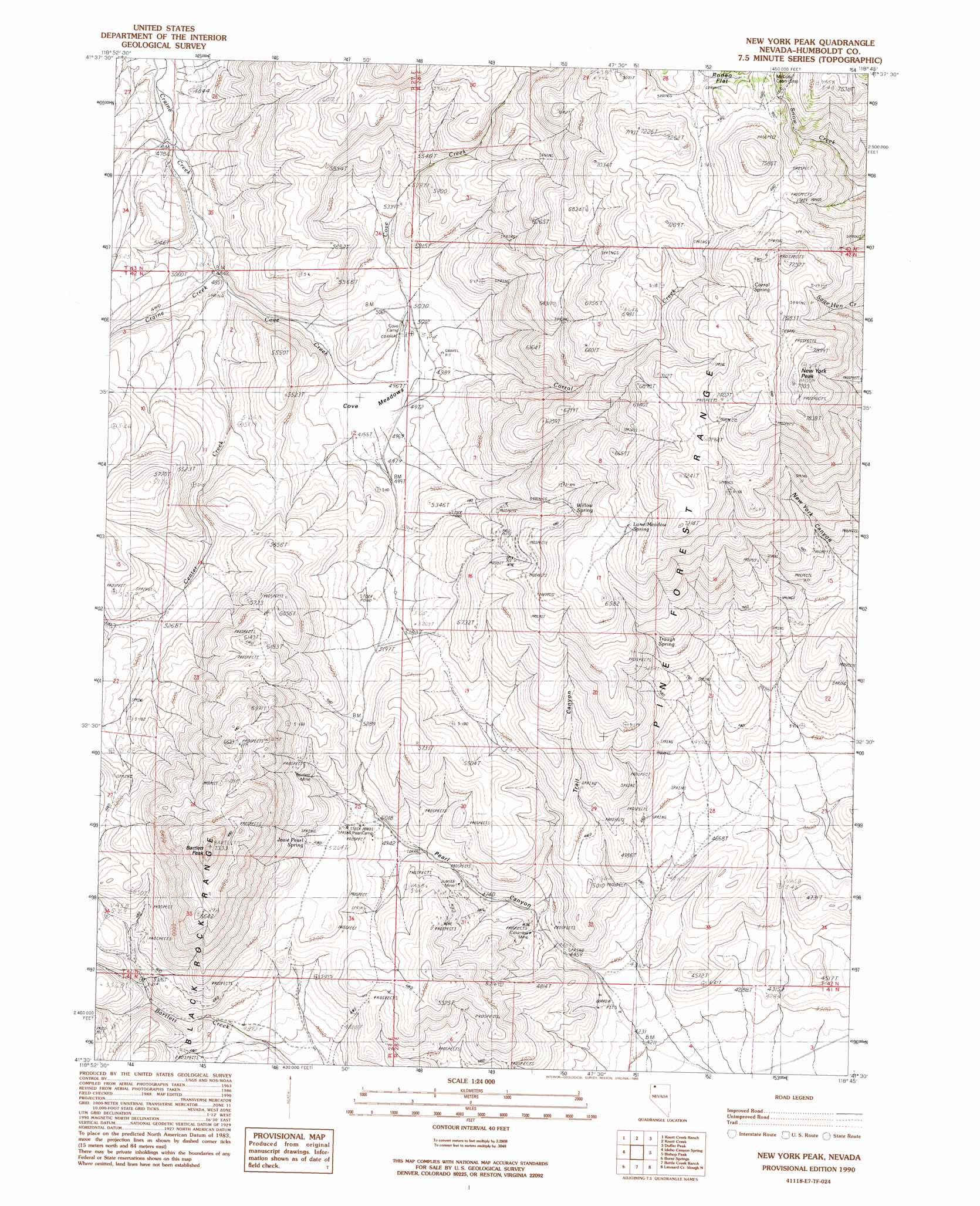
USGS Topo Quad 41118e7 - 1:24,000 scale
| Topo Map Name: | New York Peak |
| USGS Topo Quad ID: | 41118e7 |
| Print Size: | ca. 21 1/4" wide x 27" high |
| Southeast Coordinates: | 41.5° N latitude / 118.75° W longitude |
| Map Center Coordinates: | 41.5625° N latitude / 118.8125° W longitude |
| U.S. State: | NV |
| Filename: | o41118e7.jpg |
| Download Map JPG Image: | New York Peak topo map 1:24,000 scale |
| Map Type: | Topographic |
| Topo Series: | 7.5´ |
| Map Scale: | 1:24,000 |
| Source of Map Images: | United States Geological Survey (USGS) |
| Alternate Map Versions: |
New York Peak NV 1990, updated 1990 Download PDF Buy paper map New York Peak NV 2011 Download PDF Buy paper map New York Peak NV 2015 Download PDF Buy paper map |
1:24,000 Topo Quads surrounding New York Peak
Virgin Valley |
Mcgee Mountain |
Alder Creek Ranch |
Vicksburg Canyon |
Denio Summit |
Rock Spring Table |
Knott Creek Ranch |
Knott Creek |
Duffer Peak |
Howard Hot Springs |
Summit Lake |
Idaho Canyon Spring |
New York Peak |
Bishop Peak |
Dyke Canyon |
Red Mountain |
Burnt Springs |
Battle Creek Ranch |
Leonard Cr Slough North |
Deer Creek Slough |
Big Mountain |
Paiute Meadows |
Pinto Mountain |
Leonard Cr Slough South |
Hobo Canyon |
> Back to 41118e1 at 1:100,000 scale
> Back to 41118a1 at 1:250,000 scale
> Back to U.S. Topo Maps home
New York Peak topo map: Gazetteer
New York Peak: Flats
Cove Meadows elevation 1510m 4954′New York Peak: Mines
Bartlett Mine elevation 1691m 5547′Columbia Mine elevation 1410m 4625′
Cove Meadow Mine elevation 2015m 6610′
Juanita Mine elevation 1489m 4885′
New York Peak: Springs
Corral Spring elevation 2215m 7267′Josie Pearl Spring elevation 1660m 5446′
Lone Meadow Spring elevation 2020m 6627′
Trough Spring elevation 1724m 5656′
Willow Spring elevation 1792m 5879′
New York Peak: Streams
Center Creek elevation 1491m 4891′Corral Creek elevation 1481m 4858′
Cove Creek elevation 1510m 4954′
New York Peak: Summits
Bartlett Peak elevation 2175m 7135′New York Peak elevation 2400m 7874′
New York Peak: Valleys
Trail Canyon elevation 1264m 4146′New York Peak digital topo map on disk
Buy this New York Peak topo map showing relief, roads, GPS coordinates and other geographical features, as a high-resolution digital map file on DVD: