Washburn Basin Topo Map Nevada
To zoom in, hover over the map of Washburn Basin
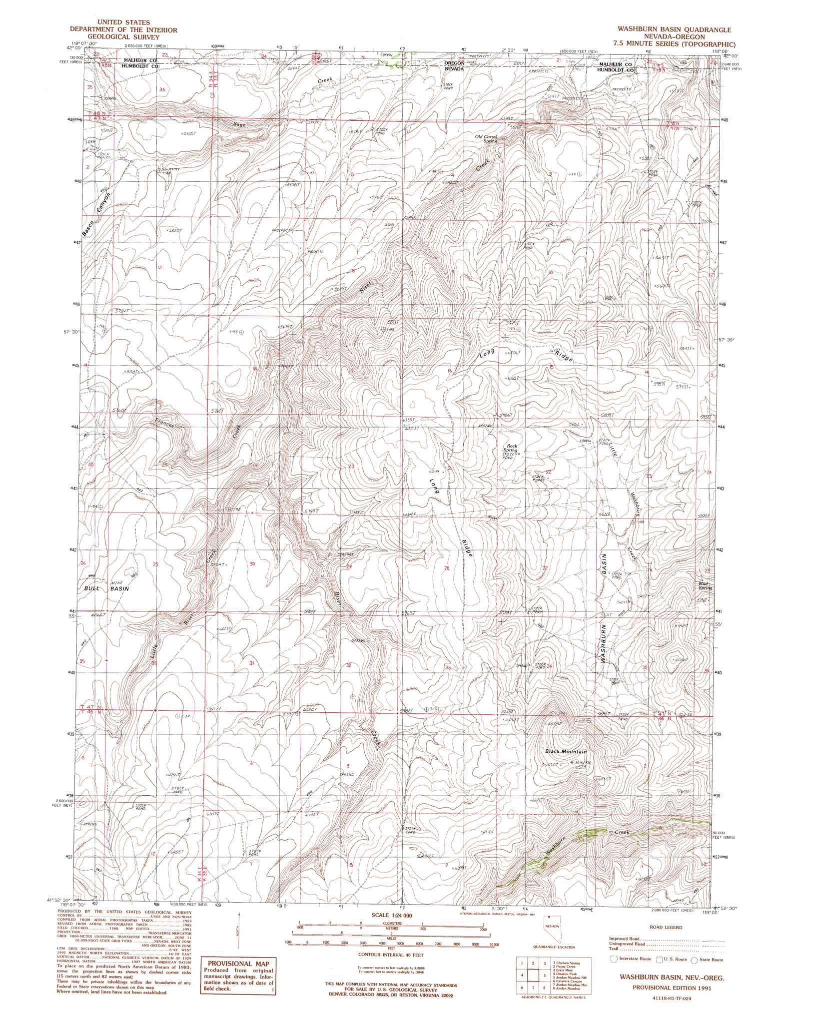
USGS Topo Quad 41118h1 - 1:24,000 scale
| Topo Map Name: | Washburn Basin |
| USGS Topo Quad ID: | 41118h1 |
| Print Size: | ca. 21 1/4" wide x 27" high |
| Southeast Coordinates: | 41.875° N latitude / 118° W longitude |
| Map Center Coordinates: | 41.9375° N latitude / 118.0625° W longitude |
| U.S. States: | NV, OR |
| Filename: | o41118h1.jpg |
| Download Map JPG Image: | Washburn Basin topo map 1:24,000 scale |
| Map Type: | Topographic |
| Topo Series: | 7.5´ |
| Map Scale: | 1:24,000 |
| Source of Map Images: | United States Geological Survey (USGS) |
| Alternate Map Versions: |
Washburn Basin NV 1991, updated 1991 Download PDF Buy paper map Washburn Basin NV 2011 Download PDF Buy paper map Washburn Basin NV 2015 Download PDF Buy paper map |
1:24,000 Topo Quads surrounding Washburn Basin
Pole Canyon |
Little Whitehorse Creek |
Doolittle Creek |
Oregon Canyon Ranch |
Bowden Waterhole |
The V |
Chicken Spring |
Payne Creek |
Bretz Mine |
Boghole Spring |
Holloway Mountain |
Disaster Peak |
Washburn Basin |
Jordan Meadow Nw |
Cordero Mine |
Kings River Ranch |
Calavera Canyon |
Jordan Meadow Mountain |
Jordan Meadow |
Hoppin Peaks |
Ninemile Summit |
Sheep Ranch Springs |
Thacker Pass |
Sentinel Rock |
Willow Creek Ranch |
> Back to 41118e1 at 1:100,000 scale
> Back to 41118a1 at 1:250,000 scale
> Back to U.S. Topo Maps home
Washburn Basin topo map: Gazetteer
Washburn Basin: Basins
Washburn Basin elevation 1706m 5597′Washburn Basin: Ridges
Long Ridge elevation 1932m 6338′Washburn Basin: Springs
Mud Spring elevation 1657m 5436′Old Corral Spring elevation 1576m 5170′
Rock Spring elevation 1795m 5889′
Washburn Basin: Streams
Frances Creek elevation 1618m 5308′Little Riser Creek elevation 1703m 5587′
Washburn Basin: Summits
Black Mountain elevation 1999m 6558′Washburn Basin: Valleys
Basco Canyon elevation 1572m 5157′Washburn Basin digital topo map on disk
Buy this Washburn Basin topo map showing relief, roads, GPS coordinates and other geographical features, as a high-resolution digital map file on DVD: