Disaster Peak Topo Map Nevada
To zoom in, hover over the map of Disaster Peak
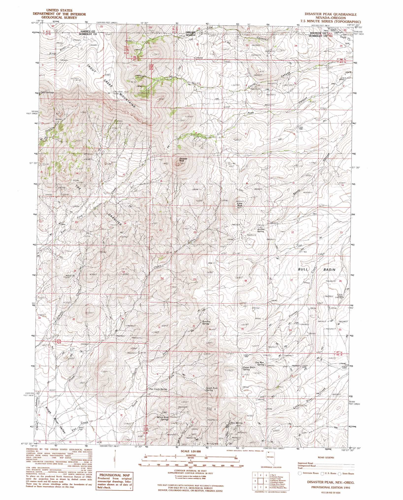
USGS Topo Quad 41118h2 - 1:24,000 scale
| Topo Map Name: | Disaster Peak |
| USGS Topo Quad ID: | 41118h2 |
| Print Size: | ca. 21 1/4" wide x 27" high |
| Southeast Coordinates: | 41.875° N latitude / 118.125° W longitude |
| Map Center Coordinates: | 41.9375° N latitude / 118.1875° W longitude |
| U.S. States: | NV, OR |
| Filename: | o41118h2.jpg |
| Download Map JPG Image: | Disaster Peak topo map 1:24,000 scale |
| Map Type: | Topographic |
| Topo Series: | 7.5´ |
| Map Scale: | 1:24,000 |
| Source of Map Images: | United States Geological Survey (USGS) |
| Alternate Map Versions: |
Disaster Peak NV 1991, updated 1991 Download PDF Buy paper map Disaster Peak NV 2011 Download PDF Buy paper map Disaster Peak NV 2015 Download PDF Buy paper map |
1:24,000 Topo Quads surrounding Disaster Peak
Trout Creek Canyon |
Pole Canyon |
Little Whitehorse Creek |
Doolittle Creek |
Oregon Canyon Ranch |
Windy Point |
The V |
Chicken Spring |
Payne Creek |
Bretz Mine |
Trident Peak |
Holloway Mountain |
Disaster Peak |
Washburn Basin |
Jordan Meadow Nw |
Shyster Butte |
Kings River Ranch |
Calavera Canyon |
Jordan Meadow Mountain |
Jordan Meadow |
Bilk Creek Reservoir |
Ninemile Summit |
Sheep Ranch Springs |
Thacker Pass |
Sentinel Rock |
> Back to 41118e1 at 1:100,000 scale
> Back to 41118a1 at 1:250,000 scale
> Back to U.S. Topo Maps home
Disaster Peak topo map: Gazetteer
Disaster Peak: Basins
Bull Basin elevation 1775m 5823′Disaster Peak: Mines
Iron King Mine elevation 1739m 5705′Disaster Peak: Ranges
The Granites elevation 1684m 5524′Disaster Peak: Springs
Arristu Spring elevation 1823m 5980′Flat Creek Spring elevation 1553m 5095′
Ikes Spring elevation 1843m 6046′
Old Man Spring elevation 1935m 6348′
South Fork Spring elevation 1805m 5921′
Summit Spring elevation 1858m 6095′
Upper Riser Spring elevation 1999m 6558′
Yellow Rose Springs elevation 1647m 5403′
Disaster Peak: Streams
North Fork Flat Creek elevation 1418m 4652′South Fork Flat Creek elevation 1417m 4648′
Disaster Peak: Summits
Disaster Peak elevation 2344m 7690′Little Peak elevation 2009m 6591′
Disaster Peak: Valleys
Corral Canyon elevation 1633m 5357′Line Canyon elevation 1679m 5508′
Peak Canyon elevation 1653m 5423′
Disaster Peak digital topo map on disk
Buy this Disaster Peak topo map showing relief, roads, GPS coordinates and other geographical features, as a high-resolution digital map file on DVD: