Leadville Topo Map Nevada
To zoom in, hover over the map of Leadville
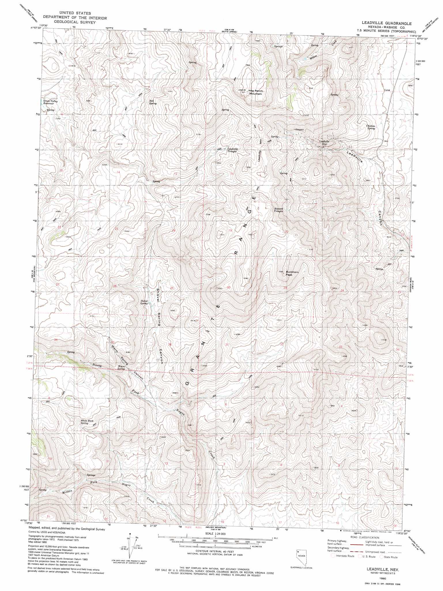
USGS Topo Quad 41119a4 - 1:24,000 scale
| Topo Map Name: | Leadville |
| USGS Topo Quad ID: | 41119a4 |
| Print Size: | ca. 21 1/4" wide x 27" high |
| Southeast Coordinates: | 41° N latitude / 119.375° W longitude |
| Map Center Coordinates: | 41.0625° N latitude / 119.4375° W longitude |
| U.S. State: | NV |
| Filename: | o41119a4.jpg |
| Download Map JPG Image: | Leadville topo map 1:24,000 scale |
| Map Type: | Topographic |
| Topo Series: | 7.5´ |
| Map Scale: | 1:24,000 |
| Source of Map Images: | United States Geological Survey (USGS) |
| Alternate Map Versions: |
Leadville NV 1980, updated 1980 Download PDF Buy paper map Leadville NV 2011 Download PDF Buy paper map Leadville NV 2015 Download PDF Buy paper map |
1:24,000 Topo Quads surrounding Leadville
Pinto Springs |
Hart Mountain |
Mahogany Mountain |
High Rock Lake |
Mud Meadow |
Bordwell Spring |
Chester Lyons Spring |
Butte Spring |
Mcconnel Canyon |
Wagner Springs |
Lost Creek Pass |
Fox Mountain |
Leadville |
Division Peak |
Donnelly Creek |
Hillside Spring |
Crutcher Canyon |
Melody Mountain |
Hualapai Flat North |
Mormon Dan Peak |
Poodle Mountain |
Squaw Valley |
The Banjo |
Hualapai Flat South |
Trego |
> Back to 41119a1 at 1:100,000 scale
> Back to 41118a1 at 1:250,000 scale
> Back to U.S. Topo Maps home
Leadville topo map: Gazetteer
Leadville: Mines
Leadville Mine elevation 1884m 6181′Tohoqua Mine elevation 1898m 6227′
Leadville: Ranges
Hog Ranch Mountains elevation 2222m 7290′Leadville: Reservoirs
Heward Troughs elevation 2040m 6692′Leadville Troughs elevation 2075m 6807′
Leadville: Springs
Bell Spring elevation 1986m 6515′Buckhorn Spring elevation 2037m 6683′
Chicken Spring elevation 1792m 5879′
Leadville Springs elevation 2066m 6778′
Shovel Spring elevation 1812m 5944′
Warm Spring elevation 1789m 5869′
White Rock Spring elevation 1853m 6079′
Leadville: Summits
Buckhorn Peak elevation 2209m 7247′Hog Ranch Mountain elevation 2332m 7650′
Leadville Mountain elevation 2198m 7211′
Leadville: Valleys
Shovel Spring Canyon elevation 1688m 5538′Warm Spring Canyon elevation 1711m 5613′
Leadville digital topo map on disk
Buy this Leadville topo map showing relief, roads, GPS coordinates and other geographical features, as a high-resolution digital map file on DVD: