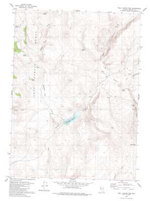
Wall Canyon Reservoir Topo Map Nevada
To zoom in, hover over the map of Wall Canyon Reservoir
USGS Topo Quad 41119b7 - 1:24,000 scale
| Topo Map Name: | Wall Canyon Reservoir |
| USGS Topo Quad ID: | 41119b7 |
| Print Size: | ca. 21 1/4" wide x 27" high |
| Southeast Coordinates: | 41.125° N latitude / 119.75° W longitude |
| Map Center Coordinates: | 41.1875° N latitude / 119.8125° W longitude |
| U.S. State: | NV |
| Filename: | o41119b7.jpg |
| Download Map JPG Image: | Wall Canyon Reservoir topo map 1:24,000 scale |
| Map Type: | Topographic |
| Topo Series: | 7.5´ |
| Map Scale: | 1:24,000 |
| Source of Map Images: | United States Geological Survey (USGS) |
| Alternate Map Versions: |
Wall Canyon Reservoir NV 1979, updated 1980 Download PDF Buy paper map Wall Canyon Reservoir NV 2011 Download PDF Buy paper map Wall Canyon Reservoir NV 2015 Download PDF Buy paper map |
1:24,000 Topo Quads surrounding Wall Canyon Reservoir
> Back to 41119a1 at 1:100,000 scale
> Back to 41118a1 at 1:250,000 scale
> Back to U.S. Topo Maps home
Wall Canyon Reservoir topo map: Gazetteer
Wall Canyon Reservoir: Dams
Wall Creek Dam Number Two elevation 1564m 5131′Wall Canyon Reservoir: Reservoirs
Cockrell Trough elevation 1723m 5652′Wall Canyon Reservoir elevation 1564m 5131′
Wall Canyon Reservoir: Springs
Big Spring elevation 1634m 5360′Irene Spring elevation 1719m 5639′
Jackknife Spring elevation 1943m 6374′
Kissler Springs elevation 1658m 5439′
Montview Spring elevation 1823m 5980′
Warm Springs elevation 1749m 5738′
Wall Canyon Reservoir: Streams
Bordwell Creek elevation 1596m 5236′Mountain View Creek elevation 1539m 5049′
Wall Canyon Reservoir: Valleys
Bordwell Canyon elevation 1635m 5364′Cockrell Canyon elevation 1707m 5600′
Indian Valley elevation 1761m 5777′
Pegleg Canyon elevation 1566m 5137′
Well Canyon elevation 1616m 5301′
Wall Canyon Reservoir digital topo map on disk
Buy this Wall Canyon Reservoir topo map showing relief, roads, GPS coordinates and other geographical features, as a high-resolution digital map file on DVD:


