Mud Meadow Topo Map Nevada
To zoom in, hover over the map of Mud Meadow
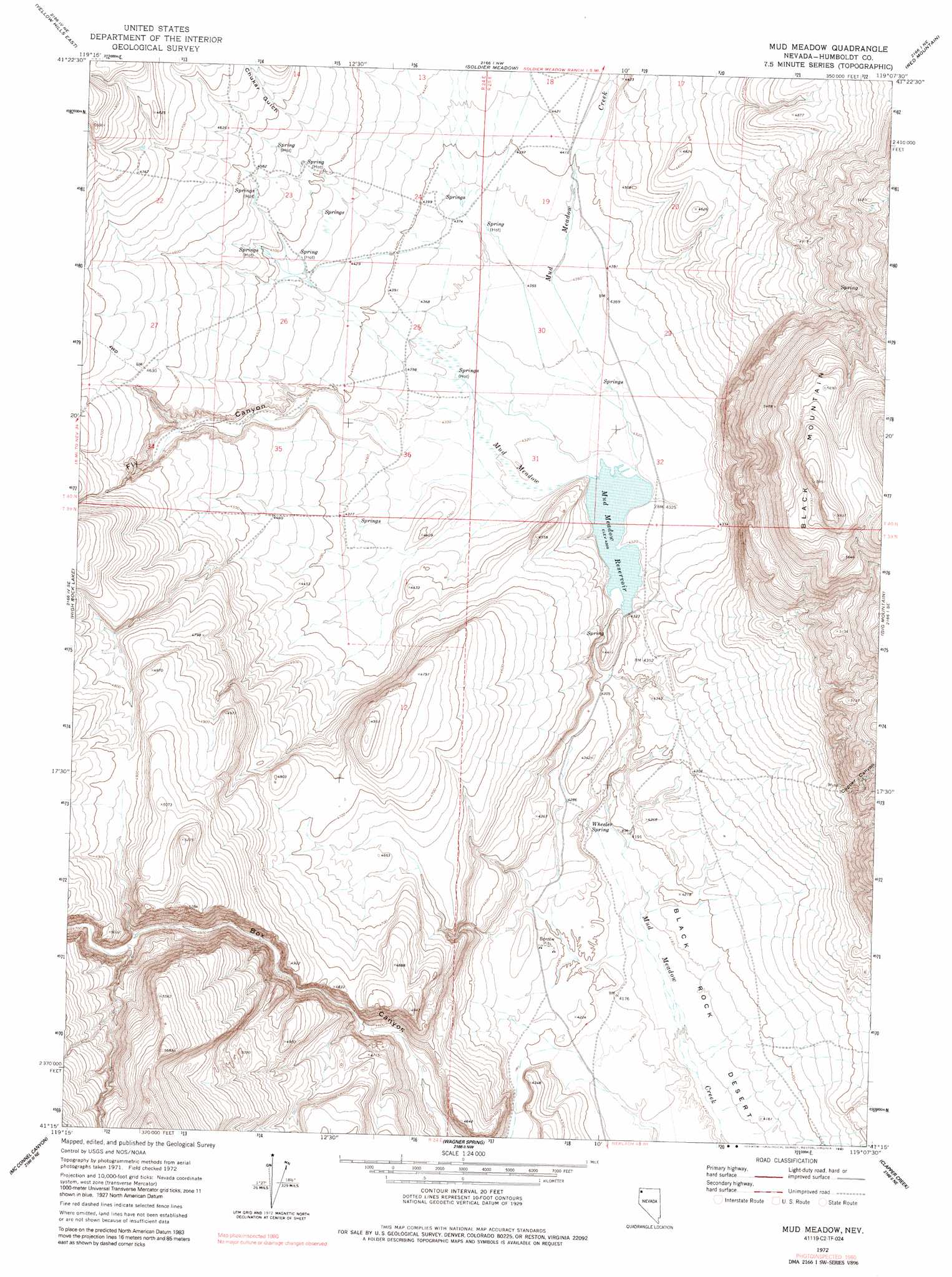
USGS Topo Quad 41119c2 - 1:24,000 scale
| Topo Map Name: | Mud Meadow |
| USGS Topo Quad ID: | 41119c2 |
| Print Size: | ca. 21 1/4" wide x 27" high |
| Southeast Coordinates: | 41.25° N latitude / 119.125° W longitude |
| Map Center Coordinates: | 41.3125° N latitude / 119.1875° W longitude |
| U.S. State: | NV |
| Filename: | o41119c2.jpg |
| Download Map JPG Image: | Mud Meadow topo map 1:24,000 scale |
| Map Type: | Topographic |
| Topo Series: | 7.5´ |
| Map Scale: | 1:24,000 |
| Source of Map Images: | United States Geological Survey (USGS) |
| Alternate Map Versions: |
Mud Meadow NV 1972, updated 1976 Download PDF Buy paper map Mud Meadow NV 1972, updated 1981 Download PDF Buy paper map Mud Meadow NV 2011 Download PDF Buy paper map Mud Meadow NV 2015 Download PDF Buy paper map |
1:24,000 Topo Quads surrounding Mud Meadow
Nut Mountain |
Badger Mountain Se |
Bear Buttes |
Summit Lake |
Idaho Canyon Spring |
Yellow Hills West |
Yellow Hills East |
Soldier Meadow |
Red Mountain |
Burnt Springs |
Mahogany Mountain |
High Rock Lake |
Mud Meadow |
Big Mountain |
Paiute Meadows |
Butte Spring |
Mcconnel Canyon |
Wagner Springs |
Clapper Creek |
Pidgeon Spring |
Leadville |
Division Peak |
Donnelly Creek |
Double Hot Springs |
Pidgeon Spring Sw |
> Back to 41119a1 at 1:100,000 scale
> Back to 41118a1 at 1:250,000 scale
> Back to U.S. Topo Maps home
Mud Meadow topo map: Gazetteer
Mud Meadow: Dams
Van Vleck Dam elevation 1314m 4311′Mud Meadow: Reservoirs
Mud Meadow Reservoir elevation 1314m 4311′Mud Meadow: Springs
Mud Spring elevation 1321m 4333′Soldier Meadows Hot Springs elevation 1347m 4419′
Wheeler Spring elevation 1275m 4183′
Mud Meadow: Streams
Fly Creek elevation 1314m 4311′Mud Meadow: Summits
Black Mountain elevation 1814m 5951′Mud Meadow: Swamps
Mud Meadow elevation 1318m 4324′Mud Meadow: Valleys
Box Canyon elevation 1279m 4196′Chukar Gulch elevation 1371m 4498′
Copper Canyon elevation 1409m 4622′
Fly Canyon elevation 1324m 4343′
Mud Meadow digital topo map on disk
Buy this Mud Meadow topo map showing relief, roads, GPS coordinates and other geographical features, as a high-resolution digital map file on DVD: