Badger Mountain Se Topo Map Nevada
To zoom in, hover over the map of Badger Mountain Se
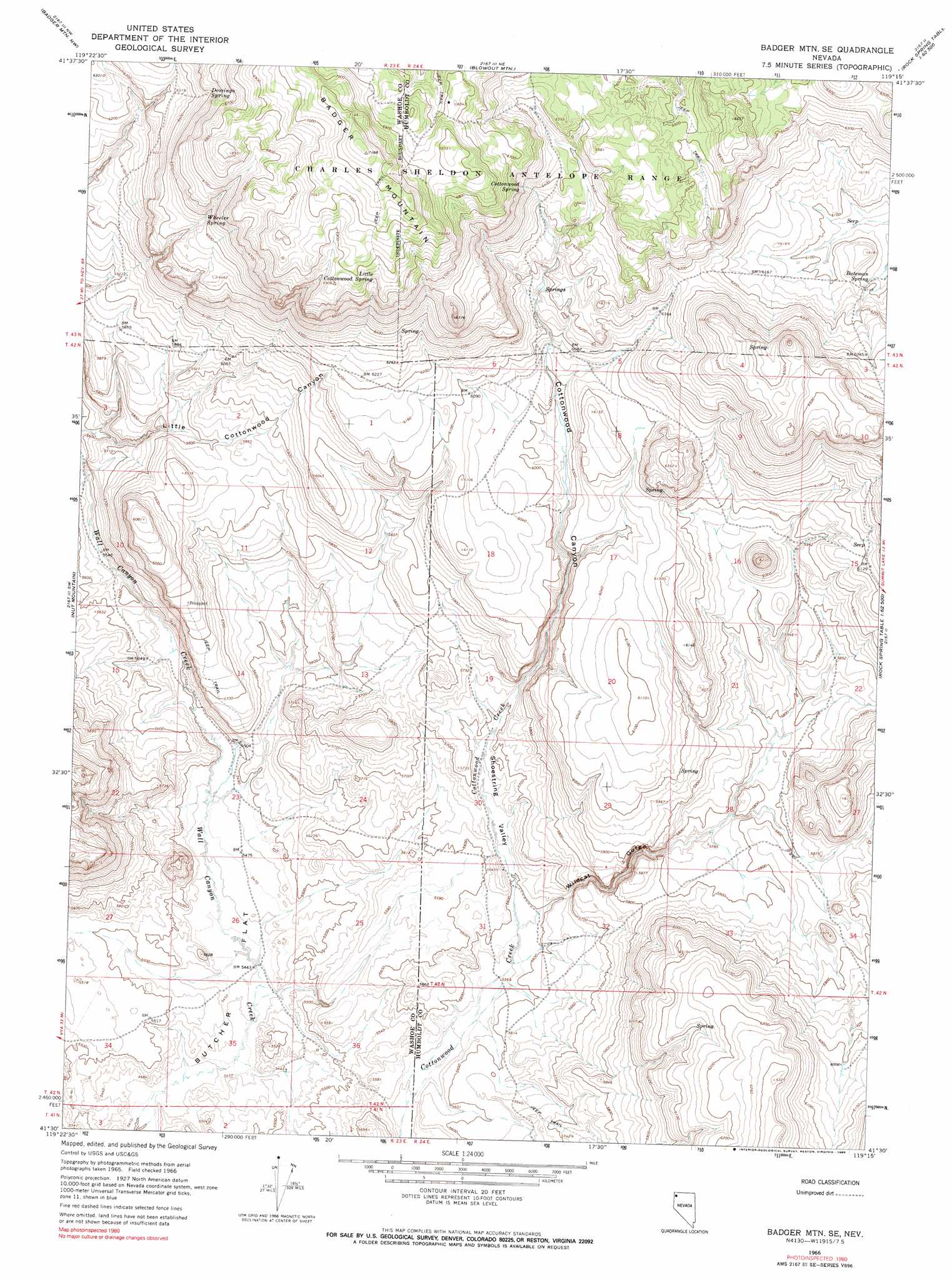
USGS Topo Quad 41119e3 - 1:24,000 scale
| Topo Map Name: | Badger Mountain Se |
| USGS Topo Quad ID: | 41119e3 |
| Print Size: | ca. 21 1/4" wide x 27" high |
| Southeast Coordinates: | 41.5° N latitude / 119.25° W longitude |
| Map Center Coordinates: | 41.5625° N latitude / 119.3125° W longitude |
| U.S. State: | NV |
| Filename: | o41119e3.jpg |
| Download Map JPG Image: | Badger Mountain Se topo map 1:24,000 scale |
| Map Type: | Topographic |
| Topo Series: | 7.5´ |
| Map Scale: | 1:24,000 |
| Source of Map Images: | United States Geological Survey (USGS) |
| Alternate Map Versions: |
Badger Mtn SE NV 1966, updated 1969 Download PDF Buy paper map Badger Mtn SE NV 1966, updated 1990 Download PDF Buy paper map Badger Mountain SE NV 2011 Download PDF Buy paper map Badger Mountain SE NV 2015 Download PDF Buy paper map |
1:24,000 Topo Quads surrounding Badger Mountain Se
Bald Mountain |
Swan Lake |
Catnip Mountain Se |
Gooch Lake |
Virgin Valley |
Massacre Lake |
Badger Mountain Nw |
Blowout Mountain |
Alkali Peak |
Rock Spring Table |
Massacre Creek |
Nut Mountain |
Badger Mountain Se |
Bear Buttes |
Summit Lake |
Nellie Spring Mountain |
Yellow Hills West |
Yellow Hills East |
Soldier Meadow |
Red Mountain |
Hart Mountain |
Mahogany Mountain |
High Rock Lake |
Mud Meadow |
Big Mountain |
> Back to 41119e1 at 1:100,000 scale
> Back to 41118a1 at 1:250,000 scale
> Back to U.S. Topo Maps home
Badger Mountain Se topo map: Gazetteer
Badger Mountain Se: Flats
Butcher Flat elevation 1660m 5446′Badger Mountain Se: Ranges
Badger Mountains elevation 2191m 7188′Badger Mountain Se: Springs
Bateman Spring elevation 1860m 6102′Cherry Spring elevation 1915m 6282′
Cottonwood Spring elevation 2037m 6683′
Domingo Spring elevation 1974m 6476′
Little Cottonwood Spring elevation 2077m 6814′
Wheeler Spring elevation 1969m 6459′
Badger Mountain Se: Summits
Badger Mountain elevation 2188m 7178′Badger Mountain Se: Valleys
Cottonwood Canyon elevation 1735m 5692′Little Cottonwood Canyon elevation 1705m 5593′
Shoestring Valley elevation 1705m 5593′
Wildcat Gorge elevation 1707m 5600′
Badger Mountain Se digital topo map on disk
Buy this Badger Mountain Se topo map showing relief, roads, GPS coordinates and other geographical features, as a high-resolution digital map file on DVD: