Vya Topo Map Nevada
To zoom in, hover over the map of Vya
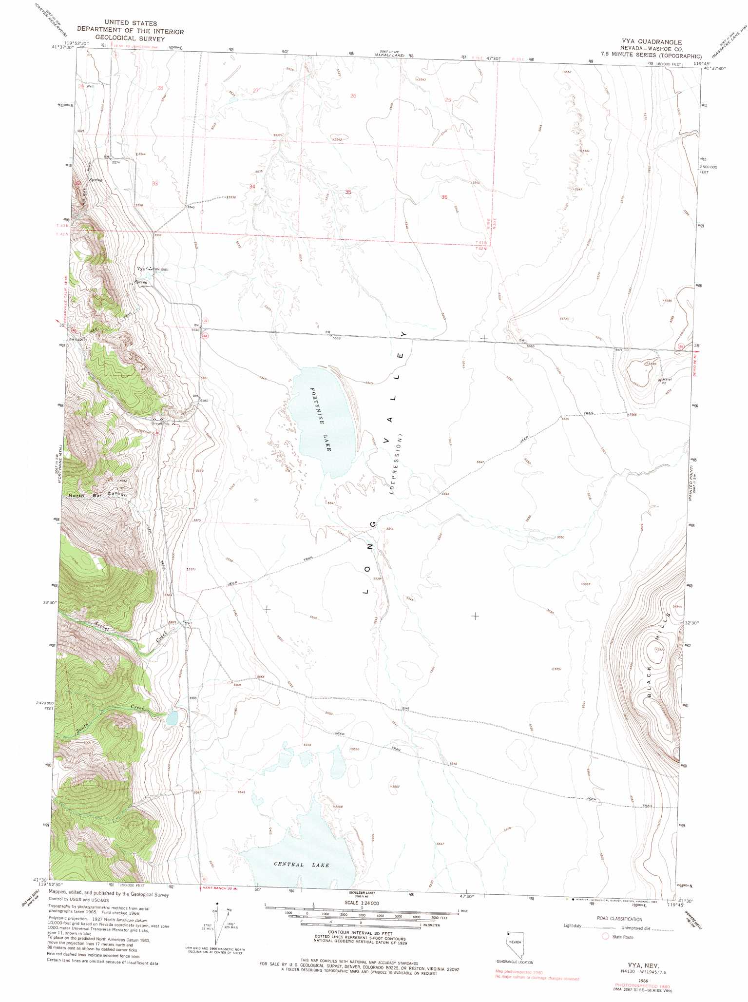
USGS Topo Quad 41119e7 - 1:24,000 scale
| Topo Map Name: | Vya |
| USGS Topo Quad ID: | 41119e7 |
| Print Size: | ca. 21 1/4" wide x 27" high |
| Southeast Coordinates: | 41.5° N latitude / 119.75° W longitude |
| Map Center Coordinates: | 41.5625° N latitude / 119.8125° W longitude |
| U.S. State: | NV |
| Filename: | o41119e7.jpg |
| Download Map JPG Image: | Vya topo map 1:24,000 scale |
| Map Type: | Topographic |
| Topo Series: | 7.5´ |
| Map Scale: | 1:24,000 |
| Source of Map Images: | United States Geological Survey (USGS) |
| Alternate Map Versions: |
Vya NV 1966, updated 1968 Download PDF Buy paper map Vya NV 1966, updated 1982 Download PDF Buy paper map Vya NV 2011 Download PDF Buy paper map Vya NV 2015 Download PDF Buy paper map |
1:24,000 Topo Quads surrounding Vya
Larkspur Hills |
Crooks Meadow |
Mosquito Valley |
Calcutta Lake |
Bald Mountain |
Boyd Hot Spring |
Carter Reservoir |
Alkali Lake |
Massacre Lake Nw |
Massacre Lake |
Leonards Hot Springs |
Fortynine Mountain |
Vya |
Painted Point |
Massacre Creek |
Hansen Island |
Big Hat Mountain |
Boulder Lake |
Powers Well |
Nellie Spring Mountain |
Eagleville |
Hays Canyon |
Boulder Mountain |
Pinto Springs |
Hart Mountain |
> Back to 41119e1 at 1:100,000 scale
> Back to 41118a1 at 1:250,000 scale
> Back to U.S. Topo Maps home
Vya topo map: Gazetteer
Vya: Lakes
Central Lake elevation 1691m 5547′Fortynine Lake elevation 1689m 5541′
Vya: Populated Places
Vya elevation 1699m 5574′Vya: Post Offices
Vya Post Office (historical) elevation 1699m 5574′Vya: Springs
Twin Springs elevation 1702m 5583′Vya: Streams
Secret Creek elevation 1690m 5544′South Creek elevation 1691m 5547′
Vya: Valleys
North Bar Canyon elevation 1691m 5547′Vya digital topo map on disk
Buy this Vya topo map showing relief, roads, GPS coordinates and other geographical features, as a high-resolution digital map file on DVD: