Carter Reservoir Topo Map Nevada
To zoom in, hover over the map of Carter Reservoir
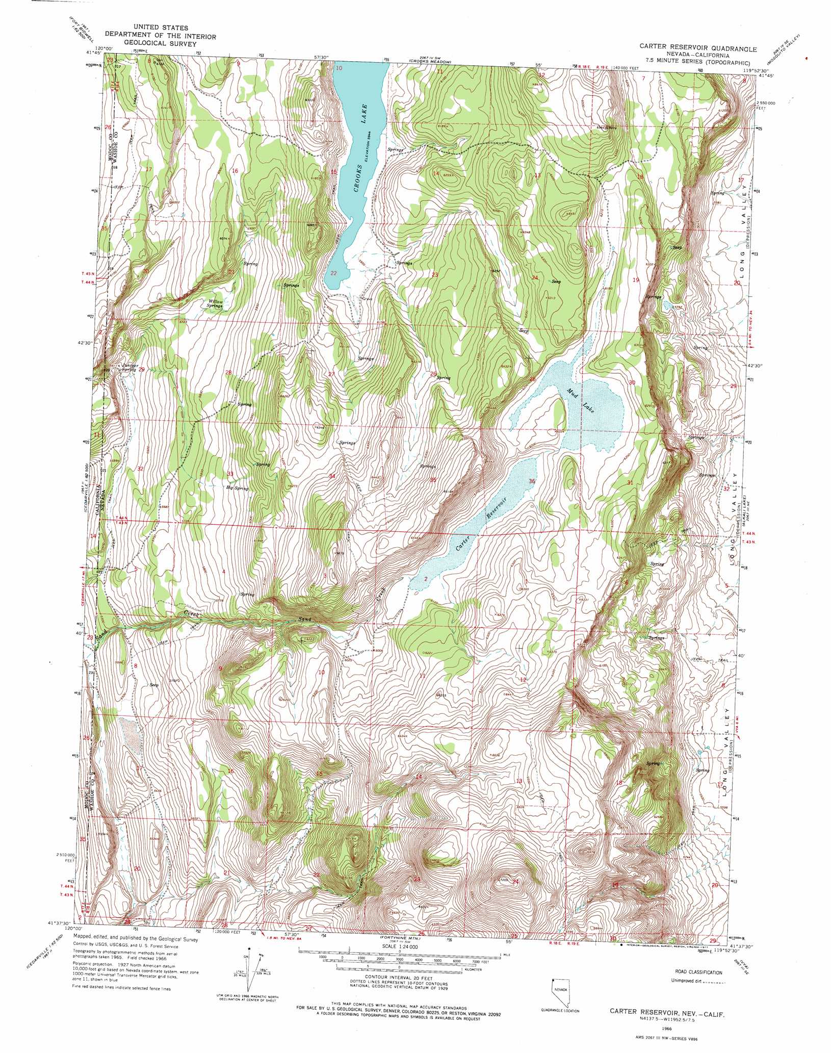
USGS Topo Quad 41119f8 - 1:24,000 scale
| Topo Map Name: | Carter Reservoir |
| USGS Topo Quad ID: | 41119f8 |
| Print Size: | ca. 21 1/4" wide x 27" high |
| Southeast Coordinates: | 41.625° N latitude / 119.875° W longitude |
| Map Center Coordinates: | 41.6875° N latitude / 119.9375° W longitude |
| U.S. States: | NV, CA |
| Filename: | o41119f8.jpg |
| Download Map JPG Image: | Carter Reservoir topo map 1:24,000 scale |
| Map Type: | Topographic |
| Topo Series: | 7.5´ |
| Map Scale: | 1:24,000 |
| Source of Map Images: | United States Geological Survey (USGS) |
| Alternate Map Versions: |
Carter Reservoir NV 1966, updated 1969 Download PDF Buy paper map Carter Reservoir NV 1966, updated 1969 Download PDF Buy paper map Carter Reservoir NV 1966, updated 1977 Download PDF Buy paper map Carter Reservoir NV 2011 Download PDF Buy paper map Carter Reservoir NV 2015 Download PDF Buy paper map |
1:24,000 Topo Quads surrounding Carter Reservoir
Mount Bidwell |
Lake Annie |
Barrel Springs |
Little Coleman Canyon |
Coleman Canyon |
Fort Bidwell |
Larkspur Hills |
Crooks Meadow |
Mosquito Valley |
Calcutta Lake |
Lake City |
Boyd Hot Spring |
Carter Reservoir |
Alkali Lake |
Massacre Lake Nw |
Cedarville |
Leonards Hot Springs |
Fortynine Mountain |
Vya |
Painted Point |
Warren Peak |
Hansen Island |
Big Hat Mountain |
Boulder Lake |
Powers Well |
> Back to 41119e1 at 1:100,000 scale
> Back to 41118a1 at 1:250,000 scale
> Back to U.S. Topo Maps home
Carter Reservoir topo map: Gazetteer
Carter Reservoir: Dams
Carter Reservoir Dam elevation 1871m 6138′Hill Dam Number Two elevation 1765m 5790′
Carter Reservoir: Lakes
Mud Lake elevation 1881m 6171′Carter Reservoir: Reservoirs
Carter Reservoir elevation 1871m 6138′Carter Reservoir: Springs
Big Spring elevation 1787m 5862′Juniper Spring elevation 1711m 5613′
Willow Springs elevation 1753m 5751′
Carter Reservoir: Summits
Metzker Peak elevation 2197m 7208′Carter Reservoir digital topo map on disk
Buy this Carter Reservoir topo map showing relief, roads, GPS coordinates and other geographical features, as a high-resolution digital map file on DVD: