Mosquito Valley Topo Map Nevada
To zoom in, hover over the map of Mosquito Valley
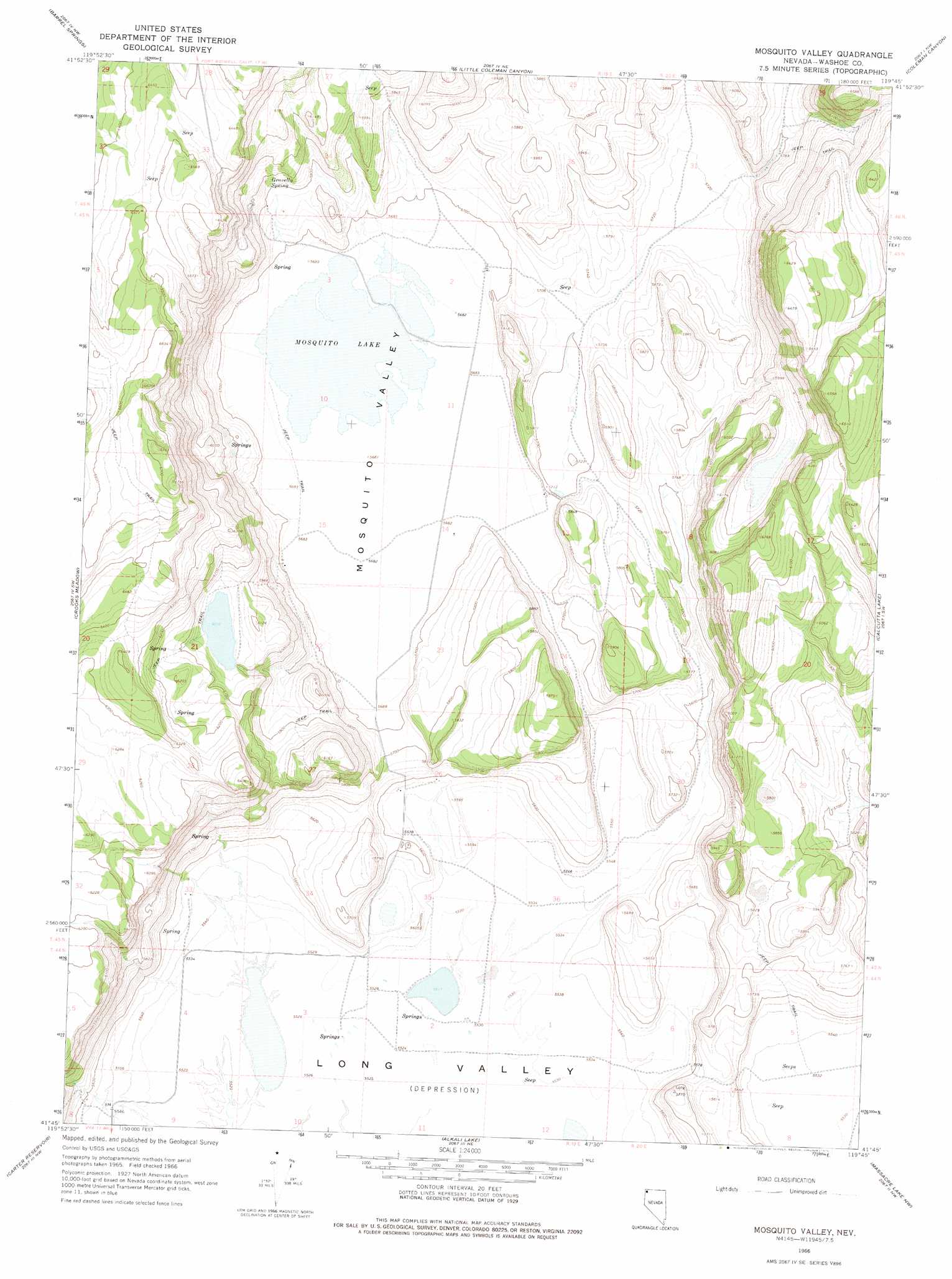
USGS Topo Quad 41119g7 - 1:24,000 scale
| Topo Map Name: | Mosquito Valley |
| USGS Topo Quad ID: | 41119g7 |
| Print Size: | ca. 21 1/4" wide x 27" high |
| Southeast Coordinates: | 41.75° N latitude / 119.75° W longitude |
| Map Center Coordinates: | 41.8125° N latitude / 119.8125° W longitude |
| U.S. State: | NV |
| Filename: | o41119g7.jpg |
| Download Map JPG Image: | Mosquito Valley topo map 1:24,000 scale |
| Map Type: | Topographic |
| Topo Series: | 7.5´ |
| Map Scale: | 1:24,000 |
| Source of Map Images: | United States Geological Survey (USGS) |
| Alternate Map Versions: |
Mosquito Valley NV 1966, updated 1968 Download PDF Buy paper map Mosquito Valley NV 1966, updated 1975 Download PDF Buy paper map Mosquito Valley NV 2011 Download PDF Buy paper map Mosquito Valley NV 2015 Download PDF Buy paper map |
1:24,000 Topo Quads surrounding Mosquito Valley
Collins Rim |
May Lake |
Coleman Lake |
Blizzard Gap |
Piute Reservoir |
Lake Annie |
Barrel Springs |
Little Coleman Canyon |
Coleman Canyon |
Rye Creek |
Larkspur Hills |
Crooks Meadow |
Mosquito Valley |
Calcutta Lake |
Bald Mountain |
Boyd Hot Spring |
Carter Reservoir |
Alkali Lake |
Massacre Lake Nw |
Massacre Lake |
Leonards Hot Springs |
Fortynine Mountain |
Vya |
Painted Point |
Massacre Creek |
> Back to 41119e1 at 1:100,000 scale
> Back to 41118a1 at 1:250,000 scale
> Back to U.S. Topo Maps home
Mosquito Valley topo map: Gazetteer
Mosquito Valley: Dams
Hill Dam Number One elevation 1837m 6026′Howard C Davis Dam elevation 1742m 5715′
Mosquito Valley: Lakes
Mosquito Lake elevation 1735m 5692′Mosquito Valley: Populated Places
Beulah (historical) elevation 1735m 5692′Diessner (historical) elevation 1737m 5698′
Mosquito Valley: Post Offices
Beulah Post Office (historical) elevation 1735m 5692′Diessner Post Office (historical) elevation 1737m 5698′
Mosquito Valley: Reservoirs
Hill Reservoir elevation 1837m 6026′Mosquito Valley: Springs
Gravelly Spring elevation 1781m 5843′Mosquito Valley: Valleys
Mosquito Valley elevation 1738m 5702′Mosquito Valley digital topo map on disk
Buy this Mosquito Valley topo map showing relief, roads, GPS coordinates and other geographical features, as a high-resolution digital map file on DVD: