Thousand Creek Spring Topo Map Nevada
To zoom in, hover over the map of Thousand Creek Spring
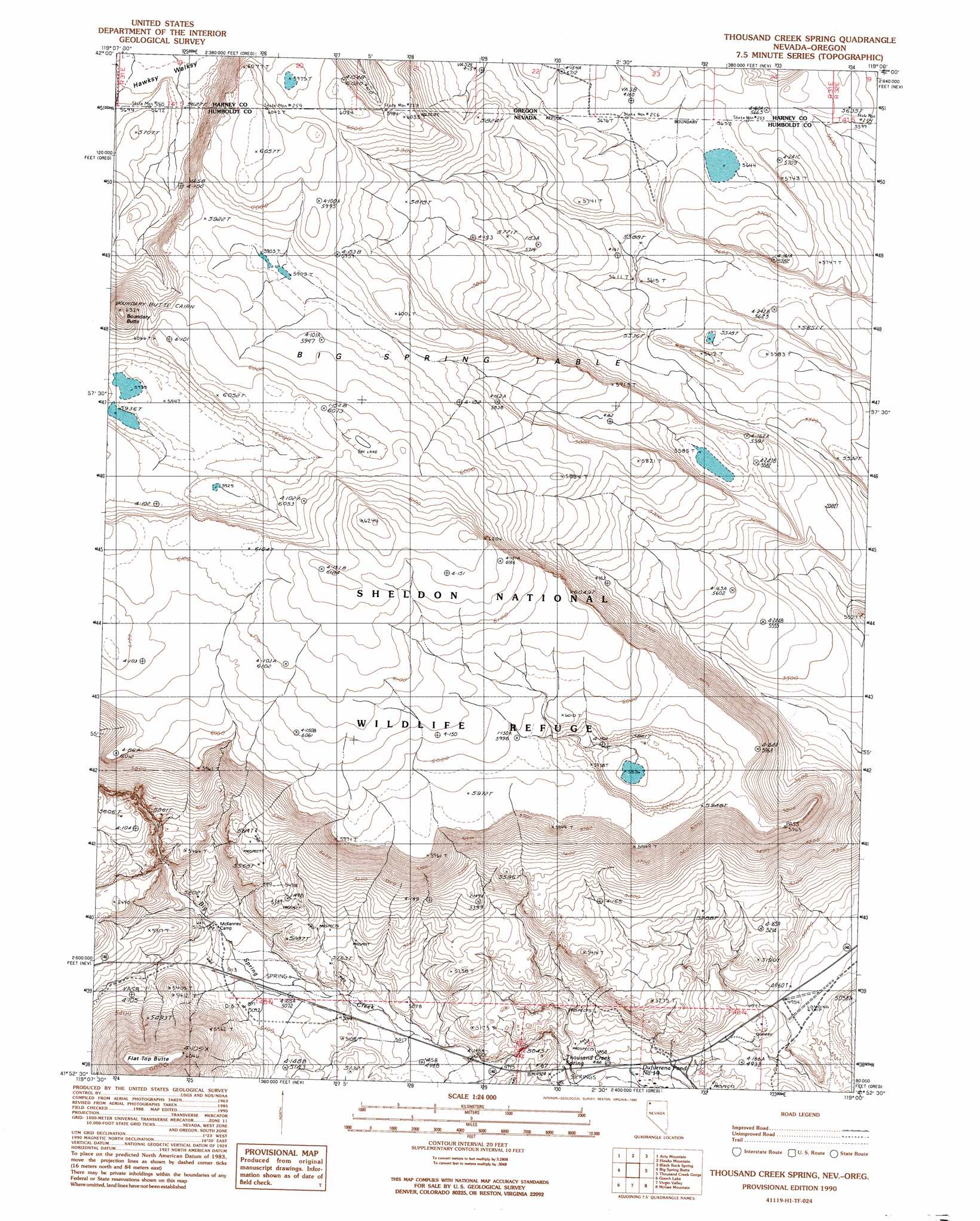
USGS Topo Quad 41119h1 - 1:24,000 scale
| Topo Map Name: | Thousand Creek Spring |
| USGS Topo Quad ID: | 41119h1 |
| Print Size: | ca. 21 1/4" wide x 27" high |
| Southeast Coordinates: | 41.875° N latitude / 119° W longitude |
| Map Center Coordinates: | 41.9375° N latitude / 119.0625° W longitude |
| U.S. States: | NV, OR |
| Filename: | o41119h1.jpg |
| Download Map JPG Image: | Thousand Creek Spring topo map 1:24,000 scale |
| Map Type: | Topographic |
| Topo Series: | 7.5´ |
| Map Scale: | 1:24,000 |
| Source of Map Images: | United States Geological Survey (USGS) |
| Alternate Map Versions: |
Thousand Creek Spring NV 1990, updated 1990 Download PDF Buy paper map Thousand Creek Spring NV 2011 Download PDF Buy paper map Thousand Creek Spring NV 2015 Download PDF Buy paper map |
1:24,000 Topo Quads surrounding Thousand Creek Spring
Chimney Rock |
Acty Mountain Nw |
Acty Mountain Ne |
Robbers Roost |
Rincon Flat |
Sage Hen Flats |
Acty Mountain |
Hawks Mountain |
Black Rock Springs |
Oregon End Table |
Sage Hen Hills |
Big Spring Butte |
Thousand Creek Spring |
Thousand Creek Gorge |
Bog Hot Springs |
Catnip Mountain Se |
Gooch Lake |
Virgin Valley |
Mcgee Mountain |
Alder Creek Ranch |
Blowout Mountain |
Alkali Peak |
Rock Spring Table |
Knott Creek Ranch |
Knott Creek |
> Back to 41119e1 at 1:100,000 scale
> Back to 41118a1 at 1:250,000 scale
> Back to U.S. Topo Maps home
Thousand Creek Spring topo map: Gazetteer
Thousand Creek Spring: Springs
Thousand Creek Spring elevation 1495m 4904′Thousand Creek Spring: Summits
Big Spring Table elevation 1764m 5787′Big Spring Table elevation 1764m 5787′
Boundary Butte elevation 1890m 6200′
Flat Top Butte elevation 1788m 5866′
Thousand Creek Spring digital topo map on disk
Buy this Thousand Creek Spring topo map showing relief, roads, GPS coordinates and other geographical features, as a high-resolution digital map file on DVD: