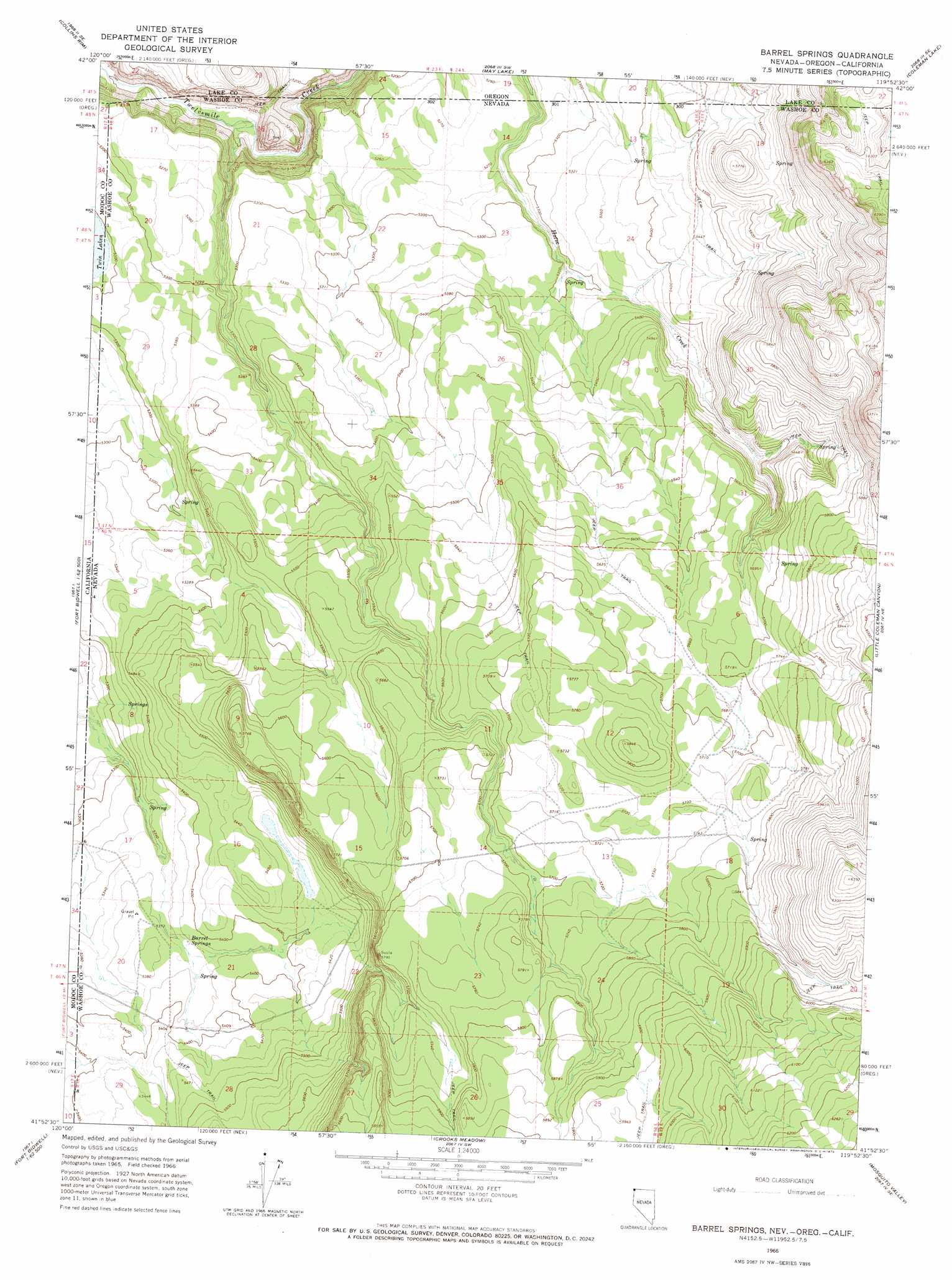
Barrel Springs Topo Map Nevada
To zoom in, hover over the map of Barrel Springs
USGS Topo Quad 41119h8 - 1:24,000 scale
| Topo Map Name: | Barrel Springs |
| USGS Topo Quad ID: | 41119h8 |
| Print Size: | ca. 21 1/4" wide x 27" high |
| Southeast Coordinates: | 41.875° N latitude / 119.875° W longitude |
| Map Center Coordinates: | 41.9375° N latitude / 119.9375° W longitude |
| U.S. States: | NV, CA, OR |
| Filename: | o41119h8.jpg |
| Download Map JPG Image: | Barrel Springs topo map 1:24,000 scale |
| Map Type: | Topographic |
| Topo Series: | 7.5´ |
| Map Scale: | 1:24,000 |
| Source of Map Images: | United States Geological Survey (USGS) |
| Alternate Map Versions: |
Barrel Springs NV 1966, updated 1968 Download PDF Buy paper map Barrel Springs NV 1966, updated 1973 Download PDF Buy paper map Barrel Springs NV 2011 Download PDF Buy paper map Barrel Springs NV 2015 Download PDF Buy paper map |
1:24,000 Topo Quads surrounding Barrel Springs
Horse Prairie |
Sage Hen Butte |
Adel |
Calderwood Reservoir |
Mud Lake Reservoir |
Crane Mountain |
Collins Rim |
May Lake |
Coleman Lake |
Blizzard Gap |
Mount Bidwell |
Lake Annie |
Barrel Springs |
Little Coleman Canyon |
Coleman Canyon |
Fort Bidwell |
Larkspur Hills |
Crooks Meadow |
Mosquito Valley |
Calcutta Lake |
Lake City |
Boyd Hot Spring |
Carter Reservoir |
Alkali Lake |
Massacre Lake Nw |
> Back to 41119e1 at 1:100,000 scale
> Back to 41118a1 at 1:250,000 scale
> Back to U.S. Topo Maps home
Barrel Springs topo map: Gazetteer
Barrel Springs: Lakes
Twin Lakes elevation 1612m 5288′Barrel Springs: Springs
Barrel Springs elevation 1637m 5370′Coleman Spring elevation 1679m 5508′
Barrel Springs digital topo map on disk
Buy this Barrel Springs topo map showing relief, roads, GPS coordinates and other geographical features, as a high-resolution digital map file on DVD: