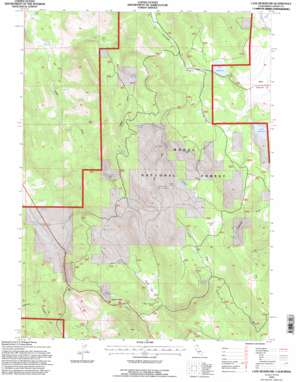
Lane Reservoir Topo Map California
To zoom in, hover over the map of Lane Reservoir
USGS Topo Quad 41120a7 - 1:24,000 scale
| Topo Map Name: | Lane Reservoir |
| USGS Topo Quad ID: | 41120a7 |
| Print Size: | ca. 21 1/4" wide x 27" high |
| Southeast Coordinates: | 41° N latitude / 120.75° W longitude |
| Map Center Coordinates: | 41.0625° N latitude / 120.8125° W longitude |
| U.S. State: | CA |
| Filename: | o41120a7.jpg |
| Download Map JPG Image: | Lane Reservoir topo map 1:24,000 scale |
| Map Type: | Topographic |
| Topo Series: | 7.5´ |
| Map Scale: | 1:24,000 |
| Source of Map Images: | United States Geological Survey (USGS) |
| Alternate Map Versions: |
Lane Reservoir CA 1990, updated 1990 Download PDF Buy paper map Lane Reservoir CA 1993, updated 1996 Download PDF Buy paper map Lane Reservoir CA 2012 Download PDF Buy paper map Lane Reservoir CA 2015 Download PDF Buy paper map |
| FStopo: | US Forest Service topo Lane Reservoir is available: Download FStopo PDF Download FStopo TIF |
1:24,000 Topo Quads surrounding Lane Reservoir
> Back to 41120a1 at 1:100,000 scale
> Back to 41120a1 at 1:250,000 scale
> Back to U.S. Topo Maps home
Lane Reservoir topo map: Gazetteer
Lane Reservoir: Dams
Elkins and Lane 1241 Dam elevation 1555m 5101′Lane Reservoir: Flats
Coyote Flat elevation 1799m 5902′Hunsinger Flat elevation 1593m 5226′
Smith Flat elevation 1587m 5206′
Lane Reservoir: Populated Places
Avila Place elevation 1419m 4655′Scotty Place elevation 1378m 4520′
Lane Reservoir: Reservoirs
Lane Reservoir elevation 1555m 5101′Moll Reservoir elevation 1607m 5272′
Williams Reservoir elevation 1694m 5557′
Lane Reservoir: Springs
Bert Bath Spring elevation 1807m 5928′Foster Spring elevation 1675m 5495′
Johnson Mill Spring elevation 1802m 5912′
Lower McBride Springs elevation 1519m 4983′
Shingle Mill Spring elevation 1650m 5413′
Walker Spring elevation 1536m 5039′
Wayman Spring elevation 1781m 5843′
Lane Reservoir: Streams
Cottonwood Creek elevation 1526m 5006′Lane Reservoir: Valleys
Coyote Flat Draw elevation 1702m 5583′Foster Draw elevation 1494m 4901′
Oxendine Draw elevation 1652m 5419′
Walker Draw elevation 1556m 5104′
Lane Reservoir digital topo map on disk
Buy this Lane Reservoir topo map showing relief, roads, GPS coordinates and other geographical features, as a high-resolution digital map file on DVD:


