Tule Mountain Topo Map California
To zoom in, hover over the map of Tule Mountain
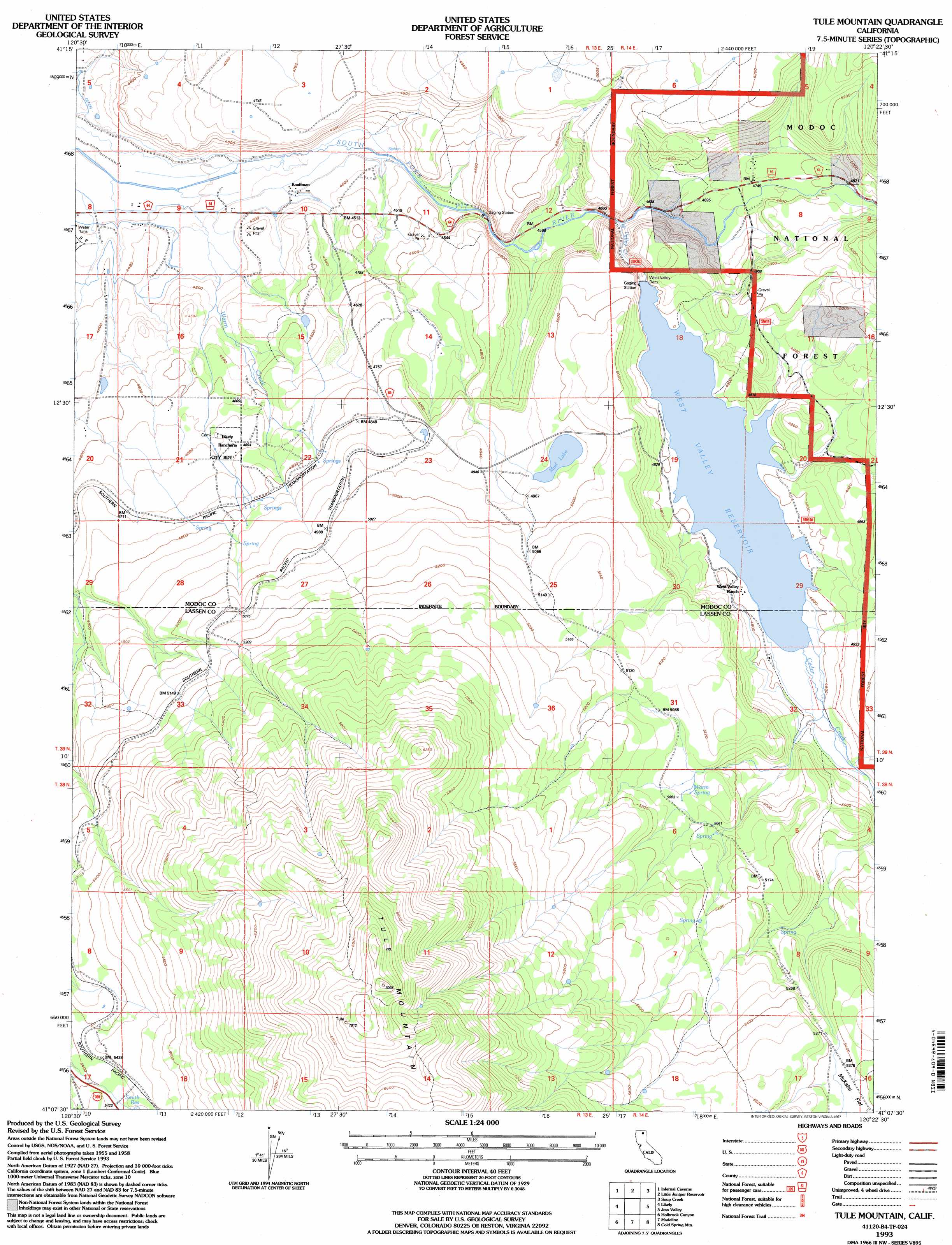
USGS Topo Quad 41120b4 - 1:24,000 scale
| Topo Map Name: | Tule Mountain |
| USGS Topo Quad ID: | 41120b4 |
| Print Size: | ca. 21 1/4" wide x 27" high |
| Southeast Coordinates: | 41.125° N latitude / 120.375° W longitude |
| Map Center Coordinates: | 41.1875° N latitude / 120.4375° W longitude |
| U.S. State: | CA |
| Filename: | o41120b4.jpg |
| Download Map JPG Image: | Tule Mountain topo map 1:24,000 scale |
| Map Type: | Topographic |
| Topo Series: | 7.5´ |
| Map Scale: | 1:24,000 |
| Source of Map Images: | United States Geological Survey (USGS) |
| Alternate Map Versions: |
Tule Mountain CA 1962, updated 1964 Download PDF Buy paper map Tule Mountain CA 1962, updated 1970 Download PDF Buy paper map Tule Mountain CA 1962, updated 1983 Download PDF Buy paper map Tule Mountain CA 1962, updated 1985 Download PDF Buy paper map Tule Mountain CA 1993, updated 1997 Download PDF Buy paper map Tule Mountain CA 2012 Download PDF Buy paper map Tule Mountain CA 2015 Download PDF Buy paper map |
| FStopo: | US Forest Service topo Tule Mountain is available: Download FStopo PDF Download FStopo TIF |
1:24,000 Topo Quads surrounding Tule Mountain
Rattlesnake Butte |
Alturas |
Dorris Reservoir |
Shields Creek |
Warren Peak |
Graven Ridge |
Bayley |
Little Juniper Reservoir |
Soup Creek |
Eagle Peak |
Knox Mountain |
Likely |
Tule Mountain |
Jess Valley |
Emerson Peak |
Ash Valley |
Holbrook Canyon |
Madeline |
Cold Spring Mountain |
Boot Lake |
Whitinger Mountain |
Anderson Mountain |
Mcdonald Peak |
Juniper Ridge |
Dodge Reservoir |
> Back to 41120a1 at 1:100,000 scale
> Back to 41120a1 at 1:250,000 scale
> Back to U.S. Topo Maps home
Tule Mountain topo map: Gazetteer
Tule Mountain: Dams
West Valley Dam elevation 1447m 4747′Tule Mountain: Populated Places
Kauffman elevation 1363m 4471′Tule Mountain: Reservoirs
Mud Lake elevation 1508m 4947′West Valley Reservoir elevation 1447m 4747′
Tule Mountain: Springs
Warm Spring elevation 1550m 5085′Tule Mountain: Streams
Cedar Creek elevation 1457m 4780′Warm Creek elevation 1349m 4425′
West Valley Creek elevation 1409m 4622′
Tule Mountain: Summits
Tule Mountain elevation 2160m 7086′Tule Mountain elevation 2144m 7034′
Tule Mountain digital topo map on disk
Buy this Tule Mountain topo map showing relief, roads, GPS coordinates and other geographical features, as a high-resolution digital map file on DVD: