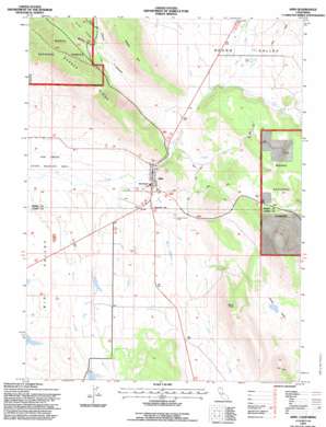
Adin Topo Map California
To zoom in, hover over the map of Adin
USGS Topo Quad 41120b8 - 1:24,000 scale
| Topo Map Name: | Adin |
| USGS Topo Quad ID: | 41120b8 |
| Print Size: | ca. 21 1/4" wide x 27" high |
| Southeast Coordinates: | 41.125° N latitude / 120.875° W longitude |
| Map Center Coordinates: | 41.1875° N latitude / 120.9375° W longitude |
| U.S. State: | CA |
| Filename: | o41120b8.jpg |
| Download Map JPG Image: | Adin topo map 1:24,000 scale |
| Map Type: | Topographic |
| Topo Series: | 7.5´ |
| Map Scale: | 1:24,000 |
| Source of Map Images: | United States Geological Survey (USGS) |
| Alternate Map Versions: |
Adin CA 1990, updated 1990 Download PDF Buy paper map Adin CA 1993, updated 1996 Download PDF Buy paper map Adin CA 2012 Download PDF Buy paper map Adin CA 2015 Download PDF Buy paper map |
| FStopo: | US Forest Service topo Adin is available: Download FStopo PDF Download FStopo TIF |
1:24,000 Topo Quads surrounding Adin
> Back to 41120a1 at 1:100,000 scale
> Back to 41120a1 at 1:250,000 scale
> Back to U.S. Topo Maps home
Adin topo map: Gazetteer
Adin: Airports
Adin Airport elevation 1289m 4229′Adin: Basins
Chace Valley elevation 1376m 4514′Adin: Dams
Albaugh Number 2 1242-2 Dam elevation 1294m 4245′Chace Valley 1243 Dam elevation 1376m 4514′
Myers 1247 Dam elevation 1307m 4288′
Adin: Populated Places
Adin elevation 1281m 4202′Dibble Place elevation 1340m 4396′
Harper elevation 1286m 4219′
Adin: Post Offices
Adin Post Office elevation 1282m 4206′Adin: Reservoirs
Myers Reservoir elevation 1307m 4288′Adin: Streams
Butte Creek elevation 1279m 4196′Dutch Flat Creek elevation 1286m 4219′
Rush Creek elevation 1286m 4219′
Willow Creek elevation 1272m 4173′
Adin: Summits
Brisco Butte elevation 1504m 4934′Harper Hill elevation 1512m 4960′
Adin: Valleys
Barber Canyon elevation 1287m 4222′Kelly Draw elevation 1300m 4265′
Round Valley elevation 1288m 4225′
Ryan Canyon elevation 1340m 4396′
Adin digital topo map on disk
Buy this Adin topo map showing relief, roads, GPS coordinates and other geographical features, as a high-resolution digital map file on DVD:


