Graven Ridge Topo Map California
To zoom in, hover over the map of Graven Ridge
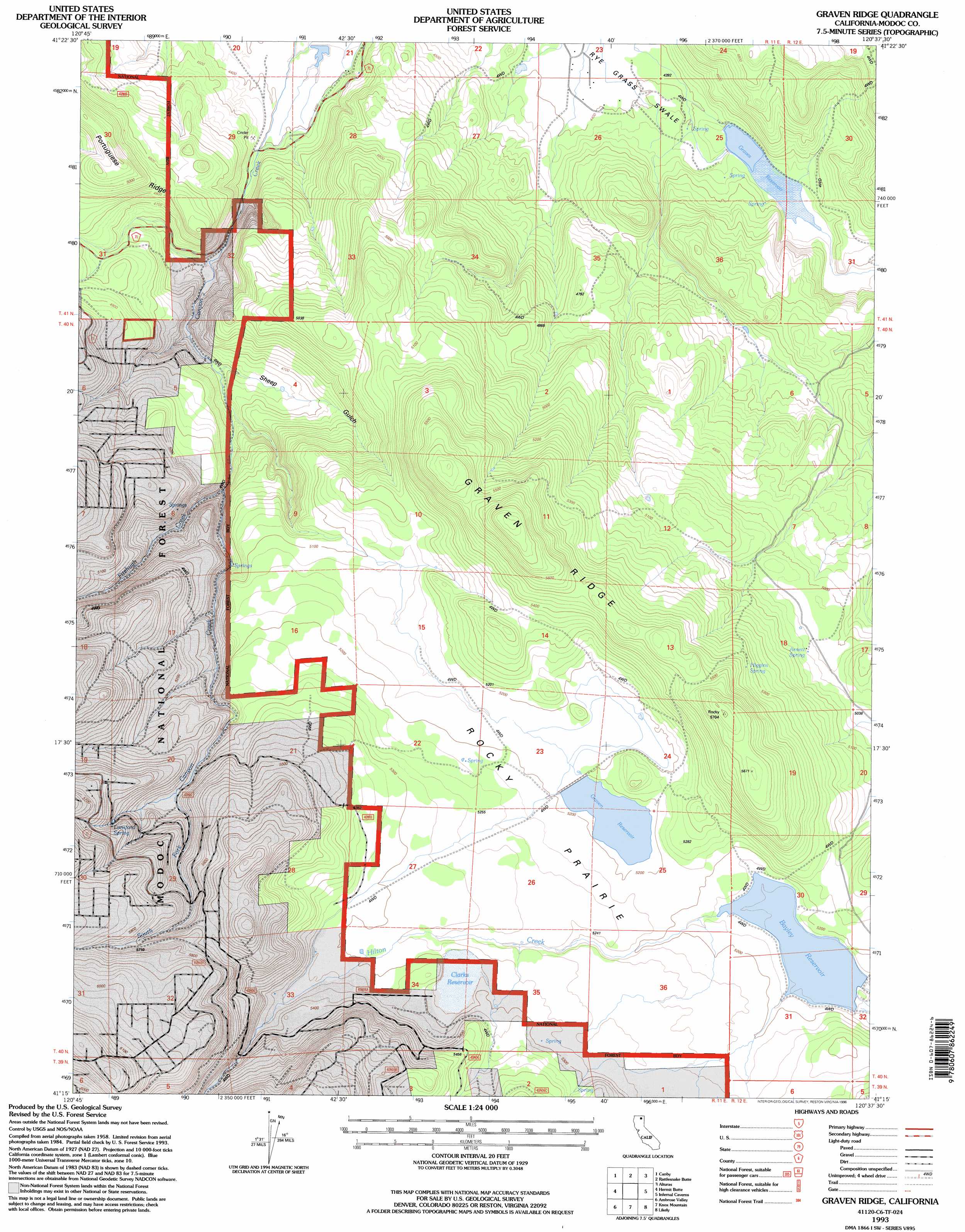
USGS Topo Quad 41120c6 - 1:24,000 scale
| Topo Map Name: | Graven Ridge |
| USGS Topo Quad ID: | 41120c6 |
| Print Size: | ca. 21 1/4" wide x 27" high |
| Southeast Coordinates: | 41.25° N latitude / 120.625° W longitude |
| Map Center Coordinates: | 41.3125° N latitude / 120.6875° W longitude |
| U.S. State: | CA |
| Filename: | o41120c6.jpg |
| Download Map JPG Image: | Graven Ridge topo map 1:24,000 scale |
| Map Type: | Topographic |
| Topo Series: | 7.5´ |
| Map Scale: | 1:24,000 |
| Source of Map Images: | United States Geological Survey (USGS) |
| Alternate Map Versions: |
Graven Ridge CA 1990, updated 1990 Download PDF Buy paper map Graven Ridge CA 1993, updated 1996 Download PDF Buy paper map Graven Ridge CA 2012 Download PDF Buy paper map Graven Ridge CA 2015 Download PDF Buy paper map |
| FStopo: | US Forest Service topo Graven Ridge is available: Download FStopo PDF Download FStopo TIF |
1:24,000 Topo Quads surrounding Graven Ridge
Ambrose |
Jacks Butte |
Big Sage Reservoir |
Mahogany Ridge |
Surprise |
Washington Mountain |
Canby |
Rattlesnake Butte |
Alturas |
Dorris Reservoir |
Adin Pass |
Hermit Butte |
Graven Ridge |
Bayley |
Little Juniper Reservoir |
Adin |
Ambrose Valley |
Knox Mountain |
Likely |
Tule Mountain |
Letterbox Hill |
Lane Reservoir |
Ash Valley |
Holbrook Canyon |
Madeline |
> Back to 41120a1 at 1:100,000 scale
> Back to 41120a1 at 1:250,000 scale
> Back to U.S. Topo Maps home
Graven Ridge topo map: Gazetteer
Graven Ridge: Dams
Bayley Reservoir 1118 Dam elevation 1572m 5157′Graven 136-002 Dam elevation 1585m 5200′
Rye Grass Swale 150 Dam elevation 1356m 4448′
Graven Ridge: Flats
Rocky Prairie elevation 1598m 5242′Graven Ridge: Reservoirs
Bayley Reservoir elevation 1572m 5157′Clarks Reservoir elevation 1609m 5278′
Graven Reservoir elevation 1585m 5200′
Graves Reservoir elevation 1356m 4448′
Graven Ridge: Ridges
Graven Ridge elevation 1692m 5551′Graven Ridge: Springs
Arnett Spring elevation 1533m 5029′Higgins Spring elevation 1637m 5370′
Lunsford Spring elevation 1696m 5564′
Graven Ridge: Streams
Fitzhugh Creek elevation 1447m 4747′Hilton Creek elevation 1578m 5177′
South Fork Canyon Creek elevation 1619m 5311′
Graven Ridge: Valleys
Sheep Gulch elevation 1396m 4580′Graven Ridge digital topo map on disk
Buy this Graven Ridge topo map showing relief, roads, GPS coordinates and other geographical features, as a high-resolution digital map file on DVD: