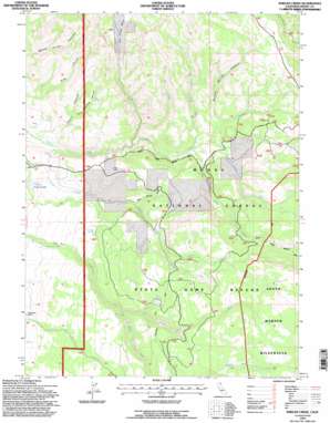
Shields Creek Topo Map California
To zoom in, hover over the map of Shields Creek
USGS Topo Quad 41120d3 - 1:24,000 scale
| Topo Map Name: | Shields Creek |
| USGS Topo Quad ID: | 41120d3 |
| Print Size: | ca. 21 1/4" wide x 27" high |
| Southeast Coordinates: | 41.375° N latitude / 120.25° W longitude |
| Map Center Coordinates: | 41.4375° N latitude / 120.3125° W longitude |
| U.S. State: | CA |
| Filename: | o41120d3.jpg |
| Download Map JPG Image: | Shields Creek topo map 1:24,000 scale |
| Map Type: | Topographic |
| Topo Series: | 7.5´ |
| Map Scale: | 1:24,000 |
| Source of Map Images: | United States Geological Survey (USGS) |
| Alternate Map Versions: |
Shields Creek CA 1963, updated 1965 Download PDF Buy paper map Shields Creek CA 1963, updated 1971 Download PDF Buy paper map Shields Creek CA 1963, updated 1977 Download PDF Buy paper map Shields Creek CA 1963, updated 1983 Download PDF Buy paper map Shields Creek CA 1993, updated 1996 Download PDF Buy paper map Shields Creek CA 2012 Download PDF Buy paper map Shields Creek CA 2015 Download PDF Buy paper map |
| FStopo: | US Forest Service topo Shields Creek is available: Download FStopo PDF Download FStopo TIF |
1:24,000 Topo Quads surrounding Shields Creek
> Back to 41120a1 at 1:100,000 scale
> Back to 41120a1 at 1:250,000 scale
> Back to U.S. Topo Maps home
Shields Creek topo map: Gazetteer
Shields Creek: Basins
Dry Creek Basin elevation 1794m 5885′Shields Creek: Dams
Plum Canyon 139 Dam elevation 1531m 5022′Shields Creek: Ranges
Warner Mountains elevation 2065m 6774′Shields Creek: Reservoirs
Porter Reservoir elevation 1531m 5022′Shields Creek: Springs
Fern Spring elevation 1727m 5666′Fitzhugh Springs elevation 1678m 5505′
Pine Spring elevation 1888m 6194′
Shields Creek: Streams
Dry Creek elevation 1615m 5298′East Dry Creek elevation 1676m 5498′
Little North Fork Parker Creek elevation 1684m 5524′
Middle Fork Parker Creek elevation 1701m 5580′
Middle Fork Pine Creek elevation 1716m 5629′
North Fork Parker Creek elevation 1677m 5501′
North Fork Pine Creek elevation 1708m 5603′
North Fork Shields Creek elevation 1820m 5971′
South Fork Parker Creek elevation 1677m 5501′
South Fork Shields Creek elevation 1820m 5971′
Shields Creek: Trails
Telephone Line Trail elevation 1916m 6286′Shields Creek: Valleys
Fern Spring Canyon elevation 1617m 5305′Mud Spring Gulch elevation 1651m 5416′
Payne Canyon elevation 1516m 4973′
Willow Spring Canyon elevation 1761m 5777′
Shields Creek digital topo map on disk
Buy this Shields Creek topo map showing relief, roads, GPS coordinates and other geographical features, as a high-resolution digital map file on DVD:


