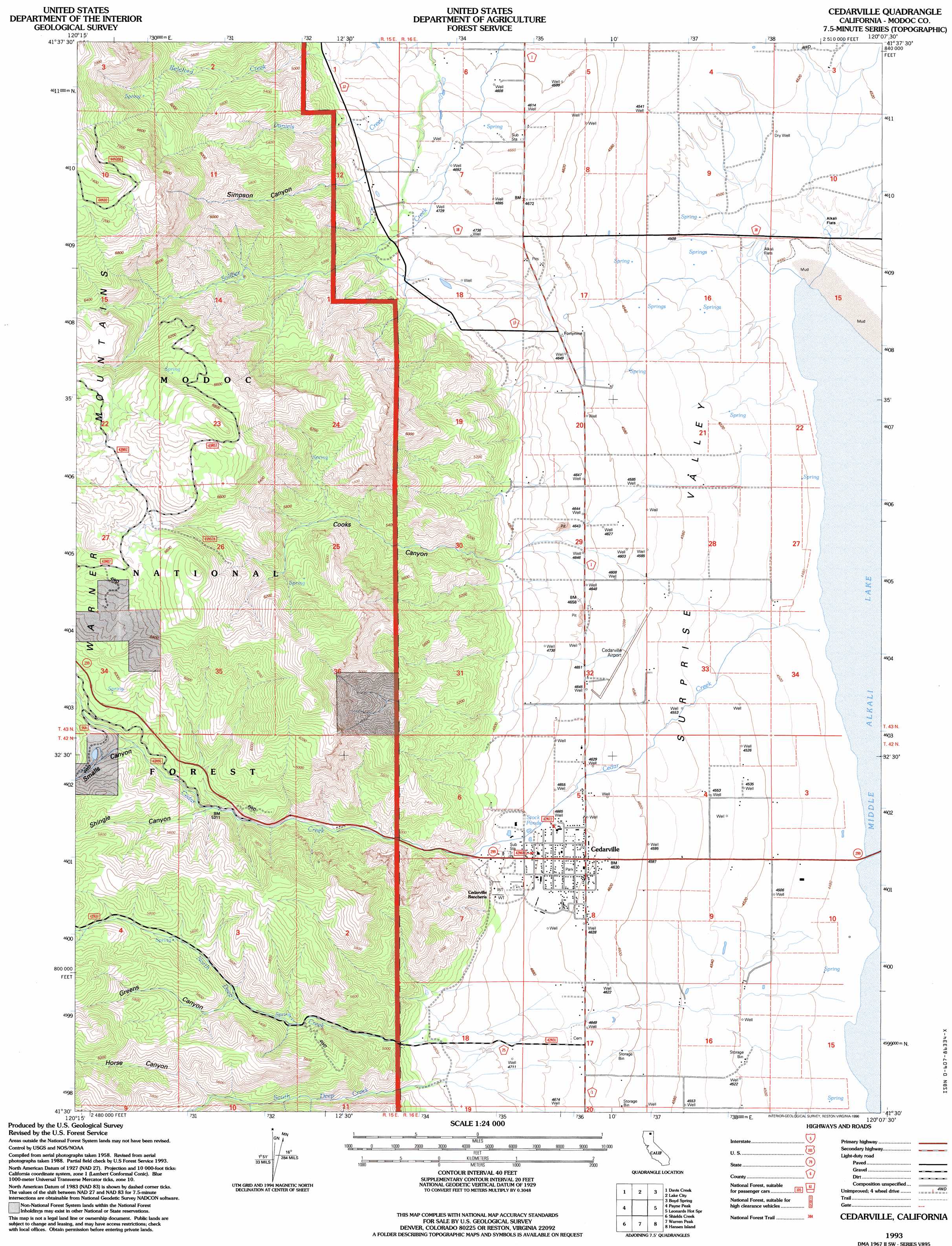
Cedarville Topo Map California
To zoom in, hover over the map of Cedarville
USGS Topo Quad 41120e2 - 1:24,000 scale
| Topo Map Name: | Cedarville |
| USGS Topo Quad ID: | 41120e2 |
| Print Size: | ca. 21 1/4" wide x 27" high |
| Southeast Coordinates: | 41.5° N latitude / 120.125° W longitude |
| Map Center Coordinates: | 41.5625° N latitude / 120.1875° W longitude |
| U.S. State: | CA |
| Filename: | o41120e2.jpg |
| Download Map JPG Image: | Cedarville topo map 1:24,000 scale |
| Map Type: | Topographic |
| Topo Series: | 7.5´ |
| Map Scale: | 1:24,000 |
| Source of Map Images: | United States Geological Survey (USGS) |
| Alternate Map Versions: |
Cedarville CA 1990, updated 1990 Download PDF Buy paper map Cedarville CA 1993, updated 1996 Download PDF Buy paper map Cedarville CA 2012 Download PDF Buy paper map Cedarville CA 2015 Download PDF Buy paper map |
| FStopo: | US Forest Service topo Cedarville is available: Download FStopo PDF Download FStopo TIF |
1:24,000 Topo Quads surrounding Cedarville
Mcginty Point |
Sugar Hill |
Fort Bidwell |
Larkspur Hills |
Crooks Meadow |
Lauer Reservoir |
Davis Creek |
Lake City |
Boyd Hot Spring |
Carter Reservoir |
Surprise |
Payne Peak |
Cedarville |
Leonards Hot Springs |
Fortynine Mountain |
Dorris Reservoir |
Shields Creek |
Warren Peak |
Hansen Island |
Big Hat Mountain |
Little Juniper Reservoir |
Soup Creek |
Eagle Peak |
Eagleville |
Hays Canyon |
> Back to 41120e1 at 1:100,000 scale
> Back to 41120a1 at 1:250,000 scale
> Back to U.S. Topo Maps home
Cedarville topo map: Gazetteer
Cedarville: Airports
Cedarville Airport elevation 1406m 4612′Cedarville: Populated Places
Cedarville elevation 1418m 4652′Cedarville: Post Offices
Cedarville Post Office elevation 1415m 4642′Cedarville: Streams
Cedar Creek elevation 1362m 4468′North Deep Creek elevation 1360m 4461′
South Deep Creek elevation 1478m 4849′
Cedarville: Valleys
Cooks Canyon elevation 1462m 4796′Greens Canyon elevation 1630m 5347′
Horse Canyon elevation 1663m 5456′
Shingle Canyon elevation 1633m 5357′
Simpson Canyon elevation 1500m 4921′
Smalls Canyon elevation 1707m 5600′
Cedarville digital topo map on disk
Buy this Cedarville topo map showing relief, roads, GPS coordinates and other geographical features, as a high-resolution digital map file on DVD: