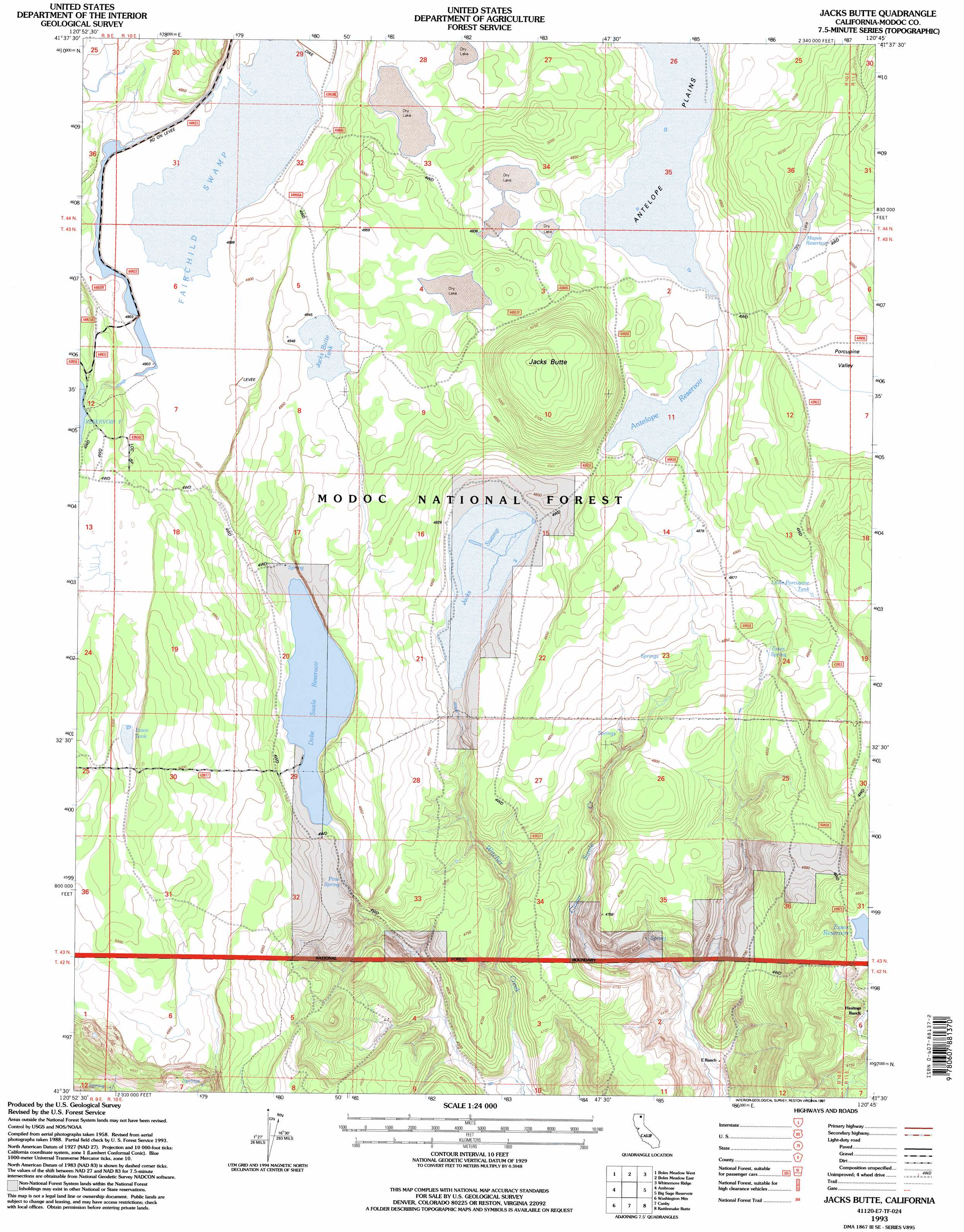
Jacks Butte Topo Map California
To zoom in, hover over the map of Jacks Butte
USGS Topo Quad 41120e7 - 1:24,000 scale
| Topo Map Name: | Jacks Butte |
| USGS Topo Quad ID: | 41120e7 |
| Print Size: | ca. 21 1/4" wide x 27" high |
| Southeast Coordinates: | 41.5° N latitude / 120.75° W longitude |
| Map Center Coordinates: | 41.5625° N latitude / 120.8125° W longitude |
| U.S. State: | CA |
| Filename: | o41120e7.jpg |
| Download Map JPG Image: | Jacks Butte topo map 1:24,000 scale |
| Map Type: | Topographic |
| Topo Series: | 7.5´ |
| Map Scale: | 1:24,000 |
| Source of Map Images: | United States Geological Survey (USGS) |
| Alternate Map Versions: |
Jacks Butte CA 1990, updated 1990 Download PDF Buy paper map Jacks Butte CA 1993, updated 1996 Download PDF Buy paper map Jacks Butte CA 1993, updated 1997 Download PDF Buy paper map Jacks Butte CA 2012 Download PDF Buy paper map Jacks Butte CA 2015 Download PDF Buy paper map |
| FStopo: | US Forest Service topo Jacks Butte is available: Download FStopo PDF Download FStopo TIF |
1:24,000 Topo Quads surrounding Jacks Butte
Pinnacle Lake |
Pothole Valley |
Hager Basin |
South Mountain |
Mcginty Reservoir |
Lone Pine Butte |
Boles Meadows West |
Boles Meadows East |
Whittemore Ridge |
Dead Horse Reservoir |
Knobcone Butte |
Ambrose |
Jacks Butte |
Big Sage Reservoir |
Mahogany Ridge |
Happy Camp Mountain |
Washington Mountain |
Canby |
Rattlesnake Butte |
Alturas |
Halls Canyon |
Adin Pass |
Hermit Butte |
Graven Ridge |
Bayley |
> Back to 41120e1 at 1:100,000 scale
> Back to 41120a1 at 1:250,000 scale
> Back to U.S. Topo Maps home
Jacks Butte topo map: Gazetteer
Jacks Butte: Dams
Cloverswale 112-003 Dam elevation 1506m 4940′Huffman Antelope 112-002 Dam elevation 1495m 4904′
Jacks Butte: Reservoirs
Antelope Reservoir elevation 1495m 4904′Essex Reservoir elevation 1470m 4822′
Essex Tank elevation 1520m 4986′
Jacks Butte Tank elevation 1508m 4947′
Little Porcupine Tank elevation 1497m 4911′
Mapes Reservoir elevation 1526m 5006′
Jacks Butte: Springs
Essex Spring elevation 1467m 4812′Pine Spring elevation 1473m 4832′
Jacks Butte: Streams
Porcupine Valley elevation 1513m 4963′Jacks Butte: Summits
Jacks Butte elevation 1575m 5167′Jacks Butte: Swamps
Dobe Swale elevation 1483m 4865′Fairchild Swamp elevation 1493m 4898′
Jacks Swamp elevation 1471m 4826′
Jacks Butte digital topo map on disk
Buy this Jacks Butte topo map showing relief, roads, GPS coordinates and other geographical features, as a high-resolution digital map file on DVD: