Ambrose Topo Map California
To zoom in, hover over the map of Ambrose
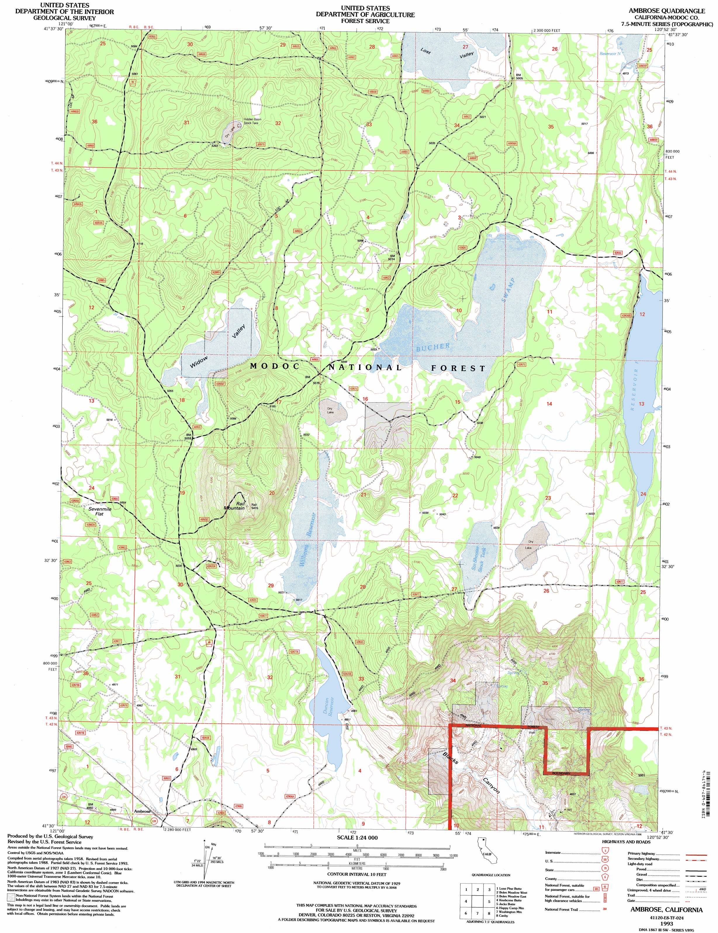
USGS Topo Quad 41120e8 - 1:24,000 scale
| Topo Map Name: | Ambrose |
| USGS Topo Quad ID: | 41120e8 |
| Print Size: | ca. 21 1/4" wide x 27" high |
| Southeast Coordinates: | 41.5° N latitude / 120.875° W longitude |
| Map Center Coordinates: | 41.5625° N latitude / 120.9375° W longitude |
| U.S. State: | CA |
| Filename: | o41120e8.jpg |
| Download Map JPG Image: | Ambrose topo map 1:24,000 scale |
| Map Type: | Topographic |
| Topo Series: | 7.5´ |
| Map Scale: | 1:24,000 |
| Source of Map Images: | United States Geological Survey (USGS) |
| Alternate Map Versions: |
Ambrose CA 1990, updated 1990 Download PDF Buy paper map Ambrose CA 1993, updated 1996 Download PDF Buy paper map Ambrose CA 2012 Download PDF Buy paper map Ambrose CA 2015 Download PDF Buy paper map |
| FStopo: | US Forest Service topo Ambrose is available: Download FStopo PDF Download FStopo TIF |
1:24,000 Topo Quads surrounding Ambrose
Double Head Mountain |
Pinnacle Lake |
Pothole Valley |
Hager Basin |
South Mountain |
Rimrock Lake |
Lone Pine Butte |
Boles Meadows West |
Boles Meadows East |
Whittemore Ridge |
Spaulding Butte |
Knobcone Butte |
Ambrose |
Jacks Butte |
Big Sage Reservoir |
Crank Mountain |
Happy Camp Mountain |
Washington Mountain |
Canby |
Rattlesnake Butte |
Donica Mountain |
Halls Canyon |
Adin Pass |
Hermit Butte |
Graven Ridge |
> Back to 41120e1 at 1:100,000 scale
> Back to 41120a1 at 1:250,000 scale
> Back to U.S. Topo Maps home
Ambrose topo map: Gazetteer
Ambrose: Dams
Duncan 149-002 Dam elevation 1512m 4960′Ambrose: Flats
Sevenmile Flat elevation 1520m 4986′Ambrose: Populated Places
Ambrose elevation 1515m 4970′Ambrose: Reservoirs
Duncan Reservoir elevation 1510m 4954′Hidden Basin Stock Tank elevation 1586m 5203′
Reservoir F elevation 1514m 4967′
Reservoir N elevation 1518m 4980′
Six-Shooter Stock Tank elevation 1534m 5032′
Williams Reservoir elevation 1531m 5022′
Ambrose: Streams
Widow Valley elevation 1539m 5049′Ambrose: Summits
Rail Mountain elevation 1650m 5413′Ambrose: Swamps
Bucher Swamp elevation 1532m 5026′Ambrose digital topo map on disk
Buy this Ambrose topo map showing relief, roads, GPS coordinates and other geographical features, as a high-resolution digital map file on DVD: