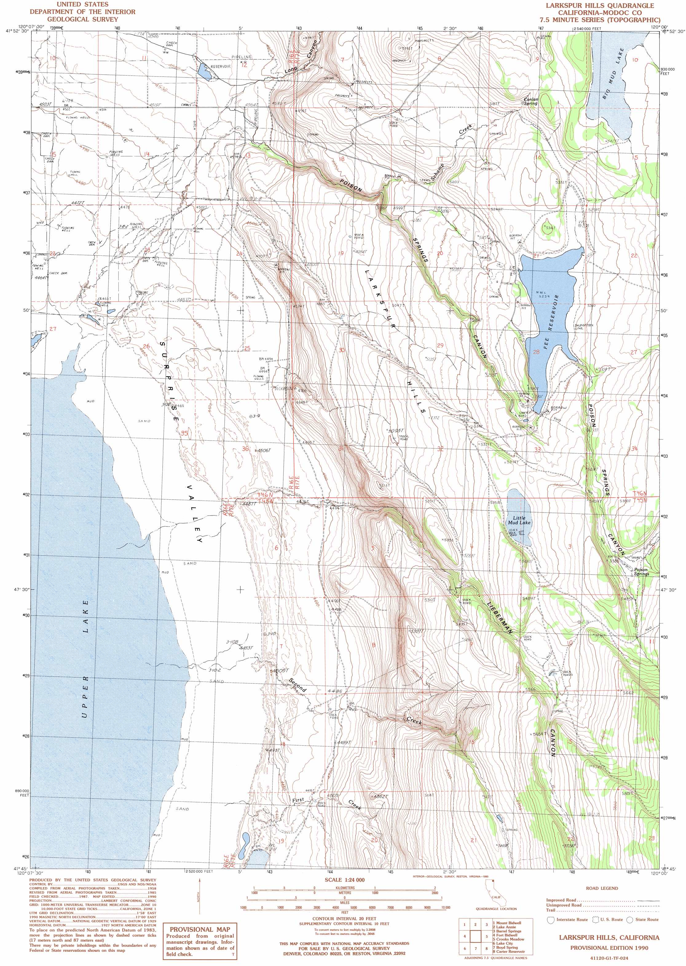
Larkspur Hills Topo Map California
To zoom in, hover over the map of Larkspur Hills
USGS Topo Quad 41120g1 - 1:24,000 scale
| Topo Map Name: | Larkspur Hills |
| USGS Topo Quad ID: | 41120g1 |
| Print Size: | ca. 21 1/4" wide x 27" high |
| Southeast Coordinates: | 41.75° N latitude / 120° W longitude |
| Map Center Coordinates: | 41.8125° N latitude / 120.0625° W longitude |
| U.S. State: | CA |
| Filename: | o41120g1.jpg |
| Download Map JPG Image: | Larkspur Hills topo map 1:24,000 scale |
| Map Type: | Topographic |
| Topo Series: | 7.5´ |
| Map Scale: | 1:24,000 |
| Source of Map Images: | United States Geological Survey (USGS) |
| Alternate Map Versions: |
Larkspur Hills CA 1990, updated 1990 Download PDF Buy paper map Larkspur Hills CA 2012 Download PDF Buy paper map Larkspur Hills CA 2015 Download PDF Buy paper map |
1:24,000 Topo Quads surrounding Larkspur Hills
Crane Creek |
Crane Mountain |
Collins Rim |
May Lake |
Coleman Lake |
Willow Ranch |
Mount Bidwell |
Lake Annie |
Barrel Springs |
Little Coleman Canyon |
Sugar Hill |
Fort Bidwell |
Larkspur Hills |
Crooks Meadow |
Mosquito Valley |
Davis Creek |
Lake City |
Boyd Hot Spring |
Carter Reservoir |
Alkali Lake |
Payne Peak |
Cedarville |
Leonards Hot Springs |
Fortynine Mountain |
Vya |
> Back to 41120e1 at 1:100,000 scale
> Back to 41120a1 at 1:250,000 scale
> Back to U.S. Topo Maps home
Larkspur Hills topo map: Gazetteer
Larkspur Hills: Dams
Poison Springs 1113 Dam elevation 1597m 5239′Larkspur Hills: Lakes
Big Mud Lake elevation 1645m 5396′Little Mud Lake elevation 1629m 5344′
Larkspur Hills: Ranges
Larkspur Hills elevation 1563m 5127′Larkspur Hills: Reservoirs
Fee Reservoir elevation 1597m 5239′Larkspur Hills: Springs
Conlan Spring elevation 1603m 5259′Poison Springs elevation 1633m 5357′
Larkspur Hills: Streams
First Creek elevation 1361m 4465′Schamp Creek elevation 1487m 4878′
Second Creek elevation 1361m 4465′
Larkspur Hills: Valleys
Lieberman Canyon elevation 1417m 4648′Poison Springs Canyon elevation 1387m 4550′
Larkspur Hills digital topo map on disk
Buy this Larkspur Hills topo map showing relief, roads, GPS coordinates and other geographical features, as a high-resolution digital map file on DVD: