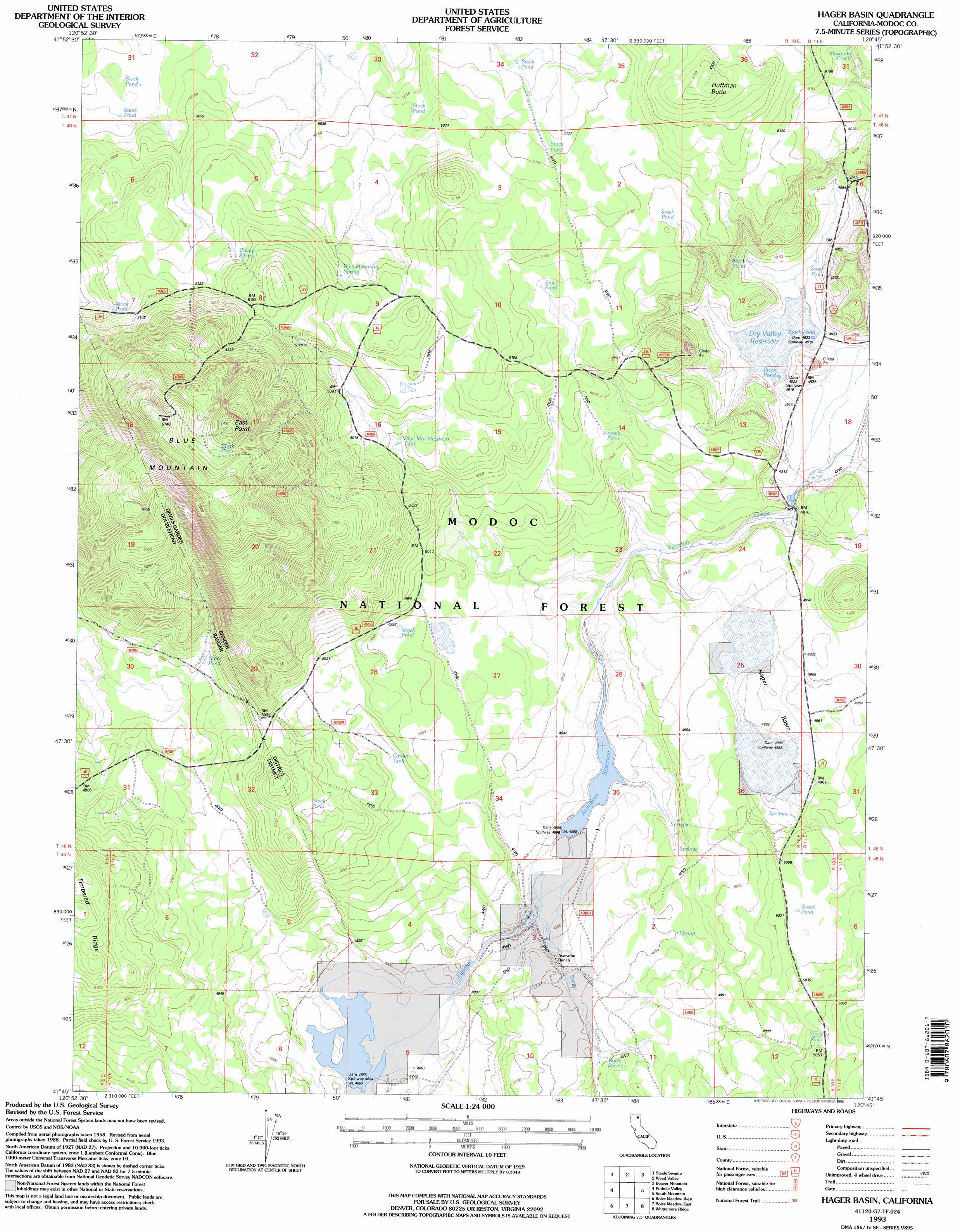
Hager Basin Topo Map California
To zoom in, hover over the map of Hager Basin
USGS Topo Quad 41120g7 - 1:24,000 scale
| Topo Map Name: | Hager Basin |
| USGS Topo Quad ID: | 41120g7 |
| Print Size: | ca. 21 1/4" wide x 27" high |
| Southeast Coordinates: | 41.75° N latitude / 120.75° W longitude |
| Map Center Coordinates: | 41.8125° N latitude / 120.8125° W longitude |
| U.S. State: | CA |
| Filename: | o41120g7.jpg |
| Download Map JPG Image: | Hager Basin topo map 1:24,000 scale |
| Map Type: | Topographic |
| Topo Series: | 7.5´ |
| Map Scale: | 1:24,000 |
| Source of Map Images: | United States Geological Survey (USGS) |
| Alternate Map Versions: |
Hager Basin CA 1990, updated 1990 Download PDF Buy paper map Hager Basin CA 1993, updated 1996 Download PDF Buy paper map Hager Basin CA 2012 Download PDF Buy paper map Hager Basin CA 2015 Download PDF Buy paper map |
| FStopo: | US Forest Service topo Hager Basin is available: Download FStopo PDF Download FStopo TIF |
1:24,000 Topo Quads surrounding Hager Basin
Brady Butte |
Antler Point |
Strawberry Butte |
Dog Lake |
Fitzwater Point |
Sagebrush Butte |
Steele Swamp |
Weed Valley |
Beaver Mountain |
Pease Flat |
Pinnacle Lake |
Pothole Valley |
Hager Basin |
South Mountain |
Mcginty Reservoir |
Lone Pine Butte |
Boles Meadows West |
Boles Meadows East |
Whittemore Ridge |
Dead Horse Reservoir |
Knobcone Butte |
Ambrose |
Jacks Butte |
Big Sage Reservoir |
Mahogany Ridge |
> Back to 41120e1 at 1:100,000 scale
> Back to 41120a1 at 1:250,000 scale
> Back to U.S. Topo Maps home
Hager Basin topo map: Gazetteer
Hager Basin: Basins
Hager Basin elevation 1513m 4963′Hager Basin: Dams
A and C 1110-002 Dam elevation 1494m 4901′Hager Basin: Reservoirs
Avanzino Reservoir elevation 1494m 4901′Blue Mountain Meadows Tank elevation 1539m 5049′
Dry Valley Reservoir elevation 1501m 4924′
Garden Tank elevation 1521m 4990′
Hager Basin Reservoir elevation 1530m 5019′
Huffman Butte Tank elevation 1546m 5072′
Hager Basin: Springs
Blue Mountain Spring elevation 1559m 5114′Boles Spring elevation 1510m 4954′
Tramp Spring elevation 1564m 5131′
Hager Basin: Streams
Beaver Creek elevation 1494m 4901′Willow Creek elevation 1500m 4921′
Hager Basin: Summits
Blue Mountain elevation 1746m 5728′East Point elevation 1752m 5748′
Huffman Butte elevation 1593m 5226′
Hager Basin digital topo map on disk
Buy this Hager Basin topo map showing relief, roads, GPS coordinates and other geographical features, as a high-resolution digital map file on DVD: