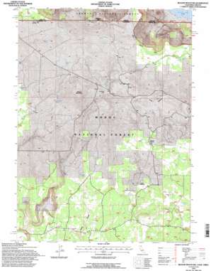
Beaver Mountain Topo Map California
To zoom in, hover over the map of Beaver Mountain
USGS Topo Quad 41120h6 - 1:24,000 scale
| Topo Map Name: | Beaver Mountain |
| USGS Topo Quad ID: | 41120h6 |
| Print Size: | ca. 21 1/4" wide x 27" high |
| Southeast Coordinates: | 41.875° N latitude / 120.625° W longitude |
| Map Center Coordinates: | 41.9375° N latitude / 120.6875° W longitude |
| U.S. States: | CA, OR |
| Filename: | o41120h6.jpg |
| Download Map JPG Image: | Beaver Mountain topo map 1:24,000 scale |
| Map Type: | Topographic |
| Topo Series: | 7.5´ |
| Map Scale: | 1:24,000 |
| Source of Map Images: | United States Geological Survey (USGS) |
| Alternate Map Versions: |
Beaver Mountain CA 1990, updated 1990 Download PDF Buy paper map Beaver Mountain CA 1993, updated 1996 Download PDF Buy paper map Beaver Mountain CA 2012 Download PDF Buy paper map Beaver Mountain CA 2015 Download PDF Buy paper map |
| FStopo: | US Forest Service topo Beaver Mountain is available: Download FStopo PDF Download FStopo TIF |
1:24,000 Topo Quads surrounding Beaver Mountain
> Back to 41120e1 at 1:100,000 scale
> Back to 41120a1 at 1:250,000 scale
> Back to U.S. Topo Maps home
Beaver Mountain topo map: Gazetteer
Beaver Mountain: Flats
Island Meadow elevation 1610m 5282′Long Meadow elevation 1708m 5603′
Rail Meadow elevation 1610m 5282′
Round Willows elevation 1662m 5452′
Beaver Mountain: Populated Places
Grizzlie Place elevation 1592m 5223′Beaver Mountain: Reservoirs
Beaver Mountain Reservoir elevation 1699m 5574′Lower Muldoon Tank elevation 1764m 5787′
Oregon Rim Reservoir elevation 1780m 5839′
Rocky Flat Tank elevation 1725m 5659′
Upper Muldoon Tank elevation 1802m 5912′
Beaver Mountain: Springs
Big Spring elevation 1616m 5301′Coffee Mill Spring elevation 1593m 5226′
Little Grizzlie Spring elevation 1577m 5173′
Mouse Spring elevation 1575m 5167′
Rail Spring elevation 1601m 5252′
Tournquist Spring elevation 1629m 5344′
Turner Spring elevation 1712m 5616′
Twin Springs elevation 1586m 5203′
Wall Spring elevation 1608m 5275′
Beaver Mountain: Streams
Barrington Creek elevation 1515m 4970′Barrington Creek elevation 1515m 4970′
Traverse Creek elevation 1516m 4973′
Traverse Creek elevation 1515m 4970′
Beaver Mountain: Summits
Beaver Mountain elevation 1766m 5793′Muldoon Mountain elevation 1832m 6010′
Muldoon Mountain elevation 1826m 5990′
Beaver Mountain digital topo map on disk
Buy this Beaver Mountain topo map showing relief, roads, GPS coordinates and other geographical features, as a high-resolution digital map file on DVD:


