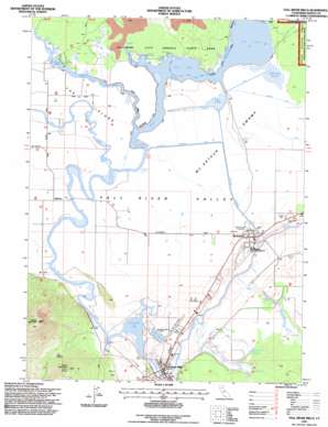
Fall River Mills Topo Map California
To zoom in, hover over the map of Fall River Mills
USGS Topo Quad 41121a4 - 1:24,000 scale
| Topo Map Name: | Fall River Mills |
| USGS Topo Quad ID: | 41121a4 |
| Print Size: | ca. 21 1/4" wide x 27" high |
| Southeast Coordinates: | 41° N latitude / 121.375° W longitude |
| Map Center Coordinates: | 41.0625° N latitude / 121.4375° W longitude |
| U.S. State: | CA |
| Filename: | o41121a4.jpg |
| Download Map JPG Image: | Fall River Mills topo map 1:24,000 scale |
| Map Type: | Topographic |
| Topo Series: | 7.5´ |
| Map Scale: | 1:24,000 |
| Source of Map Images: | United States Geological Survey (USGS) |
| Alternate Map Versions: |
Fall River Mills CA 1990, updated 1990 Download PDF Buy paper map Fall River Mills CA 1995, updated 1998 Download PDF Buy paper map Fall River Mills CA 2012 Download PDF Buy paper map Fall River Mills CA 2015 Download PDF Buy paper map |
| FStopo: | US Forest Service topo Fall River Mills is available: Download FStopo PDF Download FStopo TIF |
1:24,000 Topo Quads surrounding Fall River Mills
> Back to 41121a1 at 1:100,000 scale
> Back to 41120a1 at 1:250,000 scale
> Back to U.S. Topo Maps home
Fall River Mills topo map: Gazetteer
Fall River Mills: Airports
Fall River Mills Airport elevation 1013m 3323′Fall River Mills: Canals
Lee Drainage Canal elevation 1010m 3313′McArthur Diversion Canal elevation 1008m 3307′
Fall River Mills: Dams
Pit Number 1 Diversion 97-099 Dam elevation 1007m 3303′Pit Number 1 Forebay 97-110 Dam elevation 1008m 3307′
Fall River Mills: Gaps
The Saddle elevation 1154m 3786′Fall River Mills: Islands
The Island elevation 1010m 3313′Fall River Mills: Lakes
Big Lake elevation 1008m 3307′Eastman Lake elevation 1008m 3307′
Fall River Lake elevation 1007m 3303′
Horr Pond elevation 1008m 3307′
Fall River Mills: Populated Places
Fall River Mills elevation 1014m 3326′Glenburn elevation 1010m 3313′
McArthur elevation 1009m 3310′
McArthur Mobile Home Park elevation 1009m 3310′
Fall River Mills: Post Offices
Fall River Mills Post Office elevation 1016m 3333′Fall River Mills: Reservoirs
Knoch Reservoir elevation 1009m 3310′Fall River Mills: Springs
Crystal Springs elevation 1008m 3307′Fall River Mills: Streams
Fall River elevation 1003m 3290′Ja She Creek elevation 1008m 3307′
Lava Creek elevation 1008m 3307′
Little Tule River elevation 1008m 3307′
Peacock Creek elevation 986m 3234′
Shelly Creek elevation 989m 3244′
Tule River elevation 1008m 3307′
Fall River Mills: Summits
Haney Mountain elevation 1345m 4412′Saddle Mountain elevation 1508m 4947′
Fall River Mills: Swamps
Hollenbeak Swamp elevation 1010m 3313′McArthur Swamp elevation 1008m 3307′
Fall River Mills: Valleys
Fall River Valley elevation 1005m 3297′Fall River Mills digital topo map on disk
Buy this Fall River Mills topo map showing relief, roads, GPS coordinates and other geographical features, as a high-resolution digital map file on DVD:


