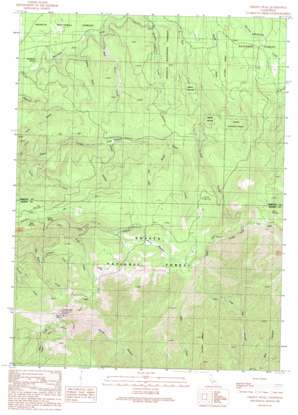
Grizzly Peak Topo Map California
To zoom in, hover over the map of Grizzly Peak
USGS Topo Quad 41121b8 - 1:24,000 scale
| Topo Map Name: | Grizzly Peak |
| USGS Topo Quad ID: | 41121b8 |
| Print Size: | ca. 21 1/4" wide x 27" high |
| Southeast Coordinates: | 41.125° N latitude / 121.875° W longitude |
| Map Center Coordinates: | 41.1875° N latitude / 121.9375° W longitude |
| U.S. State: | CA |
| Filename: | o41121b8.jpg |
| Download Map JPG Image: | Grizzly Peak topo map 1:24,000 scale |
| Map Type: | Topographic |
| Topo Series: | 7.5´ |
| Map Scale: | 1:24,000 |
| Source of Map Images: | United States Geological Survey (USGS) |
| Alternate Map Versions: |
Grizzly Peak CA 1990, updated 1990 Download PDF Buy paper map Grizzly Peak CA 1998, updated 2003 Download PDF Buy paper map Grizzly Peak CA 2012 Download PDF Buy paper map Grizzly Peak CA 2015 Download PDF Buy paper map |
| FStopo: | US Forest Service topo Grizzly Peak is available: Download FStopo PDF Download FStopo TIF |
1:24,000 Topo Quads surrounding Grizzly Peak
> Back to 41121a1 at 1:100,000 scale
> Back to 41120a1 at 1:250,000 scale
> Back to U.S. Topo Maps home
Grizzly Peak topo map: Gazetteer
Grizzly Peak: Basins
Bear Wallow elevation 1410m 4625′Grizzly Peak: Flats
Angel Meadow elevation 1267m 4156′Stouts Meadow elevation 1607m 5272′
Grizzly Peak: Springs
Bundoora Spring elevation 1086m 3562′Dad Lofton Spring elevation 1811m 5941′
Deer Springs elevation 1842m 6043′
Grass Spring elevation 1490m 4888′
Grizzly Peak: Streams
Big Basin Creek elevation 1190m 3904′Blue Heron Creek elevation 1094m 3589′
Gold Creek elevation 1390m 4560′
Pigeon Creek elevation 1272m 4173′
Turtle Creek elevation 1039m 3408′
Whiskey Creek elevation 1108m 3635′
Grizzly Peak: Summits
Grizzly Peak elevation 1892m 6207′Pigeon Hill elevation 1750m 5741′
Grizzly Peak: Trails
Angel Meadow Trail elevation 1568m 5144′Cone Point Trail elevation 1528m 5013′
Grizzly Peak: Valleys
Bull Canyon elevation 782m 2565′Dry Gulch elevation 1050m 3444′
Gopher Gulch elevation 1110m 3641′
Live Oak Canyon elevation 801m 2627′
Red Ant Gulch elevation 1391m 4563′
Steep Hollow elevation 1286m 4219′
Grizzly Peak digital topo map on disk
Buy this Grizzly Peak topo map showing relief, roads, GPS coordinates and other geographical features, as a high-resolution digital map file on DVD:


