Sagebrush Butte Topo Map California
To zoom in, hover over the map of Sagebrush Butte
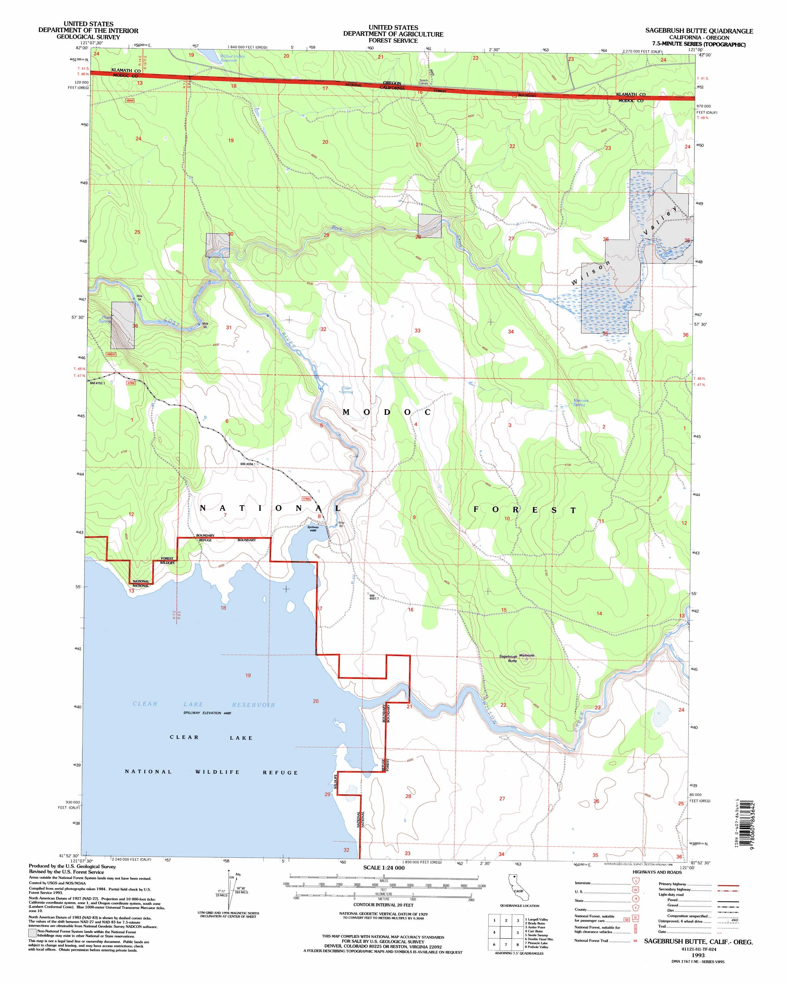
USGS Topo Quad 41121h1 - 1:24,000 scale
| Topo Map Name: | Sagebrush Butte |
| USGS Topo Quad ID: | 41121h1 |
| Print Size: | ca. 21 1/4" wide x 27" high |
| Southeast Coordinates: | 41.875° N latitude / 121° W longitude |
| Map Center Coordinates: | 41.9375° N latitude / 121.0625° W longitude |
| U.S. States: | CA, OR |
| Filename: | o41121h1.jpg |
| Download Map JPG Image: | Sagebrush Butte topo map 1:24,000 scale |
| Map Type: | Topographic |
| Topo Series: | 7.5´ |
| Map Scale: | 1:24,000 |
| Source of Map Images: | United States Geological Survey (USGS) |
| Alternate Map Versions: |
Sagebrush Butte CA 1988, updated 1988 Download PDF Buy paper map Sagebrush Butte CA 1993, updated 1996 Download PDF Buy paper map Sagebrush Butte CA 2012 Download PDF Buy paper map Sagebrush Butte CA 2015 Download PDF Buy paper map |
| FStopo: | US Forest Service topo Sagebrush Butte is available: Download FStopo PDF Download FStopo TIF |
1:24,000 Topo Quads surrounding Sagebrush Butte
Lorella |
Goodlow Mountain |
Gerber Reservoir |
Barnes Valley |
Arkansas Flat |
Bryant Mountain |
Langell Valley |
Brady Butte |
Antler Point |
Strawberry Butte |
Newell |
Carr Butte |
Sagebrush Butte |
Steele Swamp |
Weed Valley |
Copic |
Double Head Mountain |
Pinnacle Lake |
Pothole Valley |
Hager Basin |
Perez |
Rimrock Lake |
Lone Pine Butte |
Boles Meadows West |
Boles Meadows East |
> Back to 41121e1 at 1:100,000 scale
> Back to 41120a1 at 1:250,000 scale
> Back to U.S. Topo Maps home
Sagebrush Butte topo map: Gazetteer
Sagebrush Butte: Dams
Clear Lake Dam elevation 1374m 4507′Sagebrush Butte: Reservoirs
Clear Lake Reservoir elevation 1374m 4507′Sagebrush Butte: Springs
Elder Spring elevation 1350m 4429′Mammoth Springs elevation 1367m 4484′
Plum Spring elevation 1411m 4629′
Rimrock Spring elevation 1417m 4648′
Sagebrush Butte: Streams
Boles Creek elevation 1393m 4570′North Fork Willow Creek elevation 1390m 4560′
Rock Creek elevation 1365m 4478′
Rock Creek elevation 1365m 4478′
Willow Creek elevation 1367m 4484′
Sagebrush Butte: Summits
Sagebrush Butte elevation 1442m 4730′Sagebrush Butte: Valleys
Wilson Valley elevation 1429m 4688′Sagebrush Butte digital topo map on disk
Buy this Sagebrush Butte topo map showing relief, roads, GPS coordinates and other geographical features, as a high-resolution digital map file on DVD: