Hatfield Topo Map California
To zoom in, hover over the map of Hatfield
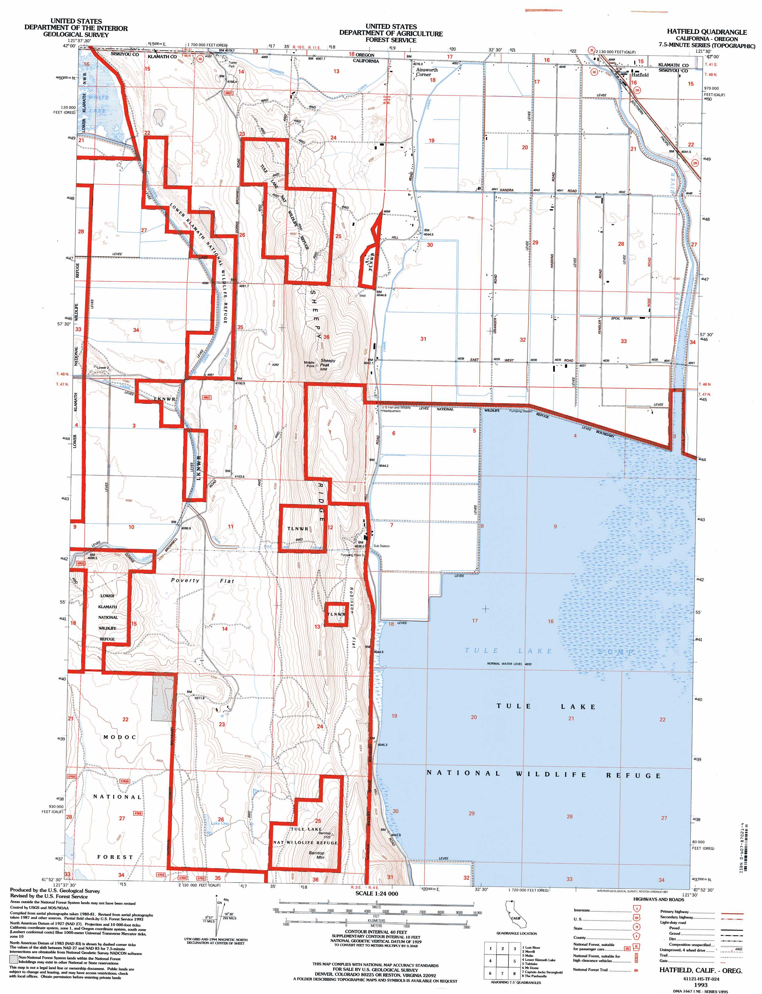
USGS Topo Quad 41121h5 - 1:24,000 scale
| Topo Map Name: | Hatfield |
| USGS Topo Quad ID: | 41121h5 |
| Print Size: | ca. 21 1/4" wide x 27" high |
| Southeast Coordinates: | 41.875° N latitude / 121.5° W longitude |
| Map Center Coordinates: | 41.9375° N latitude / 121.5625° W longitude |
| U.S. States: | CA, OR |
| Filename: | o41121h5.jpg |
| Download Map JPG Image: | Hatfield topo map 1:24,000 scale |
| Map Type: | Topographic |
| Topo Series: | 7.5´ |
| Map Scale: | 1:24,000 |
| Source of Map Images: | United States Geological Survey (USGS) |
| Alternate Map Versions: |
Hatfield CA 1985, updated 1985 Download PDF Buy paper map Hatfield CA 1993, updated 1997 Download PDF Buy paper map Hatfield CA 2012 Download PDF Buy paper map Hatfield CA 2015 Download PDF Buy paper map |
| FStopo: | US Forest Service topo Hatfield is available: Download FStopo PDF Download FStopo TIF |
1:24,000 Topo Quads surrounding Hatfield
Klamath Falls |
Altamont |
Dairy |
Bonanza |
Lorella |
Worden |
Lost River |
Merrill |
Malin |
Bryant Mountain |
Sheepy Lake |
Lower Klamath Lake |
Hatfield |
Tulelake |
Newell |
Red Rock Lakes |
Mount Dome |
Captain Jacks Stronghold |
The Panhandle |
Copic |
Sharp Mountain |
Bonita Butte |
Schonchin Butte |
Caldwell Butte |
Perez |
> Back to 41121e1 at 1:100,000 scale
> Back to 41120a1 at 1:250,000 scale
> Back to U.S. Topo Maps home
Hatfield topo map: Gazetteer
Hatfield: Canals
Van Brimmer Canal elevation 1245m 4084′Hatfield: Flats
Poverty Flat elevation 1250m 4101′Robinson Flat elevation 1340m 4396′
Hatfield: Lakes
Lake One elevation 1328m 4356′Tule Lake elevation 1230m 4035′
Hatfield: Populated Places
Ainsworth Corner elevation 1240m 4068′Hatfield elevation 1239m 4064′
Hatfield: Ridges
High Rim elevation 1485m 4872′Hatfield: Streams
Lost River elevation 1230m 4035′Hatfield: Summits
Barntop Mountain elevation 1560m 5118′Sheepy Peak elevation 1591m 5219′
Hatfield: Tunnels
Tule Lake Tunnel elevation 1313m 4307′Hatfield digital topo map on disk
Buy this Hatfield topo map showing relief, roads, GPS coordinates and other geographical features, as a high-resolution digital map file on DVD: