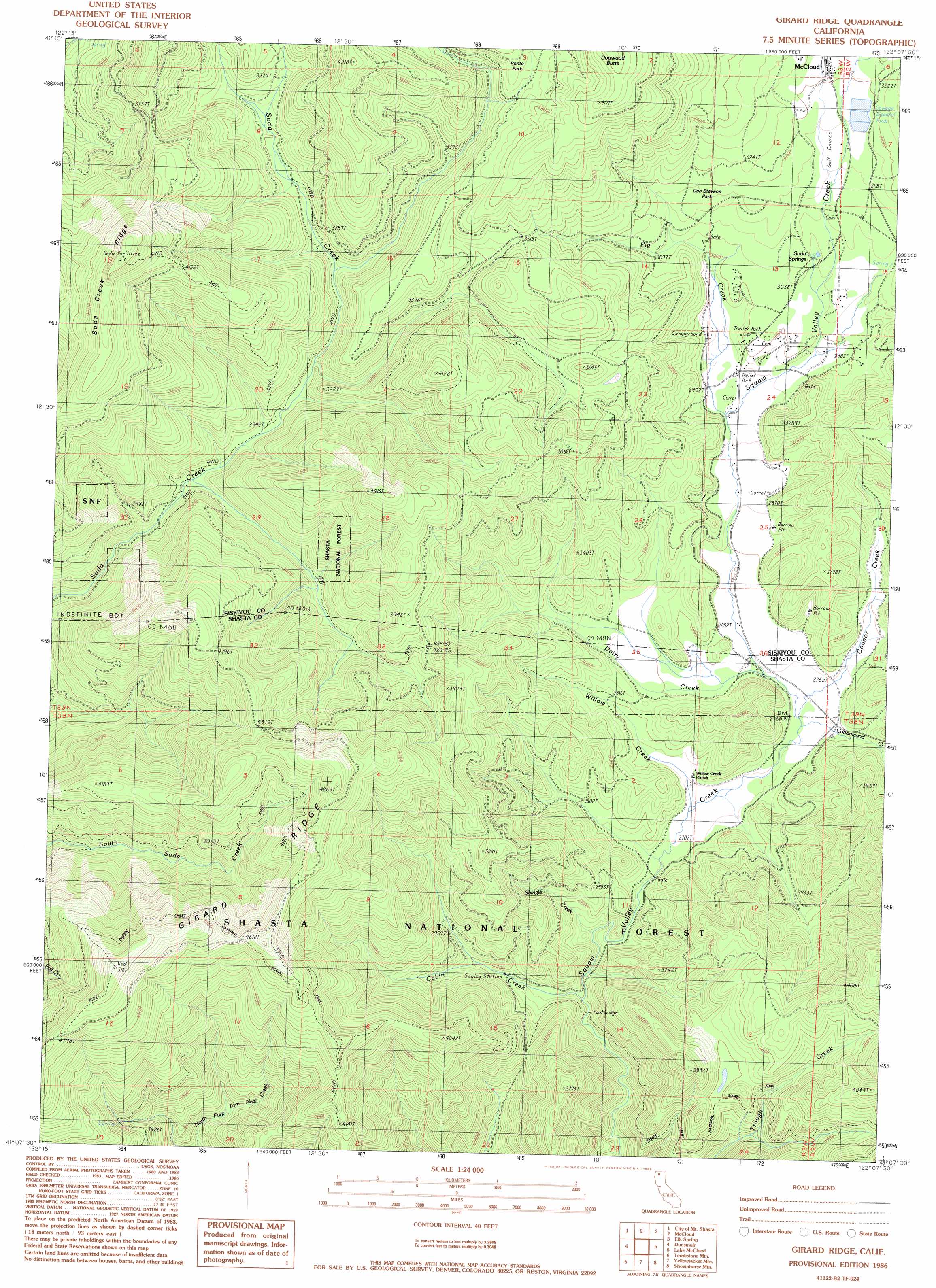
Girard Ridge Topo Map California
To zoom in, hover over the map of Girard Ridge
USGS Topo Quad 41122b2 - 1:24,000 scale
| Topo Map Name: | Girard Ridge |
| USGS Topo Quad ID: | 41122b2 |
| Print Size: | ca. 21 1/4" wide x 27" high |
| Southeast Coordinates: | 41.125° N latitude / 122.125° W longitude |
| Map Center Coordinates: | 41.1875° N latitude / 122.1875° W longitude |
| U.S. State: | CA |
| Filename: | o41122b2.jpg |
| Download Map JPG Image: | Girard Ridge topo map 1:24,000 scale |
| Map Type: | Topographic |
| Topo Series: | 7.5´ |
| Map Scale: | 1:24,000 |
| Source of Map Images: | United States Geological Survey (USGS) |
| Alternate Map Versions: |
Girard Ridge CA 1986, updated 1986 Download PDF Buy paper map Girard Ridge CA 1998, updated 2003 Download PDF Buy paper map Girard Ridge CA 2012 Download PDF Buy paper map Girard Ridge CA 2015 Download PDF Buy paper map |
| FStopo: | US Forest Service topo Girard Ridge is available: Download FStopo PDF Download FStopo TIF |
1:24,000 Topo Quads surrounding Girard Ridge
Weed |
Hotlum |
Mount Shasta |
Ash Creek Butte |
Rainbow Mountain |
Mount Eddy |
City Of Mount Shasta |
Mccloud |
Elk Spring |
Kinyon |
Seven Lakes Basin |
Dunsmuir |
Girard Ridge |
Lake Mccloud |
Grizzly Peak |
Chicken Hawk Hill |
Tombstone Mountain |
Yellowjacket Mountain |
Shoeinhorse Mountain |
Big Bend |
Lamoine |
Hanland Peak |
Bollibokka Mountain |
Goose Gap |
Roaring Creek |
> Back to 41122a1 at 1:100,000 scale
> Back to 41122a1 at 1:250,000 scale
> Back to U.S. Topo Maps home
Girard Ridge topo map: Gazetteer
Girard Ridge: Flats
Dan Stevens elevation 963m 3159′Ponto Park elevation 1141m 3743′
Girard Ridge: Populated Places
Warmcastle Mobile Home Park elevation 917m 3008′Girard Ridge: Ridges
Girard Ridge elevation 1492m 4895′Soda Creek Ridge elevation 1337m 4386′
Girard Ridge: Springs
Soda Springs elevation 935m 3067′Water Trough Springs elevation 1179m 3868′
Girard Ridge: Streams
Cabin Creek elevation 836m 2742′Connor Creek elevation 840m 2755′
Cottonwood Creek elevation 842m 2762′
Dairy Creek elevation 844m 2769′
Pig Creek elevation 883m 2896′
Shingle Creek elevation 813m 2667′
Willow Creek elevation 843m 2765′
Girard Ridge digital topo map on disk
Buy this Girard Ridge topo map showing relief, roads, GPS coordinates and other geographical features, as a high-resolution digital map file on DVD: